Saint Regis Mountain
- 2,876 ft
- summit
- 1
- way up
Saint Regis Mountain is a summit in northern New York, rising to 2,876 feet about 4 miles from the town of Paul Smiths. It sits at the center of a cluster of trails and waterways, with several routes and paddling spots within a short drive. Summer is the most comfortable time to go. Typical averages from a nearby weather station at Saranac Lake show July highs around 77°F with lows near 51°F. That station sits well below the summit, so temperatures up high run cooler. The closest trails are the Spring Bay Trail, about 1.5 miles away, and the St. Regis Mountain Trail, about 2 miles out. In winter, the Fish Pond Truck Trail is a cross-country ski route about 2 miles away. For paddling, the West Branch Saint Regis River lies roughly 4.6 miles from the summit.
Conditions and forecast
Daily highs and lows, wind and the chance of precipitation at the summit and route start for the next 7 days, from the Open-Meteo model.
- Summit elevation
- 2,876 ft
Elevation from USGS 3D Elevation Program terrain data (about 10 m resolution).
Map © Mapbox © OpenStreetMap contributors Questions about Saint Regis Mountain
How tall is Saint Regis Mountain?
2,876 ft (877 m).
How many routes go to the summit of Saint Regis Mountain?
One: St. Regis Mountain Trail.
- Long Pond Mountain2,530 ft · New York1 route4.3 mi away
- Floodwood Mountain2,315 ft · New York1 route8.1 mi away
- Baker Mountain2,458 ft · New York1 route12 mi away
 Ampersand Mountain3,349 ft · New York1 route14 mi awayPhoto: Mwanner, CC BY-SA 3.0 (via Wikimedia Commons)
- Loon Lake Mountains3,330 ft · New York1 route14 mi away
- Debar Mountain3,303 ft · New York1 route14 mi away
- Spring Bay TrailHiking1.5 mi
- Fish Pond Truck TrailCross-country skiing1.8 mi
- St. Regis Mountain TrailHiking2.1 mi
- Yellow CompCross-country skiing2.7 mi
- West Branch Saint Regis RiverCanoeing4.6 mi
- Floodwood Pond LoopCanoeing5.8 mi
- K: Northern RegionRock climbing6 mi
- Lower Saranac LakeLake fishing9.6 mi
Source: Roamze catalog (indexable pages within 10 miles, PostGIS distance)
 Azure MountainSummit · ~21 min drivePhoto: Mwanner, CC BY-SA 3.0 (via Wikimedia Commons)
 Stony Creek MountainSummit · ~23 min drivePhoto: Mwanner at en.wikipedia, CC BY-SA 3.0 (via Wikimedia Commons)
- Ampersand MountainSummit · ~23 min drivePhoto: Mwanner, CC BY-SA 3.0 (via Wikimedia Commons)
 McKenzie MountainSummit · ~27 min drivePhoto: Mwanner, CC BY-SA 3.0 (via Wikimedia Commons)
 Seward MountainSummit · ~31 min drivePhoto: petersent, Public domain (via Wikimedia Commons)
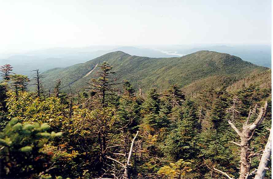 Donaldson MountainSummit · ~32 min drivePhoto: petersent, Public domain (via Wikimedia Commons)
 Mount MorrisSummit · ~32 min drivePhoto: Dclemens1971, CC BY 4.0 (via Wikimedia Commons)
 Seymour MountainSummit · ~33 min drivePhoto: petersent, Public domain (via Wikimedia Commons)
 Mount EmmonsSummit · ~33 min drivePhoto: petersent, Public domain (via Wikimedia Commons)
 Whiteface MountainSummit · ~37 min drivePhoto: Mwanner, CC BY-SA 3.0 (via Wikimedia Commons)
Best time to visit Saint Regis Mountain
No month here meets our mild-weather rule. Best months have typical highs of 55–85 °F, lows of 30 °F or warmer (32 °F where the station doesn't record snow), at most one snowy day and no more than 12 wet days.
Jan
25° / 2°
15 wet
Feb
28° / 3°
13 wet
Mar
37° / 12°
14 wet
Apr
50° / 26°
15 wet
May
64° / 37°
16 wet
Jun
72° / 46°
16 wet
Jul
77° / 51°
16 wet
Aug
75° / 49°
16 wet
Sep
68° / 41°
14 wet
Oct
54° / 32°
16 wet
Nov
42° / 22°
16 wet
Dec
30° / 11°
17 wet
Typical high / low (°F) and days with rain or snow, 1991–2020. Measured at Saranac Rgnl Ap, NY, 6.3 mi away at 1,663 ft. The station sits about 1,200 ft lower than this place, so expect it a little cooler here. This station doesn't record snowfall. Source: NOAA NCEI U.S. Climate Normals 1991–2020.

