Esker Trail
 Photo: andyarthur, CC BY 2.0 (via Flickr)
- 1.1 mi
- one way
- 178 ft
- climb
- 1,881 ft
- high point
- Point to point
- route
Esker Trail is an easy 1.1-mile point-to-point hike in New York, just under a mile from the village of Keese Mill. The trail gains about 180 feet in elevation from its start at roughly 1,730 feet to a high point near 1,880 feet. The steepest stretch comes at about 0.5 miles, with a 12% grade, and the route ends with a small loss in elevation. Summer is the most comfortable time to go. Typical July averages at a nearby weather station run about 77°F for highs and 51°F for lows, while winter highs stay near 25°F in January and February. That station sits about 220 feet lower than the trail's high point, so temperatures on the trail run slightly cooler. Several cross-country ski routes sit right beside the trail, including Logger's Loop (Olive) and Draper Lussi, each about 0.1 mile away, and the Skidder Trail hike is about 0.2 mile off. Farther out, the West Branch Saint Regis River offers canoeing about 7 miles away.
Local outfitters
- Cloudsplitter Outfitters34 mi away
Not on Roamze yet. Their page has how to reach them.
Best time to go
Best time to visit Esker Trail
No month here meets our mild-weather rule. Best months have typical highs of 55–85 °F, lows of 30 °F or warmer (32 °F where the station doesn't record snow), at most one snowy day and no more than 12 wet days.
Jan
25° / 2°
15 wet
Feb
28° / 3°
13 wet
Mar
37° / 12°
14 wet
Apr
50° / 26°
15 wet
May
64° / 37°
16 wet
Jun
72° / 46°
16 wet
Jul
77° / 51°
16 wet
Aug
75° / 49°
16 wet
Sep
68° / 41°
14 wet
Oct
54° / 32°
16 wet
Nov
42° / 22°
16 wet
Dec
30° / 11°
17 wet
Typical high / low (°F) and days with rain or snow, 1991–2020. Measured at Saranac Rgnl Ap, NY, 5.4 mi away at 1,663 ft. This station doesn't record snowfall. Source: NOAA NCEI U.S. Climate Normals 1991–2020.
Keep exploring — more trails worth the drive
 Photo: andyarthur, CC BY 2.0 (via Flickr)
Skidder Trail
Next door
0.52-mile point-to-point trail in New York with 96 ft elevation gain.
Photo: andyarthur, CC BY 2.0 (via Flickr)Jenkins Mountain Trail (Blue)
~2 min drive
4.24-mile out-and-back trail in New York with 1,187 ft elevation gain
 Photo: andyarthur, CC BY 2.0 (via Flickr)
Adirondack Rail Trail
~18 min drive
12.82-mile out-and-back rail trail in New York with 1,035 ft elevation gain
Photo: andyarthur, CC BY 2.0 (via Flickr)Fox Run Trail
Next door
0.32-mile point-to-point trail in New York with 63 ft of elevation gain
HIKE
Kettle Trail
~6 min drive
5.96-mile out-and-back trail in New York with 1,175 ft gain and 1,715 ft max elevation.
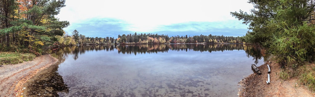 Photo: Tony Webster, CC BY-SA 2.0 (via Flickr)
Bog Trail
~15 min drive
10.36-mile out-and-back trail in New York with 790 ft elevation gain
 Photo: andyarthur, CC BY 2.0 (via Flickr)
Easy Street
~1 min drive
0.98-mile point-to-point trail in New York with 97 ft gain.
HIKE
Adirondack Rail Trail
~10 min drive
5.74-mile out-and-back rail trail in New York with 392 ft elevation gain/loss
HIKE
Long Pond Mountain Trail
~13 min drive
1.44-mile point-to-point trail in New York with 985 ft elevation loss
 Photo: andyarthur, CC BY 2.0 (via Flickr)
Barnum Brook Trail
~2 min drive
0.65-mile loop trail in New York with 71 ft gain.
Map and trail data © OpenStreetMap contributors
