Railway Trail (BLUE)
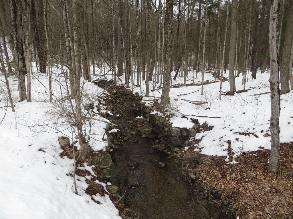 Photo: Russ Nelson, CC BY-SA 2.0 (via Flickr)
- 1.1 mi
- round trip
- 316 ft
- climb
- 468 ft
- high point
- Out and back
- route
- Apr, Jun
- best months
Railway Trail (BLUE) is an easy out-and-back hike in New York, about 0.7 miles from the town of Rock City Falls. The route is roughly 2.2 miles long, with a total climb of about 316 feet and a high point of 468 feet. The trail is rated easy, and the steepest stretch comes at about 0.9 miles in, with a grade of about 4 percent. Late spring and early fall are the most comfortable times to go. Typical averages from a nearby weather station in Saratoga Springs show May highs around 73°F and September highs around 75°F, with July the warmest month at about 84°F. Creekside Trail (RED) starts just 0.1 mile away. Don Juan's Traverse (Blue trail) is about 4.2 miles off, and Parish Trail (red) and Five Mile Trail are both within about 6 miles.
- Creekside Trail (RED)HikingPhoto: Russ Nelson, CC BY-SA 2.0 (via Flickr)0.1 mi
- Don Juan's Traverse (Blue trail)Hiking4.2 mi
- Parish Trail (red)Hiking4.9 mi
 Five Mile TrailHikingPhoto: New York Public Library, No restrictions (via Wikimedia Commons)5.9 mi
 Zim Smith TrailHikingPhoto: P_R_F, CC BY 2.0 (via Flickr)6 mi
 Pitney Farm TrailHikingPhoto: ronmcc, CC BY 3.0 (via Wikimedia Commons)6.4 mi
- Green TrailHiking6.8 mi
- Yellow TrailHiking6.8 mi
Source: Roamze catalog (indexable pages within 10 miles, PostGIS distance)
- Five Mile TrailHiking · ~10 min drivePhoto: New York Public Library, No restrictions (via Wikimedia Commons)
- Zim Smith TrailHiking · ~10 min drivePhoto: P_R_F, CC BY 2.0 (via Flickr)
 Western Ridge TrailHiking · ~24 min drivePhoto: Doug Kerr from Albany, NY, United States, CC BY-SA 2.0 (via Wikimedia Commons)
- Zim Smith Mid-County TrailHiking · ~12 min drive
- Pitney Farm TrailHiking · ~11 min drivePhoto: ronmcc, CC BY 3.0 (via Wikimedia Commons)
- Main TrailHiking · ~14 min drive
 Zim Smith Mid-County TrailHiking · ~17 min drivePhoto: P_R_F, CC BY 2.0 (via Flickr)
- Spruce Mountain TrailHiking · ~18 min drive
 Main LoopHiking · ~17 min drivePhoto: Dangerfulman66, CC BY-SA 3.0 (via Wikimedia Commons)
- Ballston Bicycle PathHiking · ~18 min drive
Best time to visit Railway Trail (BLUE)
Best months: April, June and August–October. Best months have typical highs of 55–85 °F, lows of 30 °F or warmer (32 °F where the station doesn't record snow), at most one snowy day and no more than 12 wet days.
Jan
32° / 14°
12 wet
Feb
35° / 16°
10 wet
Mar
45° / 25°
11 wet
Apr
60° / 36°
11 wet
May
73° / 47°
13 wet
Jun
80° / 56°
12 wet
Jul
84° / 61°
13 wet
Aug
82° / 59°
11 wet
Sep
75° / 52°
10 wet
Oct
62° / 41°
11 wet
Nov
49° / 31°
12 wet
Dec
37° / 22°
12 wet
Typical high / low (°F) and days with rain or snow, 1991–2020. Measured at Saratoga Springs 4 Sw, NY, 5.5 mi away at 326 ft. This station doesn't record snowfall. Source: NOAA NCEI U.S. Climate Normals 1991–2020.
Map and trail data © OpenStreetMap contributors
