Erie Canalway Trail (Syracuse to Dewitt)
- 6.2 mi
- one way
- 59 ft
- climb
- 464 ft
- high point
- Point to point
- route
- Jun–Sep
- best months
The Erie Canalway Trail from Syracuse to DeWitt is a 6.2-mile point-to-point route that sits within easy reach of the city, starting just 0.6 miles from Syracuse. The trail's modest climb of 59 feet over its length makes it a low-key outing rather than a serious ascent, and it's a moderate hike that takes about two hours to complete. The route rises from a low point of 392 feet to a high of 464 feet, with the steepest stretch coming around mile 6. The slight drop of 178 feet over the course of the trip makes it easy to adjust for a return leg if you want to turn the journey into a loop. Late spring and early fall are the most comfortable times to go. Typical averages from a nearby weather station in Syracuse put May highs near 69°F and September highs around 73°F, with July the warmest month at about 82°F. The trail sits close to a variety of other outdoor options. The Bear Trap Creek Bikeway is about 2.8 miles away, and the Onondaga Lake Circumnavigation paddling route is about 3.7 miles away. The West Shore Trail is roughly 4.1 miles off, and the Right Wall climbing area lies about 5 miles away.
Best time to go · Jun–Sep
Best time to visit Erie Canalway Trail (Syracuse to Dewitt)
Best months: June–September. Best months have typical highs of 55–85 °F, lows of 30 °F or warmer (32 °F where the station doesn't record snow), at most one snowy day and no more than 12 wet days.
Jan
32° / 16°
19 wet
Feb
34° / 18°
16 wet
Mar
42° / 25°
16 wet
Apr
56° / 36°
14 wet
May
69° / 47°
13 wet
Jun
77° / 57°
12 wet
Jul
82° / 62°
12 wet
Aug
80° / 60°
11 wet
Sep
73° / 53°
11 wet
Oct
60° / 42°
15 wet
Nov
48° / 33°
16 wet
Dec
37° / 24°
18 wet
Typical high / low (°F) and days with rain or snow, 1991–2020. Measured at Syracuse Hancock Intl Ap, NY, 4.8 mi away at 413 ft. This station doesn't record snowfall. Source: NOAA NCEI U.S. Climate Normals 1991–2020.
Keep exploring — more trails worth the drive
 Photo: Doug Letterman, CC BY 2.0 (via Flickr)
Deer Run Trail
~14 min drive
2.49-mile point-to-point trail in New York with 1,669 ft gain
 Photo: edt11x, CC BY 2.0 (via Flickr)
Old Growth Trail
~15 min drive
0.45-mile out-and-back hike in New York with 53 ft gain and 170 ft loss.
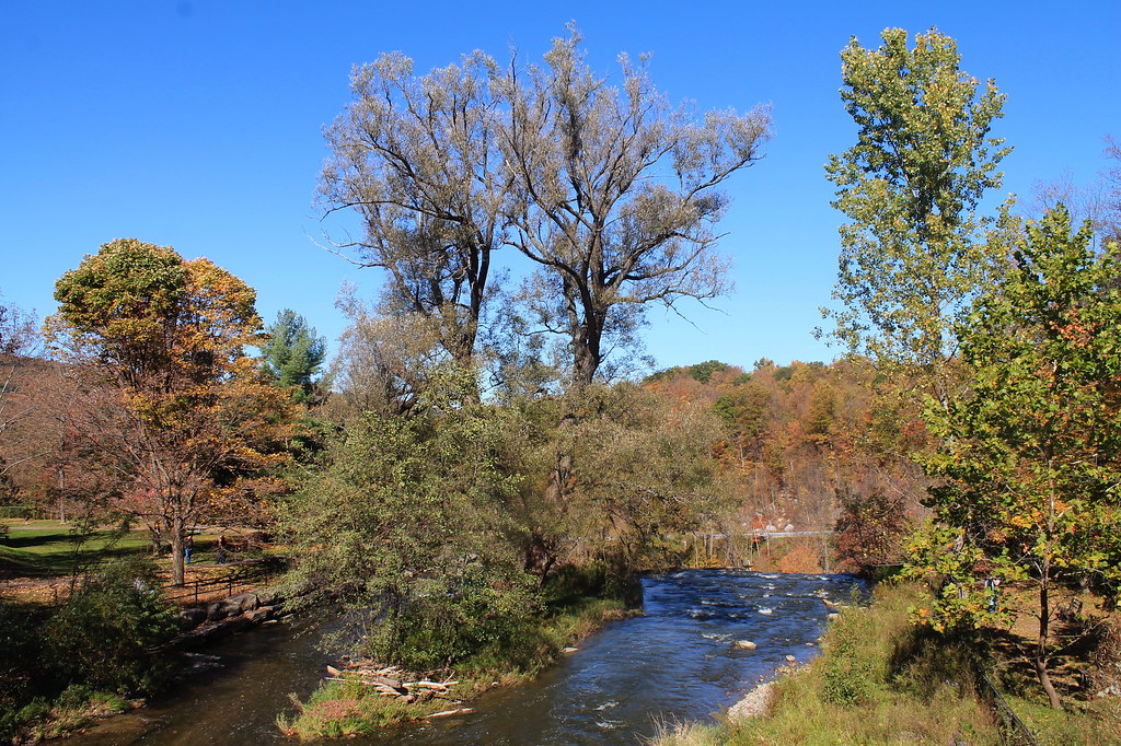 Photo: andyarthur, CC BY 2.0 (via Flickr)
Lehigh Valley Railroad (Link Trail)
~30 min drive
14.29-mile out-and-back trail in New York with 892 ft gain
 Photo: Doug Letterman, CC BY 2.0 (via Flickr)
Overlook Trail
~14 min drive
Short point-to-point trail with scenic overlook views in New York.
HIKE
Lake Trail
~9 min drive
Easy point-to-point trail to a scenic lake in New York.
Photo: Doug Letterman, CC BY 2.0 (via Flickr)Vista Trail
~14 min drive
1.51-mile loop trail in New York with 146 ft elevation gain.
HIKE
Erie Canalway Trail (Camillus to Syracuse)
~10 min drive
9.02-mile point-to-point trail from Camillus to Syracuse on the Erie Canalway.
Photo: Doug Letterman, CC BY 2.0 (via Flickr)Farmer's Hill Trail
~14 min drive
1.41-mile loop trail in New York with 97 ft elevation gain.
HIKE
Cazenovia South Trail
~31 min drive
5.66-mile out-and-back trail in New York with 253 ft elevation gain
Photo: edt11x, CC BY 2.0 (via Flickr)Rolling Hills Trail
~15 min drive
1.39-mile out-and-back trail in New York with 142 ft gain.
Map and trail data © OpenStreetMap contributors
