Webster Parks Camp
- May–Jun, Sep
- best months
- At 8,729 ftHigh camp: expect cold nights, even in summer
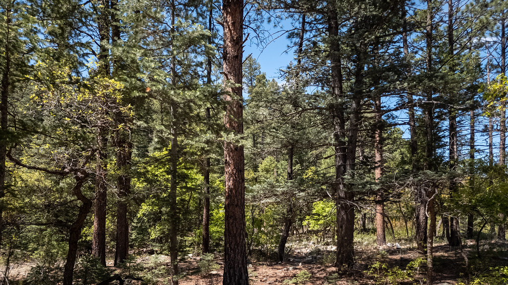
Webster Parks Camp is an unstaffed campground in northern New Mexico, about 4.4 miles from the town of Ute Park. It is a dry site, and its program ties to crew-based challenge initiatives, which suggests it is used for organized group trips rather than as a regular backcountry base. The most comfortable months for a visit are typically late spring and early fall. Typical averages from the nearby Eagle Nest weather station, which sits about 450 feet lower than the camp, show May highs around 66°F and September highs around 72°F, with July and August bringing the most wet days of the year. Several trails start close by. The Webster Parks to Lower Sawmill Trail is just 0.1 mile away, and the Cimarroncito to Webster Parks Trail is 0.3 mile off. The Aspen Springs - Cimarroncito Trail and the Aspen Springs Junction to Lower Sawmill Trail are both within a mile.
Local outfitters
- Angel Fire Luxury RV Resort14 mi away
- Taos Mountain Outfitters28 mi away
Not on Roamze yet. Their page has how to reach them.
Best time to go · May–Jun, Sep
Best time to visit Webster Parks Camp
Best months: May–June and September. Best months have typical highs of 55–85 °F, lows of 30 °F or warmer (32 °F where the station doesn't record snow), at most one snowy day and no more than 12 wet days.
Jan
39° / 5°
7 wet
Feb
42° / 10°
7 wet
Mar
49° / 18°
8 wet
Apr
56° / 24°
8 wet
May
66° / 32°
7 wet
Jun
77° / 38°
9 wet
Jul
79° / 44°
15 wet
Aug
77° / 43°
15 wet
Sep
72° / 35°
9 wet
Oct
62° / 25°
6 wet
Nov
49° / 15°
6 wet
Dec
39° / 6°
7 wet
Typical high / low (°F) and days with rain or snow, 1991–2020. Measured at Eagle Nest, NM, 11 mi away at 8,280 ft. This station doesn't record snowfall. Source: NOAA NCEI U.S. Climate Normals 1991–2020.
Keep exploring — more campsites worth the drive
BED
Cimarroncito
~1 min drive
Cimarroncito is a campground in Texas at about 8,145 feet.
BED
Aspen Springs Camp
~2 min drive
Aspen Springs Camp is a campground in New Mexico at about 7,931 feet.
BED
Lower Sawmill Camp
~2 min drive
Lower Sawmill Camp is a campground in New Mexico at about 8,313 feet.
BED
Hunting Lodge
~2 min drive
Hunting Lodge is a campground in Texas at about 7,780 feet.
BED
Ute Springs Camp
~2 min drive
Ute Springs Camp is a campground in New Mexico at about 7,699 feet.
BED
Upper Sawmill Camp
~2 min drive
Upper Sawmill Camp is a campground in New Mexico at about 8,607 feet.
BED
Ute Park Pass
~3 min drive
BED
Bailout Camp
~3 min drive
Bailout Camp is a campground in New Mexico at about 8,739 feet.
BED
Sawmill
~3 min drive
Sawmill is a campground in New Mexico at about 9,188 feet.
BED
Cathedral Rock Camp
~3 min drive
Cathedral Rock Camp is a campground in Texas at about 7,536 feet.
Map and trail data © OpenStreetMap contributors
