Camp Yaw Paw
Campground
Campground · 17 mi from the trail
 Photo: Tainanian, CC BY 2.0 (via Flickr)
Clear today
Weather is good · OpenWeather · checked 8 h ago
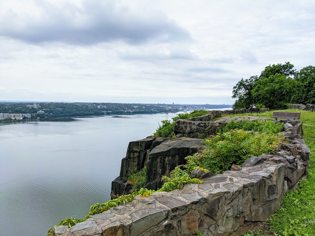
Lamont Rock Trail is a 1-mile hike on county land within Camp Alpine in New Jersey, about a mile from the town of Alpine. The route is rated easy, and it rises from a low of about 200 feet to a high of 493 feet, with a total gain of 412 feet. The climb is front-loaded, with the steepest stretch at about 0.29 miles in, where the grade reaches 25 percent. The trail is a point-to-point route, and it works well as a short outing. The trip takes about half an hour, and the route is open to bikes, so it can be done on foot or on a bicycle. For comfortable weather, aim for late spring or early fall. Typical averages from a nearby weather station in Dobbs Ferry, New York, show May highs around 73°F and September highs around 77°F, with July the warmest month at about 86°F. Several other trails sit close by. The Sneden Harring Lamont Trail (Yellow) is about 0.1 mile away, and the Red Circle and Roaring Ravine Trail (Red) are each within a third of a mile. Orange Hill Bouldering, a climbing area, is about half a mile off.
Camp Yaw Paw
Campground
 If it rainsJim.henderson, CC0 · Wikimedia Commons
Places © OpenStreetMap contributors · Photos: Jim.henderson, CC0 (commons)
More in Mount KiscoNot on Roamze yet. Their page has how to reach them.
 Sneden Harring Lamont Trail (Yellow)HikingPhoto: Tainanian, CC BY 2.0 (via Flickr)0.1 mi
 Red CircleHikingPhoto: Tainanian, CC BY 2.0 (via Flickr)0.2 miRoaring Ravine Trail (Red)HikingPhoto: Tainanian, CC BY 2.0 (via Flickr)0.3 mi
 Bronx RiverCanoeingPhoto: Jim.henderson, Public domain (via Wikimedia Commons)8.1 mi
Source: Roamze catalog (indexable pages within 10 miles, PostGIS distance)
Sneden Harring Lamont Trail (Yellow)Hiking · Next doorPhoto: Tainanian, CC BY 2.0 (via Flickr)Red CircleHiking · Next doorPhoto: Tainanian, CC BY 2.0 (via Flickr) White TrailHiking · ~6 min drivePhoto: clembore, CC BY-SA 2.0 (via Flickr)Roaring Ravine Trail (Red)Hiking · Next doorPhoto: Tainanian, CC BY 2.0 (via Flickr)
 Shore TrailHiking · ~2 min drivePhoto: PunkToad, CC BY 2.0 (via Flickr)Yellow TrailHiking · ~7 min drivePhoto: clembore, CC BY-SA 2.0 (via Flickr)
 Hiking Route Orange TrailHiking · Next doorPhoto: Tainanian, CC BY 2.0 (via Flickr)WhiteHiking · Next doorPhoto: Tainanian, CC BY 2.0 (via Flickr)
Best months: April–June and August–October. Best months have typical highs of 55–85 °F, lows of 30 °F or warmer (32 °F where the station doesn't record snow), at most one snowy day and no more than 12 wet days.
Jan
40° / 23°
11 wet
Feb
43° / 25°
9 wet
Mar
51° / 31°
11 wet
Apr
63° / 40°
12 wet
May
73° / 50°
12 wet
Jun
81° / 59°
11 wet
Jul
86° / 64°
10 wet
Aug
84° / 63°
10 wet
Sep
77° / 56°
9 wet
Oct
65° / 45°
9 wet
Nov
54° / 36°
10 wet
Dec
44° / 29°
11 wet
Typical high / low (°F) and days with rain or snow, 1991–2020. Measured at Dobbs Ferry-Ardsley, NY, 4.5 mi away at 200 ft. This station doesn't record snowfall. Source: NOAA NCEI U.S. Climate Normals 1991–2020.
Map and trail data © OpenStreetMap contributors
