Pasture Trail
 Photo: rmburnes, CC BY 2.0 (via Flickr)
- 0.4 mi
- round trip
- 413 ft
- climb
- 1,184 ft
- high point
- Out and back
- route
- May–Oct
- best months
Pasture Trail is a short, easy out-and-back hike in New Hampshire's Pinehurst area, managed by a non-governmental organization. The trail is 0.72 miles long, with a total elevation gain of 413 feet, and it reaches a high point of 1,184 feet. The climb is front-loaded, with the steepest stretch at about 0.2 miles from the start, where the grade reaches 29 percent. Summer is the most comfortable time to go. Typical averages from a nearby weather station in Meredith show July highs around 81°F with lows near 60°F, and the station sits about 320 feet lower than the trail's high point, so temperatures on the summit run cooler. The hike takes about half an hour. The trail starts at the low point of 771 feet and returns to it, so the total gain and loss are each 413 feet. Several other trails lie close by, including Five Finger Point Trail at 0.1 mile and East Rattlesnake Trail at 0.2 mile. Climbers can find Pulpit Rock Area about 4 miles away, and Campton Campground is roughly 8 miles off.
- Five Finger Point TrailHikingPhoto: rmburnes, CC BY 2.0 (via Flickr)0.1 mi
- East Rattlesnake TrailHiking0.2 mi
 Col TrailHikingPhoto: marcn, CC BY 2.0 (via Flickr)0.3 mi
- Ridge TrailHiking0.3 mi
- Roadside BoulderRock climbing4 mi
- Roadside AreaRock climbing4.1 mi
- Pulpit Rock AreaRock climbing4.1 mi
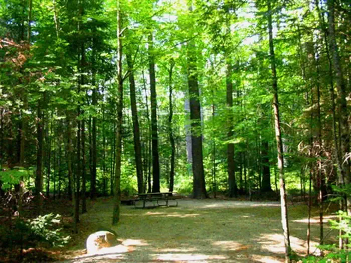 Campton CampgroundCampingPhoto: Recreation.gov (RIDB) / public domain8.1 mi
Source: Roamze catalog (indexable pages within 10 miles, PostGIS distance)
- Col TrailHiking · Next doorPhoto: marcn, CC BY 2.0 (via Flickr)
- Mount Percival TrailHiking · ~2 min drivePhoto: marcn, CC BY 2.0 (via Flickr)
 Crawford-Ridgepole TrailHiking · ~6 min drivePhoto: Magicpiano, CC BY-SA 3.0 (via Wikimedia Commons)
- Eagle Cliff TrailHiking · ~7 min drive
- Butterworth TrailHiking · ~2 min drivePhoto: rmburnes, CC BY 2.0 (via Flickr)
 Prescott TrailHiking · ~5 min drivePhoto: Magicpiano, CC BY-SA 3.0 (via Wikimedia Commons)
- Wentworth TrailHiking · ~8 min drive
- Undercut TrailHiking · ~2 min drivePhoto: marcn, CC BY 2.0 (via Flickr)
- Cotton Mountain TrailHiking · ~6 min drivePhoto: Magicpiano, CC BY-SA 3.0 (via Wikimedia Commons)
- Brooks Fisher TrailHiking · ~3 min drivePhoto: Magicpiano, CC BY-SA 3.0 (via Wikimedia Commons)
Best time to visit Pasture Trail
Best months: May–October. Best months have typical highs of 55–85 °F, lows of 30 °F or warmer (32 °F where the station doesn't record snow), at most one snowy day and no more than 12 wet days.
Jan
29° / 13°
10 wet
Feb
32° / 15°
9 wet
Mar
41° / 23°
10 wet
Apr
54° / 34°
11 wet
May
67° / 45°
12 wet
Jun
75° / 55°
12 wet
Jul
81° / 60°
11 wet
Aug
79° / 59°
10 wet
Sep
71° / 52°
10 wet
Oct
58° / 40°
11 wet
Nov
45° / 30°
11 wet
Dec
34° / 21°
11 wet
Typical high / low (°F) and days with rain or snow, 1991–2020. Measured at Meredith 3 Nne, NH, 6.6 mi away at 861 ft. This station doesn't record snowfall. Source: NOAA NCEI U.S. Climate Normals 1991–2020.
Map and trail data © OpenStreetMap contributors
