Col Trail
 Photo: marcn, CC BY 2.0 (via Flickr)
- 0.7 mi
- round trip
- 358 ft
- climb
- 1,047 ft
- high point
- Out and back
- route
- May–Oct
- best months
Col Trail is a short, easy out-and-back hike in New Hampshire, about 0.6 miles from the village of Rockywold. The trail is 1.3 miles long, with a total climb of 358 feet and a high point of 1,047 feet. The route starts at that high point and descends back to the trailhead, so the climb is back-loaded, and the steepest stretch comes about a quarter of a mile in at 18%. Summer is the most comfortable time to go. Typical averages from a nearby weather station in Meredith run to highs around 81°F in July and 79°F in August, with lows near 60°F. That station sits about 186 feet lower than the trail's high point, so temperatures on the summit run a little cooler. The hike takes about half an hour. Several other trails start within a third of a mile, including Pasture Trail, Five Finger Point Trail and Ridge Trail. For climbing, Pulpit Rock Area is about 3.8 miles away.
 Pasture TrailHikingPhoto: rmburnes, CC BY 2.0 (via Flickr)0.3 mi
- Five Finger Point TrailHikingPhoto: rmburnes, CC BY 2.0 (via Flickr)0.3 mi
- Ridge TrailHiking0.3 mi
- East Rattlesnake TrailHiking0.4 mi
- Roadside BoulderRock climbing3.7 mi
- Roadside AreaRock climbing3.8 mi
- Pulpit Rock AreaRock climbing3.8 mi
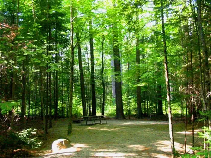 Campton CampgroundCampingPhoto: Recreation.gov (RIDB) / public domain7.9 mi
Source: Roamze catalog (indexable pages within 10 miles, PostGIS distance)
- Pasture TrailHiking · Next doorPhoto: rmburnes, CC BY 2.0 (via Flickr)
- Five Finger Point TrailHiking · Next doorPhoto: rmburnes, CC BY 2.0 (via Flickr)
 Crawford-Ridgepole TrailHiking · ~6 min drivePhoto: Magicpiano, CC BY-SA 3.0 (via Wikimedia Commons)
- Wentworth TrailHiking · ~7 min drive
- Butterworth TrailHiking · ~1 min drivePhoto: rmburnes, CC BY 2.0 (via Flickr)
- Mount Percival TrailHiking · ~2 min drivePhoto: marcn, CC BY 2.0 (via Flickr)
- Eagle Cliff TrailHiking · ~7 min drive
- Undercut TrailHiking · ~2 min drivePhoto: marcn, CC BY 2.0 (via Flickr)
 Prescott TrailHiking · ~5 min drivePhoto: Magicpiano, CC BY-SA 3.0 (via Wikimedia Commons)
- Algonquin TrailHiking · ~10 min drive
Best time to visit Col Trail
Best months: May–October. Best months have typical highs of 55–85 °F, lows of 30 °F or warmer (32 °F where the station doesn't record snow), at most one snowy day and no more than 12 wet days.
Jan
29° / 13°
10 wet
Feb
32° / 15°
9 wet
Mar
41° / 23°
10 wet
Apr
54° / 34°
11 wet
May
67° / 45°
12 wet
Jun
75° / 55°
12 wet
Jul
81° / 60°
11 wet
Aug
79° / 59°
10 wet
Sep
71° / 52°
10 wet
Oct
58° / 40°
11 wet
Nov
45° / 30°
11 wet
Dec
34° / 21°
11 wet
Typical high / low (°F) and days with rain or snow, 1991–2020. Measured at Meredith 3 Nne, NH, 6.8 mi away at 861 ft. This station doesn't record snowfall. Source: NOAA NCEI U.S. Climate Normals 1991–2020.
Map and trail data © OpenStreetMap contributors
