Electric Loop
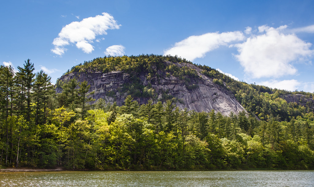 Photo: rjshade, CC BY 2.0 (via Flickr)
- 2.9 mi
- loop
- 43 ft
- climb
- 563 ft
- high point
- Loop
- route
Is Electric Loop open right now?
Closure in the area
There's a closure order in White Mountain National Forest. It doesn't name Electric Loop, so check the source for the area it covers (2 listed).
Wild River Fire - Androscoggin Ranger District
Agency closure covering White Mountain National Forest · USFS · White Mountain National Forest
Rattlesnake Fire – Pemigewasset Ranger District
Agency closure covering White Mountain National Forest · USFS · White Mountain National Forest
Town Hall Road Camping and Fire Restrictions
Agency alert covering White Mountain National Forest · USFS · White Mountain National Forest
Lincoln Woods Trail Closure
Agency alert covering White Mountain National Forest · USFS · White Mountain National Forest
Forest Roads Status
Agency alert covering White Mountain National Forest · USFS · White Mountain National Forest
As of · Source: USFS · White Mountain National Forest. Agencies don't list every closure — check before you go.
Electric Loop is a 2.9-mile loop hike in the Saco Ranger District of White Mountain National Forest in New Hampshire, on Forest Service land. It's an easy walk with a low elevation gain of 43 feet, so the trail stays nearly flat. The loop starts and ends at roughly the same elevation, with the high point at 563 feet and the low point at 502 feet. The route is natural-surface and bikes are allowed, which makes it a good option for a leisurely outing on foot or by bike. The trail reaches the steepest part at about 1.6 miles in, with a grade of around 5 percent, but it remains mild overall. The loop is open year-round. Summer and early fall are the most comfortable times to go. Typical averages from a nearby weather station in Conway show July highs around 81°F and September highs near 72°F, while winter brings highs in the 30s and regular snow days. The Thompson Falls Trail sits just 0.1 mile away, and the Lower Stony Ridge Trail is about 0.6 mile off. Climbers can head to Cathonian Slab, about 0.8 mile away, and the Saco River offers fishing roughly 4.6 miles from the loop.
- Thompson Falls TrailHikingPhoto: rjshade, CC BY 2.0 (via Flickr)0.1 mi
- Lower Stony Ridge TrailHiking0.6 mi
- Cathonian SlabRock climbing0.8 mi
- Inferno - Atlantis AreaRock climbing0.8 mi
- Covered BridgeCamping4.1 mi
- Blackberry CrossingCamping4.5 mi
- Saco RiverRiver fishing4.6 mi
- Ellis RiverRiver fishing7.4 mi
Source: Roamze catalog (indexable pages within 10 miles, PostGIS distance)
- Thompson Falls TrailHiking · Next doorPhoto: rjshade, CC BY 2.0 (via Flickr)
 Red Ridge TrailHiking · ~3 min drivePhoto: dgjarvis10@gmail.com, CC BY-SA 2.0 (via Flickr)
 Middle Mountain TrailHiking · ~7 min drivePhoto: gotjen, CC BY 3.0 (via Wikimedia Commons)
 Echo Lake TrailHiking · ~2 min drivePhoto: Bob Linsdell — CC BY 2.0 (via Flickr)
 Sabbaday Brook Trail - New HampshireHiking · ~7 min drivePhoto: Eric Kilby, CC BY-SA 2.0 (via Flickr)
 Red Tail TrailHiking · ~7 min drivePhoto: gotjen, CC BY 3.0 (via Wikimedia Commons)
- White Horse Ledge Trail (Yellow)Hiking · ~2 min drivePhoto: dgjarvis10@gmail.com, CC BY-SA 2.0 (via Flickr)
- Moat Mountain TrailHiking · ~5 min drive
- Boulder Loop TrailHiking · ~7 min drivePhoto: Eric Kilby, CC BY-SA 2.0 (via Flickr)
 Pudding Pond TrailHiking · ~4 min drivePhoto: Bob Linsdell, CC BY 2.0 (via Flickr)

