Back 80 Trail
 Photo: Šarūnas Burdulis from USA, CC BY-SA 2.0 (via Wikimedia Commons)
- 2.7 mi
- round trip
- 1,293 ft
- climb
- 2,476 ft
- high point
- Out and back
- route
- May–Oct
- best months
Back 80 Trail is a moderate out-and-back hike in Cardigan Mountain State Forest in New Hampshire, managed by the State Department of Natural Resources. The trail is about 5.4 miles long, with a total elevation gain of 1,293 feet, and it starts at roughly 2,463 feet, rising to a high point of 2,476 feet before returning to the trailhead. The route is rolling rather than steep, and the climb is spread across the full length of the hike. Summer is the most comfortable time to go. Typical averages from a nearby weather station in Meredith run to highs around 81°F in July, and temperatures at the higher end of the trail run cooler than that station's figures. The trip takes about 2.5 hours. Manning Trail lies about a mile away, and Holt Trail and Mowglis Trail are each about 1.5 miles off. Paddlers can reach the Indian River, about 4.8 miles away.
- Manning TrailHikingPhoto: Šarūnas Burdulis from USA, CC BY-SA 2.0 (via Wikimedia Commons)1 mi
- Holt TrailHikingPhoto: Šarūnas Burdulis from USA, CC BY-SA 2.0 (via Wikimedia Commons)1.5 mi
 Mowglis TrailHikingPhoto: Šarūnas Burdulis from USA, CC BY-SA 2.0 (via Wikimedia Commons)1.5 mi
- Indian RiverCanoeing4.8 mi
- Smith RiverCanoeing8.1 mi
- Slab WallRock climbing9.7 mi
- Small WallRock climbing9.7 mi
- Buffalo PitRock climbing9.7 mi
Source: Roamze catalog (indexable pages within 10 miles, PostGIS distance)
- Manning TrailHiking · ~2 min drivePhoto: Šarūnas Burdulis from USA, CC BY-SA 2.0 (via Wikimedia Commons)
- Mowglis TrailHiking · ~2 min drivePhoto: Šarūnas Burdulis from USA, CC BY-SA 2.0 (via Wikimedia Commons)
 Back 80 LoopHiking · ~3 min drivePhoto: timsackton, CC BY-SA 2.0 (via Flickr)
- Holt TrailHiking · ~2 min drivePhoto: Šarūnas Burdulis from USA, CC BY-SA 2.0 (via Wikimedia Commons)
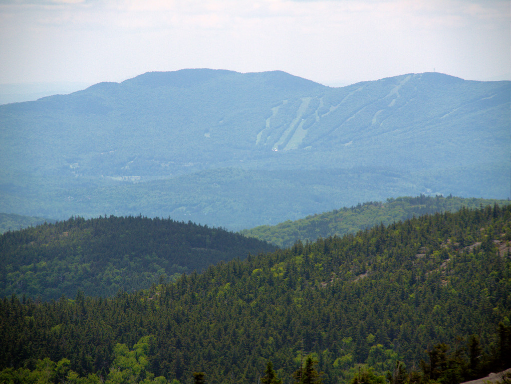 Clark TrailHiking · ~3 min drivePhoto: Šarūnas Burdulis, CC BY-SA 2.0 (via Flickr)
 Kimball Ski TrailHiking · ~3 min drivePhoto: Šarūnas Burdulis from USA, CC BY-SA 2.0 (via Wikimedia Commons)
- South Ridge TrailHiking · ~3 min drivePhoto: Šarūnas Burdulis, CC BY-SA 2.0 (via Flickr)
 Bailey Brook Ski TrailHiking · ~4 min drivePhoto: Šarūnas Burdulis from USA, CC BY-SA 2.0 (via Wikimedia Commons)
- Alexandria Ski TrailHiking · ~3 min drivePhoto: Šarūnas Burdulis, CC BY-SA 2.0 (via Flickr)
- Nature TrailHiking · ~4 min drivePhoto: Šarūnas Burdulis from USA, CC BY-SA 2.0 (via Wikimedia Commons)
Best time to visit Back 80 Trail
Best months: May–October. Best months have typical highs of 55–85 °F, lows of 30 °F or warmer (32 °F where the station doesn't record snow), at most one snowy day and no more than 12 wet days.
Jan
29° / 13°
10 wet
Feb
32° / 15°
9 wet
Mar
41° / 23°
10 wet
Apr
54° / 34°
11 wet
May
67° / 45°
12 wet
Jun
75° / 55°
12 wet
Jul
81° / 60°
11 wet
Aug
79° / 59°
10 wet
Sep
71° / 52°
10 wet
Oct
58° / 40°
11 wet
Nov
45° / 30°
11 wet
Dec
34° / 21°
11 wet
Typical high / low (°F) and days with rain or snow, 1991–2020. Measured at Meredith 3 Nne, NH, 22 mi away at 861 ft. The station sits about 1,600 ft lower than this place, so expect it a little cooler here. This station doesn't record snowfall. Source: NOAA NCEI U.S. Climate Normals 1991–2020.

Map and trail data © OpenStreetMap contributors
