California Crag
California Crag in Nevada has 10 routes ranging across 10 difficulty grades, offering sport and trad climbing.
 Photo: joannapoe, CC BY-SA 2.0 (via Flickr)
- 10 routes
- 5.10- – 5.12d
- Sport · Trad
Best time to visit California Crag
Best months: February–May and October–November. Best months have typical highs of 55–85 °F, lows of 30 °F or warmer (32 °F where the station doesn't record snow), at most one snowy day and no more than 12 wet days.
Jan
53° / 32°
4 wet
Feb
56° / 35°
5 wet
Mar
64° / 41°
4 wet
Apr
70° / 47°
2 wet
May
80° / 56°
1 wet
Jun
90° / 66°
1 wet
Jul
95° / 73°
2 wet
Aug
94° / 72°
2 wet
Sep
87° / 62°
2 wet
Oct
75° / 50°
2 wet
Nov
62° / 38°
2 wet
Dec
52° / 31°
3 wet
Typical high / low (°F) and days with rain or snow, 1991–2020. Measured at Red Rock Canyon - Spg Mt Rch S, NV, 6.4 mi away at 3,780 ft. The station sits about 500 ft lower than this place, so expect it a little cooler here. This station doesn't record snowfall. Source: NOAA NCEI U.S. Climate Normals 1991–2020.
California Crag is a climbing area in Nevada on Bureau of Land Management land within the Red Rock/Sloan Field Office. It sits among a cluster of other climbing areas, with Hidden Corridor, The Pier and Americrag all about 0.1 mile away. Spring and fall are the most comfortable times to visit. Typical averages from a nearby weather station show April highs around 70°F and October highs around 75°F, while July and August average in the mid-90s. The area has 10 routes, mostly sport climbing with one trad route. Grades run from 5.10b to 5.12d, with California Clowns at 5.12d and The Escalator at 5.10b. The Pier and Front Corridor are also close by for more climbing. For a hike, Calico Tanks Trail is about 0.2 mile away and Turtlehead Peak about 0.3 mile. Red Rock Canyon Campground, roughly 4 miles off, is the closest place to camp.
Routes (10)
Keep exploring — more climbs worth the drive
Photo: joannapoe, CC BY-SA 2.0 (via Flickr)Hidden Corridor
~0 min drive
Hidden Corridor in Nevada has 8 climbing routes across 7 grades, offering sport and trad options.
 Photo: joannapoe, CC BY-SA 2.0 (via Wikimedia Commons)
The Pier
~0 min drive
The Pier in Nevada has 17 sport climbing routes on 11 difficulty grades.
Photo: joannapoe, CC BY-SA 2.0 (via Flickr)Americrag
~0 min drive
Americrag in Nevada has 5 sport climbing routes across 3 difficulty grades.
 Photo: Alexander Hatley, CC BY 2.0 (via Flickr)
Front Corridor
~0 min drive
Front Corridor in Nevada has 19 climbing routes across 13 grades, offering sport and trad options.
 Photo: Alexander Hatley, CC BY 2.0 (via Wikimedia Commons)
White Slab
~0 min drive
7-route climbing area in Nevada with mixed routes at moderate to expert difficulty.
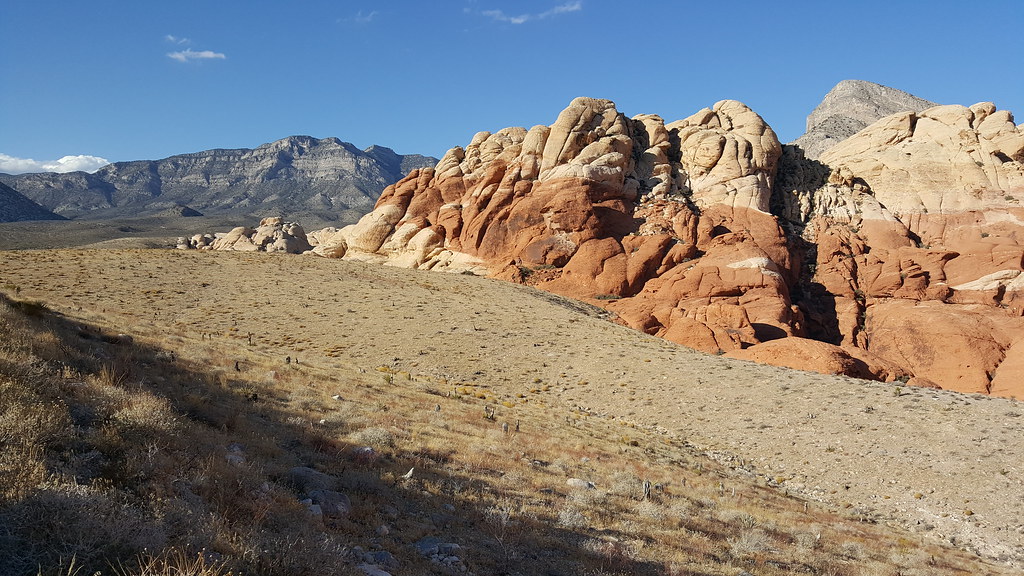 Photo: Moo.The.Cow, CC BY 2.0 (via Flickr)
Calico Hills Trail
~0 min drive
Colorful Nevada sandstone climbing with varied routes and scenic desert views.
 Photo: Lukáš Lalinský, CC BY-SA 2.0 (via Flickr)
Sandy Corridor
~0 min drive
Sandy Corridor in Nevada has 11 climbing routes across 8 difficulty grades, featuring mixed, sport, and trad styles.
Photo: Lukáš Lalinský, CC BY-SA 2.0 (via Flickr)Parking Lot Area
~0 min drive
Parking Lot Area in Nevada has 1 sport climbing route.
 Photo: joannapoe, CC BY-SA 2.0 (via Flickr)
Running Man Wall
~0 min drive
Running Man Wall in Nevada has 16 climbing routes across 11 grades, featuring mixed, sport, and trad styles.
 Photo: Corey Leopold, CC BY 2.0 (via Flickr)
The Mass Production Wall
~1 min drive
The Mass Production Wall in Nevada has 7 sport climbing routes across 6 grades.


