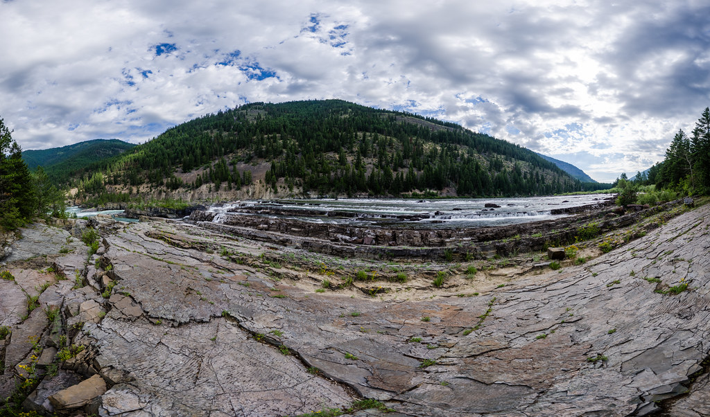
Kootenai Falls
 Photo: Bjorn, CC BY-SA 2.0 (via Wikimedia Commons)
- 1,936 ft
- elevation
- Apr–Jun, Sep–Oct
- best months
Is Kootenai Falls open right now?
Closure in the area
There's a closure order in Three Rivers Ranger District. It doesn't name Kootenai Falls, so check the source for the area it covers (2 listed).
Ross Creek Cedars Road Closure & Storm Damage Update
Agency closure covering Three Rivers Ranger District · Order 01-14-04-26-08 · USFS · Three Rivers Ranger District
Kootenai Flood Event & Inaccessible Areas
Agency closure covering Kootenai National Forest · USFS · Kootenai National Forest
Updated Skillet Fire Area, Road, Trail Closure
Agency alert covering Kootenai National Forest · Order 01-10- · USFS · Kootenai National Forest
Spar Lake Road #384 Road Closed to Motorized Vehicles
Agency alert covering Three Rivers Ranger District · Order 01-14-04-26-04 · USFS · Three Rivers Ranger District
As of · Source: USFS · Three Rivers Ranger District. Agencies don't list every closure — check before you go.
Kootenai Falls is a waterfall in the Three Rivers Ranger District of the Kootenai National Forest in northwest Montana, about 6 miles from the town of Troy. It sits at roughly 1,936 feet, and the surrounding forest makes it an easy addition to a day of hiking in this part of the forest. Summer is the most comfortable time to visit. Typical averages from the Troy weather station, a few miles away at nearly the same elevation, show July highs around 87°F with lows near 49°F, while September cools to about 75°F by day and 42°F at night. Winter is cold, with January highs averaging about 33°F. The falls make a natural anchor for a short outing. Kootenai Creek is less than a mile away, and Bighorn Trail #42 and the Grambauer hike are within about 1.5 miles. Anglers can head to Bull Lake Area, roughly 9 miles off.
- Elevation
- 1,936 ft
Elevation from USGS 3D Elevation Program terrain data (about 10 m resolution).
 Kootenai CreekHikingPhoto: waterarchives, CC BY-SA 2.0 (via Flickr)0.6 mi
 Bighorn Trail #42HikingPhoto: Arbron, CC BY 2.0 (via Flickr)1.1 mi
- BighornHiking1.3 mi
 GrambauerHikingPhoto: Arbron, CC BY 2.0 (via Flickr)1.5 mi
- Lake CreekCanoeing7.4 mi
- Callahan CreekCanoeing8.5 mi
- Bull Lake AreaLake fishing9.2 mi
- #423 Grouse LakeLake fishing9.2 mi
Source: Roamze catalog (indexable pages within 10 miles, PostGIS distance)
- Yaak FallsWaterfall · ~25 min drive
- Char FallsWaterfall · ~34 min drive
- Grouse Creek FallsWaterfall · ~45 min drive
- Moyie FallsWaterfall · ~46 min drive
- Little North Fork FallsWaterfall · ~47 min drive
- Turner FallsWaterfall · ~51 min drive
- Sutton Creek FallsWaterfall · ~54 min drive
- Lower FallsWaterfall · ~57 min drive
- Snow Creek FallsWaterfall · ~58 min drive
- Pinkham FallsWaterfall · ~1h 5m drive
Best time to visit Kootenai Falls
Best months: April–June and September–October. Best months have typical highs of 55–85 °F, lows of 30 °F or warmer (32 °F where the station doesn't record snow), at most one snowy day and no more than 12 wet days.
Jan
33° / 23°
13 wet
Feb
39° / 24°
10 wet
Mar
50° / 28°
11 wet
Apr
59° / 33°
9 wet
May
70° / 40°
10 wet
Jun
76° / 46°
10 wet
Jul
87° / 49°
6 wet
Aug
86° / 48°
5 wet
Sep
75° / 42°
6 wet
Oct
57° / 35°
9 wet
Nov
41° / 29°
13 wet
Dec
32° / 23°
13 wet
Typical high / low (°F) and days with rain or snow, 1991–2020. Measured at Troy, MT, 6.8 mi away at 1,929 ft. This station doesn't record snowfall. Source: NOAA NCEI U.S. Climate Normals 1991–2020.

