Old Yellowstone Trail-001c
Campground
Campground · < 0.1 mi from the trail
Closure in the area
There's a closure order in Custer Gallatin National Forest. It doesn't name Yankee Jim Boating Site, so check the source for the area it covers (14 listed).
NFSR #1700 South Plateau Road Closure
Agency closure covering Custer Gallatin National Forest · USFS · Custer Gallatin National Forest
Tom Miner Campground Closure
Agency closure covering Gardiner Ranger District · Order 01-11-03-26-02 · USFS · Gardiner Ranger District
Hyalite Porcupine Buffalo Horn Summer Interim Travel Order and Map and Order # 01-11-00-26-02
Agency closure covering Custer Gallatin National Forest · Order 01-11-00-26-02 · USFS · Custer Gallatin National Forest
Hyalite Porcupine Buffalo Horn Winter Interim Travel Order and Map Order Number: #01-11-00-26-01
Agency closure covering Custer Gallatin National Forest · USFS · Custer Gallatin National Forest
Glacier Lake Road #2421 Closure Order Number: # 01-11-82-26- 01
Agency closure covering Custer Gallatin National Forest · Order 01-11-82-26- · USFS · Custer Gallatin National Forest
As of · Source: USFS · Custer Gallatin National Forest. Agencies don't list every closure — check before you go.
Yankee Jim Boating Site is a boat launch in the Gardiner Ranger District of Custer Gallatin National Forest in Montana, about 3.7 miles from the community of Corwin Springs. It is a simple put-in with vault toilets as the only facility, and no fees are required to use it. Summer is the most comfortable time to visit. Typical averages from the nearby Gardiner weather station show July highs around 87°F with lows near 53°F, while June and September run a little milder, with highs in the upper 70s. The site sits right beside the climbing areas of Mile 13 Boulders and Fortress Area, both within a mile. The Yankee Jim Canyon Interp hike starts about 0.9 miles away, and the Canyon campground is roughly 1.9 miles off.
Old Yellowstone Trail-001c
Campground
Places © OpenStreetMap contributors
More in Emigrant Yankee Jim Canyon InterpHikingPhoto: Juhele_CZ, Public Domain Dedication (CC0) (via Flickr)0.9 mi
 Yankee Jim Toll SouthHikingPhoto: Juhele_CZ, Public Domain Dedication (CC0) (via Flickr)0.9 mi
 Slip & SlideHikingPhoto: Don Henise, CC BY 2.0 (via Flickr)0.9 mi
Source: Roamze catalog (indexable pages within 10 miles, PostGIS distance)
 Gallatin RiverCanoeing · ~27 min drivePhoto: Jim from Lexington, KY, USA, CC BY-SA 2.0 (via Wikimedia Commons)
 Gardner RiverCanoeing · ~29 min drivePhoto: Jo Suderman, Public domain (via Wikimedia Commons)
 Madison RiverCanoeing · ~54 min drivePhoto: Jim Peaco, National Park Service, Public domain (via Wikimedia Commons)
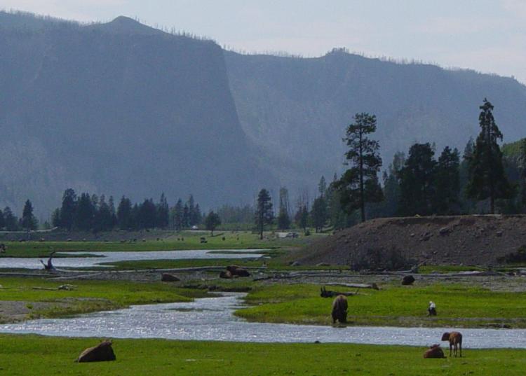 Gibbon RiverCanoeing · ~56 min drivePhoto: Daniel Mayer, CC BY-SA 3.0 (via Wikimedia Commons)
 East Gallatin RiverCanoeing · ~1h 7m drivePhoto: Mike Cline, Public domain (via Wikimedia Commons)
Best months: April–June and September–October. Best months have typical highs of 55–85 °F, lows of 30 °F or warmer (32 °F where the station doesn't record snow), at most one snowy day and no more than 12 wet days.
Jan
35° / 17°
Feb
38° / 18°
Mar
49° / 25°
Apr
57° / 32°
May
67° / 39°
Jun
77° / 46°
Jul
87° / 53°
Aug
86° / 52°
Sep
76° / 44°
Oct
60° / 34°
Nov
44° / 24°
Dec
34° / 17°
Typical high / low (°F) and days with rain or snow, 1991–2020. Measured at Gardiner, MT, 12 mi away at 5,275 ft. We don't have this place's elevation, so higher spots nearby can run cooler. This station doesn't record snowfall. Source: NOAA NCEI U.S. Climate Normals 1991–2020.
