Fr644-01 Mica Ck
Campground
Campground · 0.9 mi from the trail
Closure in the area
There's a closure order in Bozeman Ranger District. It doesn't name Fs 425, so check the source for the area it covers (16 listed).
Sourdough/Bozeman Creek Trailhead and Trail Closure
Agency closure covering Bozeman Ranger District · Order 01-11-06-27-02 · USFS · Bozeman Ranger District
NFSR #1700 South Plateau Road Closure
Agency closure covering Custer Gallatin National Forest · USFS · Custer Gallatin National Forest
Storm Castle Creek Trail #185 Temporarily Closed Due to Storm Damage
Agency closure covering Bozeman Ranger District · Order 01-11-06-26-07 · USFS · Bozeman Ranger District
Hyalite Porcupine Buffalo Horn Summer Interim Travel Order and Map and Order # 01-11-00-26-02
Agency closure covering Custer Gallatin National Forest · Order 01-11-00-26-02 · USFS · Custer Gallatin National Forest
Hyalite Porcupine Buffalo Horn Winter Interim Travel Order and Map Order Number: #01-11-00-26-01
Agency closure covering Custer Gallatin National Forest · USFS · Custer Gallatin National Forest
As of · Source: USFS · Bozeman Ranger District. Agencies don't list every closure — check before you go.
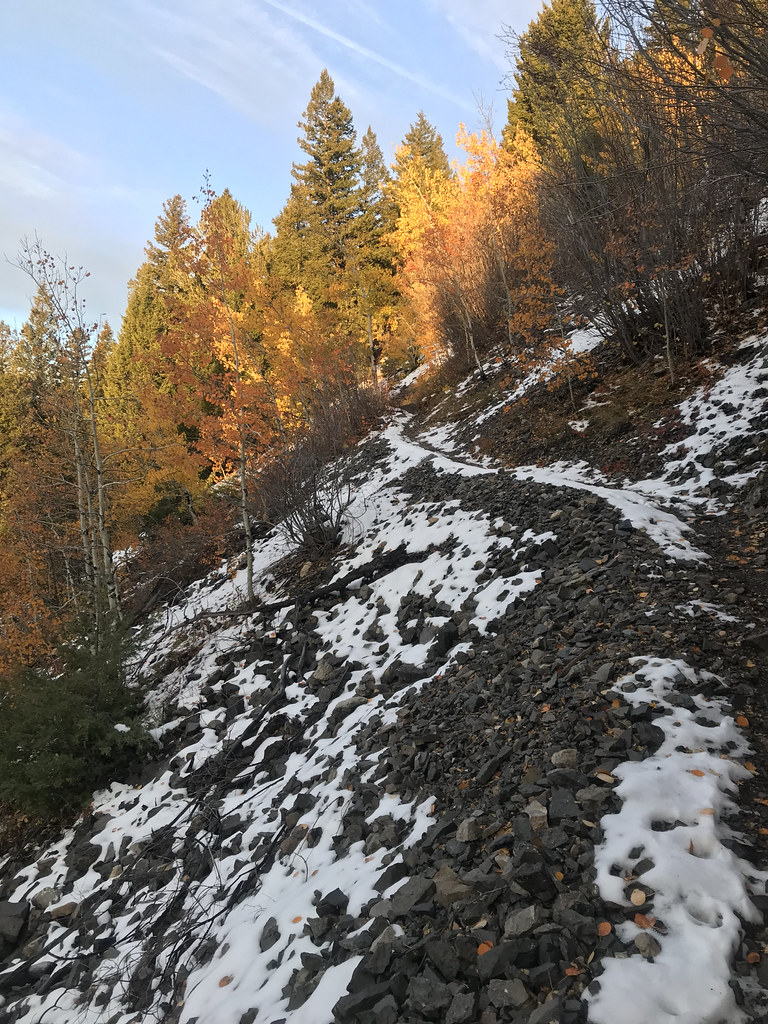
Fs 425 is a mountain biking route in Montana's Custer Gallatin National Forest, on the Bozeman Ranger District. It is a 5.2-mile out-and-back, rising from 5,741 feet to 7,495 feet with a total gain of 3,721 feet. The climb is hard, and the steepest stretch comes about half a mile in, where the grade reaches 26%. Summer is the most comfortable time to ride. Typical averages from a nearby weather station at Big Sky, which sits about 900 feet lower, show July highs around 78°F with lows near 41°F, and August is nearly as warm. Winter is cold, with January highs around 30°F. Mica Creek Road, a mountain biking route, lies just 0.3 miles away. Lime Creek, a hike, is 0.8 miles off. Spire Rock campground is about 1.9 miles away, and the Stormcastle climbing area is about 3.1 miles away.
Fr644-01 Mica Ck
Campground
Blacksmith Italian
Restaurant
Places © OpenStreetMap contributors
More in EmigrantBest months: July–September. Best months have typical highs of 55–85 °F, lows of 30 °F or warmer (32 °F where the station doesn't record snow), at most one snowy day and no more than 12 wet days.
Jan
30° / 9°
13 wet
Feb
34° / 9°
11 wet
Mar
42° / 17°
12 wet
Apr
48° / 23°
11 wet
May
58° / 30°
14 wet
Jun
67° / 36°
14 wet
Jul
78° / 41°
11 wet
Aug
77° / 39°
11 wet
Sep
68° / 33°
10 wet
Oct
53° / 25°
10 wet
Nov
37° / 16°
11 wet
Dec
27° / 9°
14 wet
Typical high / low (°F) and days with rain or snow, 1991–2020. Measured at Big Sky 2wnw, MT, 14.4 mi away at 6,590 ft. The station sits about 900 ft lower than this place, so expect it a little cooler here. This station doesn't record snowfall. Source: NOAA NCEI U.S. Climate Normals 1991–2020.
RIDE
Mica Creek Road
Next door
2.15-mile out-and-back singletrack in Montana with 1,394 ft elevation gain.
RIDE
Mica Mine Road
~2 min drive
0.45-mile out-and-back gravel road with 297 ft elevation gain in Montana.
RIDE
Rat Lake Trail
~3 min drive
5.30-mile out-and-back singletrack in Montana with 2,420 ft elevation gain.
RIDE
Rat Lake Accessible
~3 min drive
0.43-mile out-and-back trail in Montana with 164 ft elevation gain
RIDE
Mica Creek Road
~2 min drive
1.52-mile moderate singletrack out-and-back in Montana with 1,304 ft elevation gain.
RIDE
Mica Mine Road
~2 min drive
0.79-mile easy gravel road in Montana with 344 ft elevation gain.
RIDE
Fs 421
~5 min drive
1.9 mi · Hard
RIDE
Garnet Mountain
~5 min drive
3.02-mile out-and-back trail in Montana with 2,229 ft elevation gain.
RIDE
Mica Creek Road
~2 min drive
1.39-mile out-and-back singletrack in Montana with 1,290 ft elevation gain.
RIDE
Mica Mine Road
~2 min drive
0.98-mile easy gravel road with 947 ft gain in Montana.
Map and trail data © OpenStreetMap contributors