Florence Falls Trail
- 0.7 mi
- round trip
- 424 ft
- climb
- 5,016 ft
- high point
- Out and back
- route
- Jun–Sep
- best months
Is Florence Falls Trail open right now?
Closure in the area
There's a closure order in Glacier National Park. It doesn't name Florence Falls Trail, so check the source for the area it covers.
Going-to-the-Sun Road Seasonal Closure
Park closure covering Glacier National Park · NPS · Glacier National Park
As of · Source: NPS · Glacier National Park. Agencies don't list every closure — check before you go.
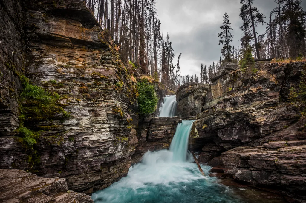
Florence Falls Trail is a short, easy out-and-back hike in Glacier National Park in Montana, managed by the National Park Service. The trail is about 0.7 miles long, and the round trip covers roughly 1.5 miles with a total elevation gain of about 424 feet. The route starts at about 4,774 feet and reaches a high point of about 5,016 feet, with the steepest stretch coming at about 0.67 miles in. Summer is the most comfortable time to go. Typical averages from a nearby weather station show July and August highs around 73°F with lows in the mid-40s and the fewest wet days of the year. That station sits about 460 feet lower than the trail, so temperatures on the trail run a little cooler. The hike takes about half an hour. The Saint Mary River, a canoeing spot, is about a mile away. Gunsight Pass Trail and Jackson Glacier Trail are both about 2 miles off, and St. Mary Falls Trail is about 3.4 miles away.
Local outfitters
- North American RV Park & Yurt Village22 mi away
- Rocky Mountain Outfitter43 mi away
Not on Roamze yet. Their page has how to reach them.
 Saint Mary RiverCanoeingPhoto: Royalbroil, CC BY-SA 3.0 (via Wikimedia Commons)0.9 mi
 Gunsight Pass TrailHikingPhoto: Gary Miotla, CC BY 3.0 (via Wikimedia Commons)2.1 mi
- Jackson Glacier TrailHikingPhoto: Gary Miotla, CC BY 3.0 (via Wikimedia Commons)2.1 mi
 St. Mary Falls TrailHikingPhoto: NPS / public domain3.4 mi
 Siyeh BendHikingPhoto: Suzie Tremmel, CC BY 2.0 (via Flickr)3.6 mi
 Siyeh Bend CutoffHikingPhoto: TerryDOtt, CC BY 2.0 (via Flickr)3.6 mi
 Highline TrailHikingPhoto: Public domain (via Wikimedia Commons)3.7 mi
- Glacier National ParkRock climbing9.1 mi
Source: Roamze catalog (indexable pages within 10 miles, PostGIS distance)
- Gunsight Pass TrailHiking · ~4 min drivePhoto: Gary Miotla, CC BY 3.0 (via Wikimedia Commons)
- Jackson Glacier TrailHiking · ~4 min drivePhoto: Gary Miotla, CC BY 3.0 (via Wikimedia Commons)
- St. Mary Falls TrailHiking · ~6 min drive
 Hidden Lake TrailHiking · ~6 min drivePhoto: Greg Willis from Denver, CO, usa, CC BY-SA 2.0 (via Wikimedia Commons)
 Siyeh Pass TrailHiking · ~8 min drivePhoto: alexblondeau, CC BY-SA 3.0 (via Wikimedia Commons)
- Highline TrailHiking · ~6 min drivePhoto: Public domain (via Wikimedia Commons)
- Siyeh Bend CutoffHiking · ~6 min drivePhoto: TerryDOtt, CC BY 2.0 (via Flickr)
- Siyeh BendHiking · ~6 min drivePhoto: Suzie Tremmel, CC BY 2.0 (via Flickr)
 Upper McDonald Creek TrailHiking · ~15 min drivePhoto: Tony Webster, CC BY 2.0 (via Flickr)
 Avalanche Lake TrailHiking · ~8 min drivePhoto: Cathy Cline, CC BY-SA 3.0 (via Wikimedia Commons)
Also worth it near here
- Saint Mary RiverCanoeing · ~1 min drivePhoto: Royalbroil, CC BY-SA 3.0 (via Wikimedia Commons)
 Reynolds MountainSummit · ~4 min drivePhoto: Public domain (via Wikimedia Commons)
 Oberlin FallsWaterfall · ~7 min drivePhoto: GlacierNPS, Public domain (via Wikimedia Commons)
- Avalanche LakeLake fishing · ~8 min drive
Best time to visit Florence Falls Trail
Best months: June–September. Best months have typical highs of 55–85 °F, lows of 30 °F or warmer (32 °F where the station doesn't record snow), at most one snowy day and no more than 12 wet days.
Jan
32° / 15°
15 wet
Feb
31° / 14°
14 wet
Mar
38° / 20°
16 wet
Apr
45° / 28°
14 wet
May
56° / 35°
13 wet
Jun
63° / 42°
12 wet
Jul
73° / 46°
9 wet
Aug
73° / 45°
8 wet
Sep
63° / 39°
9 wet
Oct
49° / 32°
12 wet
Nov
37° / 25°
14 wet
Dec
31° / 17°
15 wet
Typical high / low (°F) and days with rain or snow, 1991–2020. Measured at St. Mary 1 Ssw, MT, 12.9 mi away at 4,555 ft. This station doesn't record snowfall. Source: NOAA NCEI U.S. Climate Normals 1991–2020.
Map and trail data © OpenStreetMap contributors
