Ppin07a
- May–Sep
- best months
Is Ppin07a open right now?
Closure in the area
There's a closure order in Beartooth Ranger District. It doesn't name Ppin07a, so check the source for the area it covers (14 listed).
Krueger Pond Wild Horse and Burro Gather Closure Area
Agency closure covering Beartooth Ranger District · Order 01-11-82-27-01 · USFS · Beartooth Ranger District
NFSR #1700 South Plateau Road Closure
Agency closure covering Custer Gallatin National Forest · USFS · Custer Gallatin National Forest
Pine Grove Campground Closure
Agency closure covering Beartooth Ranger District · Order 01-11-82-26-04 · USFS · Beartooth Ranger District
Hyalite Porcupine Buffalo Horn Summer Interim Travel Order and Map and Order # 01-11-00-26-02
Agency closure covering Custer Gallatin National Forest · Order 01-11-00-26-02 · USFS · Custer Gallatin National Forest
Hyalite Porcupine Buffalo Horn Winter Interim Travel Order and Map Order Number: #01-11-00-26-01
Agency closure covering Custer Gallatin National Forest · USFS · Custer Gallatin National Forest
As of · Source: USFS · Beartooth Ranger District. Agencies don't list every closure — check before you go.
- At 6,214 ft
- Beartooth Ranger DistrictCuster Gallatin National Forest
Ppin07a is a campground in Montana with 5 sites. It is managed by the Forest Service.
Local outfitters
- Spring Creek Campground26 mi away
- Tiny Town Campground39 mi away
Not on Roamze yet. Their page has how to reach them.
 Initial CreekHikingPhoto: Jstuby at en.wikipedia, Public domain (via Wikimedia Commons)0.5 mi
- Castle CreekHiking1 mi
- Rabbit Gulch Trailhead SpurHikingPhoto: Jstuby at en.wikipedia, Public domain (via Wikimedia Commons)1.1 mi
- Initial Creek CampgroundCamping2 mi
- West Fork StillwaterHiking2.7 mi
- Meyers Creek CabinCamping4.5 mi
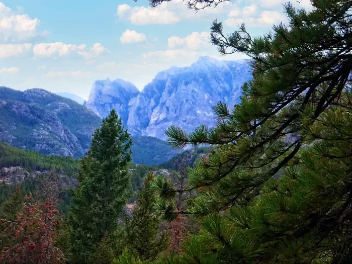 Woodbine CampgroundCampingPhoto: Recreation.gov (RIDB) / public domain5.6 mi
- Arch RockSummit8.2 mi
Source: Roamze catalog (indexable pages within 10 miles, PostGIS distance)
- Ppin057Camping · Next door
- Meyers Creek Rental CabinHut camping · ~7 min drive
- Brd2846-012Camping · ~1 min drive
- Ppin06Camping · ~1 min drive
- Brd2846-011Camping · ~2 min drive
- Brd2846-010Camping · ~3 min drive
- Brd2846-009Camping · ~3 min drive
- Brd2846-008Camping · ~3 min drive
- Brd2846-007Camping · ~3 min drive
- Brd2140-007Camping · ~3 min drive
Best time to visit Ppin07a
Best months: May–September. Best months have typical highs of 55–85 °F, lows of 30 °F or warmer (32 °F where the station doesn't record snow), at most one snowy day and no more than 12 wet days.
Jan
40° / 19°
5 wet · 4 snow
Feb
40° / 18°
5 wet · 4 snow
Mar
48° / 25°
7 wet · 5 snow
Apr
55° / 30°
9 wet · 3 snow
May
63° / 37°
12 wet · 1 snow
Jun
72° / 43°
12 wet
Jul
83° / 48°
10 wet
Aug
83° / 47°
8 wet
Sep
73° / 40°
7 wet
Oct
59° / 33°
7 wet · 2 snow
Nov
46° / 26°
6 wet · 3 snow
Dec
38° / 19°
5 wet · 4 snow
Typical high / low (°F) and days with rain or snow, 1991–2020. Measured at Nye #2, MT, 6.1 mi away at 4,840 ft. The station sits about 1,400 ft lower than this place, so expect it a little cooler here. Source: NOAA NCEI U.S. Climate Normals 1991–2020.
