Kahrs-Boger Park
- Apr–Jun, Sep–Oct
- best months
Clear today
Weather is good · OpenWeather · checked 10 h ago
Kahrs-Boger Park is a 106-acre park in Missouri, about 7 miles from the town of Smithton. It is a compact parcel of land rather than a destination with a set route, so planning here is simple: the park itself is the place to visit. For comfortable weather, aim for late spring or early fall. Typical averages from a nearby weather station in Sedalia show May highs around 74°F and September highs around 78°F, while July averages climb to about 87°F. Paddlers can find water close by. Haw Creek, a canoeing spot, lies about 4.5 miles away, and Flat Creek, another canoeing route, is roughly 9 miles off.
Park size
106 acres
Source: Roamze catalog (indexable pages within 10 miles, PostGIS distance)
 Harry S Truman State ParkState park · ~47 min drivePhoto: Semipaw, CC BY 3.0 (via Wikimedia Commons)
 Lake Of The Ozarks State ParkState park · ~1h 13m drivePhoto: James Carr, CC BY 2.0 (via Wikimedia Commons)
 Ha Ha Tonka State ParkState park · ~1h 19m drivePhoto: Paul Knittel from St. Louis, United States, CC BY 2.0 (via Wikimedia Commons)
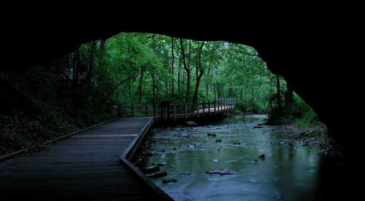 Rock Bridge Memorial State ParkState park · ~1h 21m drivePhoto: Narbonne1944, CC BY-SA 4.0 (via Wikimedia Commons)
 Van Meter State ParkState park · ~1h 23m drivePhoto: Americasroof, CC BY-SA 3.0 (via Wikimedia Commons)
 Pomme De Terre State ParkState park · ~1h 25m drivePhoto: mostateparks, Public domain (via Wikimedia Commons)
- Knob Noster State ParkState park · ~50 min drive
Best time to visit Kahrs-Boger Park
Best months: April–June and September–October. Best months have typical highs of 55–85 °F, lows of 30 °F or warmer (32 °F where the station doesn't record snow), at most one snowy day and no more than 12 wet days.
Jan
38° / 19°
7 wet · 2 snow
Feb
43° / 23°
6 wet · 1 snow
Mar
54° / 32°
9 wet · 1 snow
Apr
65° / 42°
11 wet
May
74° / 53°
11 wet
Jun
83° / 63°
9 wet
Jul
87° / 67°
8 wet
Aug
86° / 64°
7 wet
Sep
78° / 56°
7 wet
Oct
67° / 44°
8 wet
Nov
54° / 33°
7 wet
Dec
43° / 24°
7 wet · 1 snow
Typical high / low (°F) and days with rain or snow, 1991–2020. Measured at Sedalia Wtp, MO, 8.9 mi away at 780 ft. We don't have this place's elevation, so higher spots nearby can run cooler. Source: NOAA NCEI U.S. Climate Normals 1991–2020.

