 Photo: The original uploader was Malepheasant at English Wikipedia., CC BY-SA 2.5 (via Wikimedia Commons)
Paddling · 5 spots
Featured spots
Photo: The original uploader was Malepheasant at English Wikipedia., CC BY-SA 2.5 (via Wikimedia Commons)Canoeing
Leaf River
Forest, Mississippi

Canoeing
Hontokalo Creek
Forest, Mississippi

Canoeing
Shockaloo Creek
Forest, Mississippi
Canoeing
Tallabogue
Forest, Mississippi
Canoeing
Tallabogue
Forest, Mississippi
All spots · 5 spots
No additional spots match this filter.
Keep exploring — more water worth the drive
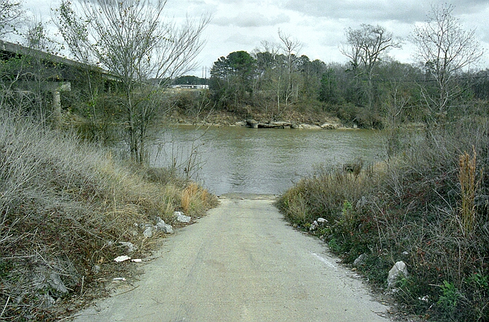
Photo: The original uploader was Malepheasant at English Wikipedia., CC BY-SA 2.5 (via Wikimedia Commons)Leaf River
~20 min drive
Leaf River is a 22-mile paddling stretch near Forest, Mississippi. It is intermittent and may run dry in some seasons. USGS models an average flow of about 1,311 cfs and a gradient of about 6.3 feet per mile. Land along it is managed by the U.S. Forest Service.
Hontokalo Creek
~8 min drive
Hontokalo Creek is a 5.5-mile paddling stretch near Forest, Mississippi. It is intermittent and may run dry in some seasons. USGS models an average flow of about 98 cfs and a gradient of about 6.7 feet per mile.
Tallabogue
~9 min drive
Tallabogue is a 21-mile paddling stretch near Forest, Mississippi. It is intermittent and may run dry in some seasons. USGS models an average flow of about 55 cfs and a gradient of about 5.5 feet per mile. Land along it is managed by the U.S. Forest Service.
Warrior Creek
~13 min drive
Warrior Creek is a 6-mile paddling stretch near Lake, Mississippi. It is intermittent and may run dry in some seasons. USGS models an average flow of about 33 cfs and a gradient of about 3.9 feet per mile.
Caney Creek
~15 min drive
Caney Creek is a 19-mile paddling stretch near Pulaski, Mississippi. It is intermittent and may run dry in some seasons. USGS models an average flow of about 58 cfs and a gradient of about 6.3 feet per mile. Land along it is managed by the U.S. Forest Service.
Shockaloo Creek
~17 min drive
Shockaloo Creek is a 21-mile paddling stretch near Forest, Mississippi. It is intermittent and may run dry in some seasons. USGS models an average flow of about 84 cfs and a gradient of about 3.5 feet per mile.
Strong River
~18 min drive
Strong River is a 22-mile paddling stretch near Morton, Mississippi. It is intermittent and may run dry in some seasons. USGS models an average flow of about 104 cfs and a gradient of about 3.4 feet per mile.
Tuscolameta Creek
~19 min drive
Tuscolameta Creek is a 1.6-mile paddling stretch near Lake, Mississippi. It is intermittent and may run dry in some seasons. USGS models an average flow of about 52 cfs and a gradient of about 3.3 feet per mile.
Balucta Creek
~29 min drive
Balucta Creek is a 20-mile paddling stretch near Lena, Mississippi. It is intermittent and may run dry in some seasons. USGS models an average flow of about 77 cfs and a gradient of about 3.9 feet per mile.
Ichusa Creek
~30 min drive
Ichusa Creek is a 33-mile paddling stretch near Louin, Mississippi. It is intermittent and may run dry in some seasons. USGS models an average flow of about 90 cfs and a gradient of about 4.3 feet per mile.
Conehatta Creek
~30 min drive
Conehatta Creek is a 18-mile paddling stretch near Decatur, Mississippi. It is intermittent and may run dry in some seasons. USGS models an average flow of about 86 cfs and a gradient of about 6.0 feet per mile.
Coffee Bogue
~30 min drive
Coffee Bogue is a 31-mile paddling stretch near Morton, Mississippi. It is intermittent and may run dry in some seasons. USGS models an average flow of about 136 cfs and a gradient of about 3.3 feet per mile.
