Barren Ridge
- 0.6 mi
- round trip
- 39 ft
- climb
- 1,637 ft
- high point
- Out and back
- route
- Aug–Sep
- best months
Is Barren Ridge open right now?
Closure in the area
There's a closure order in Superior National Forest. It doesn't name Barren Ridge, so check the source for the area it covers.
Post Wildfire Closures, Effective October 1, 2026
Agency closure covering Superior National Forest · Order 09-09-00-26-11 · USFS · Superior National Forest
Forest Road Improvement Projects
Agency alert covering Superior National Forest · USFS · Superior National Forest
As of · Source: USFS · Superior National Forest. Agencies don't list every closure — check before you go.
Barren Ridge is a short, flat cross-country ski route in Minnesota's Boundary Waters Canoe Area Wilderness, about half a mile from the town of Ely. The State Department of Natural Resources manages the land, and the trip starts and ends at roughly 1,613 feet with a peak of 1,637 feet. The route is an out-and-back that covers about a mile of mostly flat ground. It is rated easy, and the steepest stretch, about 2% grade, comes early in the run. The total climb is about 39 feet for the whole trip, so it works well as a quick outing or a warm-up before exploring more of the surrounding trails. Winter is the season for skiing here. Typical averages from the Ely weather station, about 8 miles away, show January highs near 15°F with lows around -7°F. June through August is the warmest stretch, with July highs near 79°F and lows around 53°F. Several other ski routes sit within a third of a mile, including Troll's Way, North Star Run and Druid Pines Trail. Lost Lake North, a hike about 0.7 miles away, rounds out the nearby options.
- Troll's WayCross-country skiing0.3 mi
- North Star RunCross-country skiing0.3 mi
- Druid Pines TrailCross-country skiing0.3 mi
- Lost Lake NorthHiking0.7 mi
- Hug a TreeHiking0.7 mi
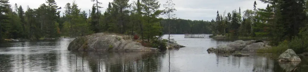 Fenske Lake CampgroundPier fishingPhoto: Recreation.gov (RIDB) / public domain3.5 mi
- Circle RouteCanoeing5 mi
- Science BoulderRock climbing6.2 mi
Source: Roamze catalog (indexable pages within 10 miles, PostGIS distance)
- Old BaldyCross-country skiing · ~1 min drive
- Thor's RunCross-country skiing · ~2 min drive
- Slim Lake LoopCross-country skiing · ~2 min drive
- Lost LakeCross-country skiing · ~1 min drive
- Coxey Cut OffCross-country skiing · ~2 min drive
- North ArmCross-country skiing · ~2 min drive
- Ole's LoopCross-country skiing · ~2 min drive
- North Junction-Nw LoopCross-country skiing · ~4 min drive
- Moose Horn LoopCross-country skiing · ~2 min drive
- Northwest PassageCross-country skiing · ~2 min drive
Best time to visit Barren Ridge
Best months: August–September. Best months have typical highs of 55–85 °F, lows of 30 °F or warmer (32 °F where the station doesn't record snow), at most one snowy day and no more than 12 wet days.
Jan
15° / -7°
11 wet
Feb
23° / -5°
9 wet
Mar
36° / 10°
9 wet
Apr
51° / 25°
10 wet
May
65° / 38°
13 wet
Jun
75° / 49°
14 wet
Jul
79° / 53°
13 wet
Aug
78° / 52°
12 wet
Sep
68° / 44°
12 wet
Oct
52° / 32°
14 wet
Nov
34° / 19°
11 wet
Dec
21° / 3°
11 wet
Typical high / low (°F) and days with rain or snow, 1991–2020. Measured at Ely, MN, 7.8 mi away at 1,382 ft. This station doesn't record snowfall. Source: NOAA NCEI U.S. Climate Normals 1991–2020.
Closures we've recorded since August 2026
Forest-wide Fire Restrictions
Superior National Forest · Order dated July 12, 2026; seen Aug 23, 2026 → lifted Aug 25, 2026 · Forest Service
Map and trail data © OpenStreetMap contributors
