Verchota Canoe Trail
- Apr, Jun–Oct
- best months
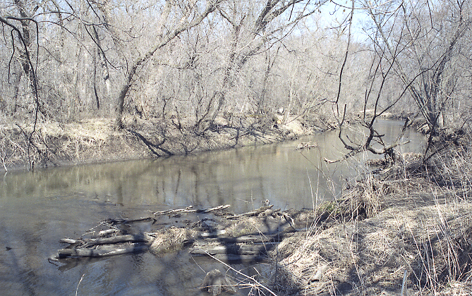
Verchota Canoe Trail is a canoeing route in Minnesota, about 1.7 miles from the town of Minnesota City. The land is managed by the U.S. Fish and Wildlife Service. Summer is the most comfortable time to paddle. Typical averages from a nearby weather station show July highs around 83°F and lows near 64°F, with June and August close behind. Winters are cold, with January highs in the low 20s and snow on about four to six days a month from December through February. Pool 8, Wildcat Park, a fishing spot across the state line in Wisconsin, is about 1.9 miles away. Garvin Brook, another paddling route, is about 4.7 miles off. The Mississippi River and the Aghaming Canoe Trail lie within roughly 8 miles.
Local outfitters
- Boulder Dam Canoe & Kayak Rental39 mi away
Not on Roamze yet. Their page has how to reach them.
- Pool 8, Wildcat ParkRiver fishing1.9 mi
- Garvin BrookCanoeing4.7 mi
- Mississippi RiverRiver fishing7.1 mi
 Low RollersHikingPhoto: Bien Stephenson, CC BY 2.0 (via Flickr)7.2 mi
- River Road TrailHiking7.3 mi
- Aghaming Canoe TrailCanoeing7.9 mi
 Sugar Loaf TrailHikingPhoto: Tim Wilson from Blaine, MN, USA, CC BY 2.0 (via Wikimedia Commons)8.8 mi
 Winona, Sugar LoafRock climbingPhoto: Tim Wilson from Blaine, MN, USA, CC BY 2.0 (via Wikimedia Commons)8.8 mi
Source: Roamze catalog (indexable pages within 10 miles, PostGIS distance)
 Whitewater RiverCanoeing · ~20 min drivePhoto: Jonathunder, CC BY-SA 3.0 (via Wikimedia Commons)
- Mertes' Slough LandingBoat launch · ~12 min drive
 Zumbro RiverCanoeing · ~60 min drivePhoto: The original uploader was Malepheasant at English Wikipedia., CC BY-SA 2.5 (via Wikimedia Commons)
- Lower Spring Lake LandingBoat launch · ~12 min drive
 Buffalo RiverCanoeing · ~1h 2m drivePhoto: Jeff the quiet, CC0 (via Wikimedia Commons)
- Upper Spring Lake LandingBoat launch · ~14 min drive
 Trempealeau RiverCanoeing · ~1h 5m drivePhoto: Royalbroil, CC BY-SA 3.0 (via Wikimedia Commons)
- Hwy 35/54 Boat LaunchBoat launch · ~19 min drive
- Garvin BrookCanoeing · ~8 min drive
- Kieps Island Boat RampBoat launch · ~21 min drive
Best time to visit Verchota Canoe Trail
Best months: April and June–October. Best months have typical highs of 55–85 °F, lows of 30 °F or warmer (32 °F where the station doesn't record snow), at most one snowy day and no more than 12 wet days.
Jan
23° / 8°
8 wet · 6 snow
Feb
28° / 11°
7 wet · 4 snow
Mar
42° / 24°
9 wet · 3 snow
Apr
56° / 37°
12 wet · 1 snow
May
69° / 50°
13 wet
Jun
79° / 59°
12 wet
Jul
83° / 64°
10 wet
Aug
80° / 62°
10 wet
Sep
71° / 54°
10 wet
Oct
57° / 41°
10 wet
Nov
41° / 28°
8 wet · 1 snow
Dec
28° / 15°
8 wet · 4 snow
Typical high / low (°F) and days with rain or snow, 1991–2020. Measured at Minnesota City Dam 5, MN, 4.2 mi away at 670 ft. Source: NOAA NCEI U.S. Climate Normals 1991–2020.

Map and trail data © OpenStreetMap contributors
