Suomi Trail
 Photo: Lorie Shaull, CC BY 2.0 (via Flickr)
- 0.5 mi
- round trip
- 77 ft
- climb
- 1,440 ft
- high point
- Out and back
- route
- May–Sep
- best months
Is Suomi Trail open right now?
Closure in the area
There's a closure order in Chippewa National Forest. It doesn't name Suomi Trail, so check the source for the area it covers.
Emergency Road Closure Notice - FR 2382 (West Pigeon Lake Rd)
Agency closure covering Chippewa National Forest · USFS · Chippewa National Forest
As of · Source: USFS · Chippewa National Forest. Agencies don't list every closure — check before you go.
The Suomi Trail is a short, easy out-and-back hike in the Deer River Ranger District of Chippewa National Forest in northern Minnesota, managed by the Forest Service. The trail is about half a mile long, with a total elevation gain of 77 feet, and it reaches a high point of about 1,440 feet. The climb is gentle, with the steepest stretch at about 0.08 miles in, and the trail is natural-surfaced and open to bikes. Summer is the most comfortable time to go. Typical averages from a nearby weather station in Marcell show July highs around 77°F with lows near 56°F, while January highs average about 16°F. The trail is open year-round, and the trip takes about half an hour. The Suomi South Side Dispersed Sites M6, M7, M11, M15, M are about 0.1 mile away, and the Suomi Hills Trail Sb is about 0.6 mile off. The Suomi Hills Trail Sd and Suomi Hills Trail Nd are each about 1.4 to 1.6 miles away.
Best time to go · May–Sep
Best time to visit Suomi Trail
Best months: May–September. Best months have typical highs of 55–85 °F, lows of 30 °F or warmer (32 °F where the station doesn't record snow), at most one snowy day and no more than 12 wet days.
Jan
16° / -5°
10 wet
Feb
22° / -3°
8 wet
Mar
36° / 12°
8 wet
Apr
49° / 27°
9 wet
May
63° / 40°
12 wet
Jun
72° / 52°
12 wet
Jul
77° / 56°
12 wet
Aug
75° / 55°
10 wet
Sep
66° / 47°
11 wet
Oct
51° / 35°
11 wet
Nov
34° / 20°
10 wet
Dec
21° / 5°
10 wet
Typical high / low (°F) and days with rain or snow, 1991–2020. Measured at Marcell 5ne, MN, 12.6 mi away at 1,387 ft. This station doesn't record snowfall. Source: NOAA NCEI U.S. Climate Normals 1991–2020.
Keep exploring — more trails worth the drive
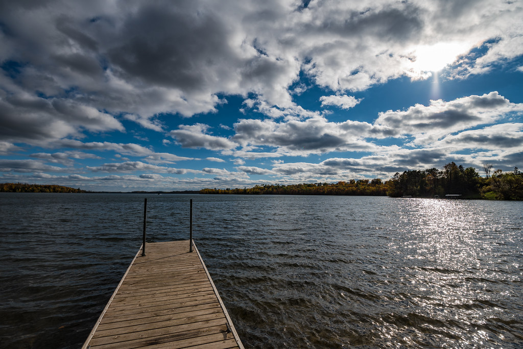 Photo: Tony Webster, CC BY-SA 2.0 (via Flickr)
Mesabi Trail
~25 min drive
112.95-mile point-to-point trail in Minnesota with 1,481 ft gain.
HIKE
Suomi Hills Trail Sb
Next door
1.98-mile out-and-back trail in Minnesota with 280 ft gain.
HIKE
Suomi Hills Trail Sd
~2 min drive
4.24-mile out-and-back trail in Minnesota with 477 ft gain
HIKE
Suomi Hills Trail S
~3 min drive
6.58-mile out-and-back hike in Minnesota with 581 ft gain
HIKE
SUOMI HILLS TRAIL ND
~3 min drive
1.9-mile out-and-back trail in Minnesota with 755 ft elevation gain
HIKE
Suomi Hills Trail Na
~4 min drive
5.34-mile loop trail in Minnesota with 668 ft elevation gain.
HIKE
Suomi Hills N Trail
~3 min drive
10.18-mile loop trail in Minnesota with 1,071 ft elevation gain.
HIKE
Suomi Hills Trail Sf
~3 min drive
0.78-mile out-and-back trail in Minnesota with 24 ft of elevation gain.
HIKE
SPUR LAKE
~31 min drive
5.8-mile out-and-back trail to Spur Lake in Minnesota with 842 ft elevation gain.
HIKE
Trout Lake Trail
~6 min drive
9.94-mile out-and-back trail in Minnesota with 696 ft elevation gain.
