Florence
- 1.1 mi
- round trip
- 214 ft
- climb
- 1,796 ft
- high point
- Out and back
- route
- May–Sep
- best months
Is Florence open right now?
Closure in the area
There's a closure order in Ottawa National Forest. It doesn't name Florence, so check the source for the area it covers.
Temporary Road Closures
Agency closure covering Ottawa National Forest · Order 09-07-00-26-01 · USFS · Ottawa National Forest
Spring Road Conditions
Agency alert covering Ottawa National Forest · USFS · Ottawa National Forest
Unmanned Aircraft Systems (UAS)
Agency alert covering Ottawa National Forest · USFS · Ottawa National Forest
As of · Source: USFS · Ottawa National Forest. Agencies don't list every closure — check before you go.
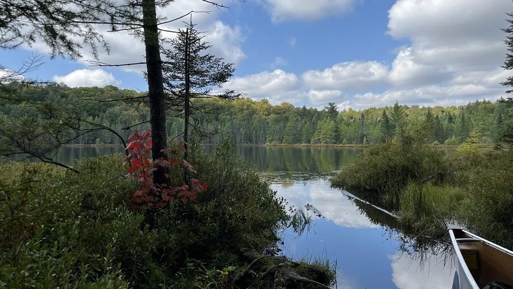
Florence is a short, easy hike in the Sylvania Wilderness, part of the Watersmeet Ranger District of the Ottawa National Forest in Michigan. The trail is about a mile long and sits within designated wilderness, so it's a compact outing for anyone already exploring this remote corner of the forest. The route is an out-and-back that starts and ends near 1,780 feet. It rises to about 1,800 feet in the middle, with a total climb of about 214 feet, and the steepest stretch comes at roughly a third of the way in. The trail is natural-surface and not accessible, and it doesn't allow bikes or horses. Summer is the most comfortable time to go. Typical July highs reach about 78°F with lows near 52°F, based on averages from a nearby weather station in Paulding, which sits a few hundred feet lower than the trail. Winters are severe, with January highs around 21°F. The Loon hike is about half a mile away, and Deer Island and Fisher Lake are each about 1.4 miles off. For an overnight stay, Clark Lake - Sylvania Camp is about 3.6 miles away.
- LoonHiking0.5 mi
- Deer IslandHiking1.4 mi
- Fisher LakeHiking1.4 mi
- Clark Lake - Sylvania CampCamping3.6 mi
 Sylvania Wilderness Backcountry CampingCampingPhoto: Recreation.gov (RIDB) / public domain3.7 mi
- Clark Lake PavilionCamping3.7 mi
- Middle Branch Ontonagon RiverCanoeing6.6 mi
 Wisconsin RiverCanoeingPhoto: Royalbroil, CC BY-SA 3.0 (via Wikimedia Commons)7.2 mi
Source: Roamze catalog (indexable pages within 10 miles, PostGIS distance)
 Corey LakeHiking · ~5 min drivePhoto: usfs_Eastern_Region, Public Domain Mark (via Flickr)
- East Bear LakeHiking · ~3 min drive
- Whitefish Lake Bike TrailHiking · ~8 min drive
 CrookedHiking · ~5 min drivePhoto: usfs_Eastern_Region, Public Domain Mark (via Flickr)
- Clark LakeHiking · ~6 min drive
- SYLVANIA OUTFITTERS SKI TRAILHiking · ~9 min drive
- High LakeHiking · ~6 min drivePhoto: usfs_Eastern_Region, Public Domain Mark (via Flickr)
- South GateHiking · ~7 min drive
- Scaup Lake HunterHiking · ~21 min drive
- Thompson LodgeHiking · ~6 min drivePhoto: usfs_Eastern_Region, Public Domain Mark (via Flickr)
Best time to visit Florence
Best months: May–September. Best months have typical highs of 55–85 °F, lows of 30 °F or warmer (32 °F where the station doesn't record snow), at most one snowy day and no more than 12 wet days.
Jan
21° / 2°
Feb
25° / 3°
Mar
37° / 12°
Apr
49° / 25°
May
64° / 38°
Jun
74° / 48°
Jul
78° / 52°
Aug
76° / 50°
Sep
68° / 43°
Oct
53° / 32°
Nov
38° / 22°
Dec
26° / 10°
Typical high / low (°F) and days with rain or snow, 1991–2020. Measured at Paulding, MI, 15.4 mi away at 1,367 ft. This station doesn't record snowfall. Source: NOAA NCEI U.S. Climate Normals 1991–2020.
