Whitefish Lake Bike Trail
- 4.5 mi
- round trip
- 350 ft
- climb
- 1,781 ft
- high point
- Out and back
- route
- May–Sep
- best months
Is Whitefish Lake Bike Trail open right now?
Closure in the area
There's a closure order in Ottawa National Forest. It doesn't name Whitefish Lake Bike Trail, so check the source for the area it covers.
Temporary Road Closures
Agency closure covering Ottawa National Forest · Order 09-07-00-26-01 · USFS · Ottawa National Forest
Spring Road Conditions
Agency alert covering Ottawa National Forest · USFS · Ottawa National Forest
Unmanned Aircraft Systems (UAS)
Agency alert covering Ottawa National Forest · USFS · Ottawa National Forest
As of · Source: USFS · Ottawa National Forest. Agencies don't list every closure — check before you go.
Whitefish Lake Bike Trail is a 4.5-mile out-and-back route in the Watersmeet Ranger District of Michigan's Ottawa National Forest, managed by the Forest Service. The trail is rated moderate, with a total elevation gain of 56 feet, and it is a gravel path that is open year-round. The trail is not accessible, and it is a route for both hikers and riders. Bikes are allowed, and the surface is gravel. The climb is gentle, with the steepest stretch at about 0.06 miles in, where the grade reaches 4 percent. The high point is 1,781 feet, and the low point is 1,723 feet. Summer is the most comfortable time to go. Typical averages from a nearby weather station in Paulding, which sits about 400 feet lower than the trail, show July highs around 78°F with lows near 52°F. Winters are cold, with January highs around 21°F. Clark Lake is about 1.5 miles away, and Clark Lake - Sylvania Camp is about 1.9 miles away. Whitefish Lake (West) is about 2 miles away, and Sylvania Wilderness Backcountry Camping is about 2.5 miles away.
- Clark LakeHiking1.5 mi
- Clark Lake - Sylvania CampCamping1.9 mi
 Whitefish Lake (West)HikingPhoto: usfs_Eastern_Region, Public Domain Mark (via Flickr)2 mi
- HayHiking2.2 mi
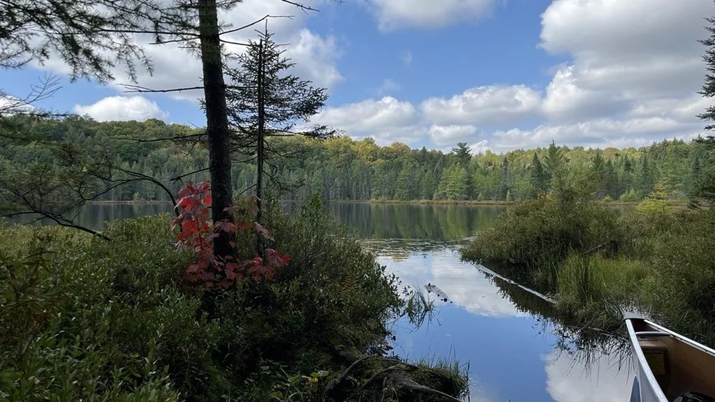 Sylvania Wilderness Backcountry CampingCampingPhoto: Recreation.gov (RIDB) / public domain2.5 mi
- Clark Lake PavilionCamping2.5 mi
- Middle Branch Ontonagon RiverCanoeing5.7 mi
- Cisco Branch Ontonagon RiverCanoeing7.2 mi
Source: Roamze catalog (indexable pages within 10 miles, PostGIS distance)
- Whitefish Lake (West)Hiking · ~3 min drivePhoto: usfs_Eastern_Region, Public Domain Mark (via Flickr)
- Clark LakeHiking · ~3 min drive
- SYLVANIA OUTFITTERS SKI TRAILHiking · ~10 min drive
 Katherine LakeHiking · ~5 min drivePhoto: usfs_Eastern_Region, Public Domain Mark (via Flickr)
- East Bear LakeHiking · ~6 min drive
- Scaup Lake HunterHiking · ~27 min drive
- Thompson LodgeHiking · ~5 min drivePhoto: usfs_Eastern_Region, Public Domain Mark (via Flickr)
- South GateHiking · ~14 min drive
 CrookedHiking · ~5 min drivePhoto: usfs_Eastern_Region, Public Domain Mark (via Flickr)
- Agonikak Mountain BikeHiking · ~16 min drive
Best time to visit Whitefish Lake Bike Trail
Best months: May–September. Best months have typical highs of 55–85 °F, lows of 30 °F or warmer (32 °F where the station doesn't record snow), at most one snowy day and no more than 12 wet days.
Jan
21° / 2°
Feb
25° / 3°
Mar
37° / 12°
Apr
49° / 25°
May
64° / 38°
Jun
74° / 48°
Jul
78° / 52°
Aug
76° / 50°
Sep
68° / 43°
Oct
53° / 32°
Nov
38° / 22°
Dec
26° / 10°
Typical high / low (°F) and days with rain or snow, 1991–2020. Measured at Paulding, MI, 13.9 mi away at 1,367 ft. This station doesn't record snowfall. Source: NOAA NCEI U.S. Climate Normals 1991–2020.
