Nuthatch Trail
- 1.2 mi
- round trip
- 329 ft
- climb
- 574 ft
- high point
- Out and back
- route
- Apr–Oct
- best months
Nuthatch Trail is an easy hike in Massachusetts, about 1.7 miles from the town of Upton. The route is an out-and-back with a rolling climb, and the round trip covers about 2.3 miles with a total elevation gain of 329 feet. The trail starts at roughly 522 feet and reaches a high point of 574 feet. The steepest stretch comes within the first third of the route, at a 10% grade. Late spring and early fall are the most comfortable times to go. Typical averages from a nearby weather station in West Medway run to highs of about 71°F in May and 76°F in September. That station sits several hundred feet lower than the trail, so temperatures on the higher ground run cooler. Winter brings regular snow days, with highs near 40°F in January and February. The trip takes about an hour. Old Hopkinton Spring Trail lies about a mile away, and Upton Bouldering is about 2 miles off. Whitehall Yellow Trail is roughly 2.2 miles away. Paddlers can find the Blackstone River about 5.4 miles from the trail.
 Old Hopkinton Spring TrailHikingPhoto: Magicpiano, CC BY-SA 3.0 (via Wikimedia Commons)1 mi
- Upton BoulderingRock climbing2 mi
- Whitehall Yellow TrailHiking2.2 mi
- Ruth Boulder GinsburgRock climbing2.3 mi
- Peppercorn Hill Central AreaRock climbing2.3 mi
 Blackstone RiverCanoeingPhoto: Marcbela (Marc N. Belanger), Public domain (via Wikimedia Commons)5.4 mi
 Sudbury RiverCanoeingPhoto: John Phelan, CC BY 3.0 (via Wikimedia Commons)6 mi
- West Hill ParkCamping6.1 mi
Source: Roamze catalog (indexable pages within 10 miles, PostGIS distance)
- Old Hopkinton Spring TrailHiking · ~2 min drivePhoto: Magicpiano, CC BY-SA 3.0 (via Wikimedia Commons)
- Whitehall Yellow TrailHiking · ~4 min drive
 John Malley TrailHiking · ~8 min drivePhoto: Eriky8 (Kevin Johnson), CC BY-SA 3.0 (via Wikimedia Commons)
- Edmund Hill TrailHiking · ~16 min drive
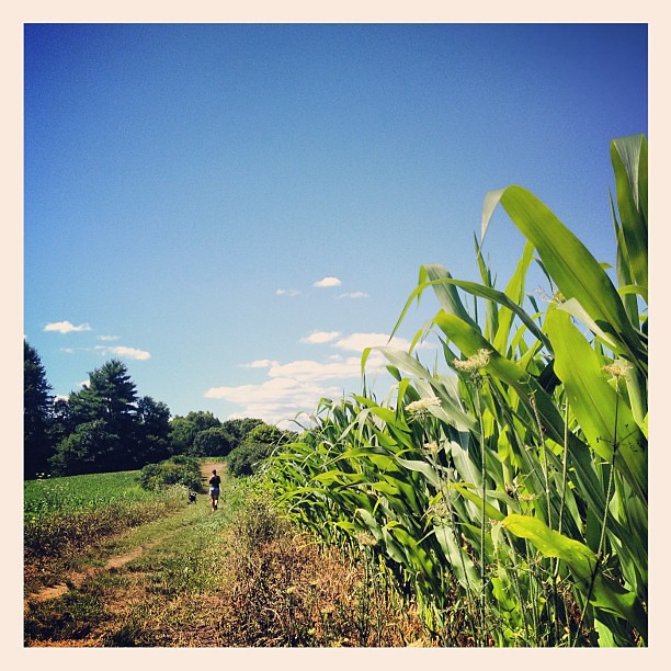 Cedar Hill TrailHiking · ~12 min drivePhoto: dee & tula monstah, CC BY 2.0 (via Flickr)
 Little Chauncy TrailHiking · ~13 min drivePhoto: Jakob Roedler (1808-1862), Public domain (via Wikimedia Commons)
- Sawink LoopHiking · ~13 min drivePhoto: Jakob Roedler (1808-1862), Public domain (via Wikimedia Commons)
 Charley's Loop TrailHiking · ~13 min drivePhoto: Matthew Simoneau, CC BY 2.0 (via Flickr)
- Chasm Loop TrailHiking · ~13 min drivePhoto: Matthew Simoneau, CC BY 2.0 (via Flickr)
 Green DiamondHiking · ~13 min drivePhoto: clembore, CC BY-SA 2.0 (via Flickr)
Best time to visit Nuthatch Trail
Best months: April–October. Best months have typical highs of 55–85 °F, lows of 30 °F or warmer (32 °F where the station doesn't record snow), at most one snowy day and no more than 12 wet days.
Jan
38° / 17°
9 wet · 6 snow
Feb
41° / 18°
8 wet · 4 snow
Mar
48° / 25°
11 wet · 3 snow
Apr
60° / 35°
10 wet · 1 snow
May
71° / 46°
10 wet
Jun
79° / 55°
9 wet
Jul
84° / 61°
9 wet
Aug
83° / 59°
9 wet
Sep
76° / 51°
9 wet
Oct
65° / 39°
9 wet
Nov
53° / 31°
9 wet · 1 snow
Dec
43° / 23°
10 wet · 4 snow
Typical high / low (°F) and days with rain or snow, 1991–2020. Measured at West Medway, MA, 9.8 mi away at 210 ft. Source: NOAA NCEI U.S. Climate Normals 1991–2020.
Map and trail data © OpenStreetMap contributors
