Manidokan Camp and Retreat Center
Campground
Campground · 1.6 mi from the trail
Closure reported
The National Park Service lists a closure that covers Maryland Heights.
Bridge to Maryland Heights & C&O Canal CLOSED
Park closure covering Harpers Ferry National Historical Park · NPS · Harpers Ferry National Historical Park
Ongoing work on Lower Town buildings
Park alert covering Harpers Ferry National Historical Park · NPS · Harpers Ferry National Historical Park
As of · Source: NPS · Harpers Ferry National Historical Park. Agencies don't list every closure — check before you go.
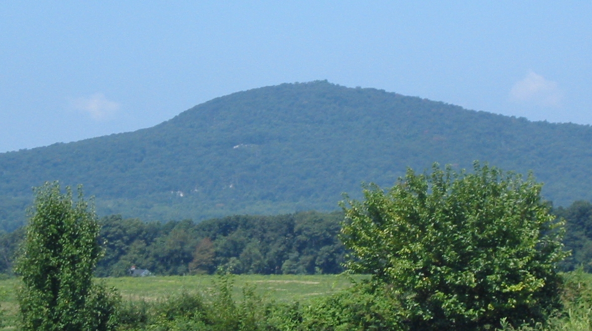
Maryland Heights is a summit of 1,459 feet in Harpers Ferry National Historical Park in Maryland, about a mile from the town of Sandy Hook. It sits within the park's boundaries, and the surrounding area offers a mix of hiking, climbing and other outdoor options within a short drive. For comfortable weather, aim for late spring or early fall. Typical averages from a nearby weather station in Sharpsburg show May highs around 74°F and September highs around 78°F, while July peaks near 86°F and winter lows drop to about 21°F in January. That station sits roughly 1,000 feet below the summit, so temperatures on top run cooler. The closest trails are Stone Fort Trail and Overlook Cliff Trail, both about a mile away. Climbers can head to the Outlying Area and Balcony Rock, each about a mile off.
Manidokan Camp and Retreat Center
Campground
 If it rainsNo machine-readable author provided. Jan Kronsell assumed (based on copyright claims)., CC BY-SA 3.0 · Wikimedia Commons
White Hall Tavern
Museum
Places © OpenStreetMap contributors, Places © Overture Maps Foundation · Photos: No machine-readable author provided. Jan Kronsell assumed (based on copyright claims)., CC BY-SA 3.0 (commons)
More in Ballenger CreekDaily highs and lows, wind and the chance of precipitation at the summit and route start for the next 7 days, from the Open-Meteo model.
Elevation from USGS 3D Elevation Program terrain data (about 10 m resolution).
1,459 ft (445 m).
One: Stone Fort Trail.

 Stone Fort TrailHikingPhoto: Nicolas Raymond from Bethesda, Maryland, USA, CC BY 2.0 (via Wikimedia Commons)0.9 miOverlook Cliff TrailHikingPhoto: Nicolas Raymond from Bethesda, Maryland, USA, CC BY 2.0 (via Wikimedia Commons)0.9 mi
 HighlandsRock climbingPhoto: HarpersFerryNPS, Public domain (via Wikimedia Commons)1.1 miCombined TrailHikingPhoto: Nicolas Raymond from Bethesda, Maryland, USA, CC BY 2.0 (via Wikimedia Commons)1.2 mi
Source: Roamze catalog (indexable pages within 10 miles, PostGIS distance)
 Short Hill MountainSummit · ~9 min drivePhoto: Arbogastlw, CC BY-SA 3.0 (via Wikimedia Commons)
 Lambs KnollSummit · ~15 min drivePhoto: Joe Calzarette, Public domain (via Wikimedia Commons)
 Furnace MountainSummit · ~17 min drivePhoto: Arbogastlw at English Wikipedia, Public domain (via Wikimedia Commons)
 Monument KnobSummit · ~21 min drivePhoto: Zeete, CC BY-SA 4.0 (via Wikimedia Commons)
 Raven RocksSummit · ~26 min drivePhoto: Mark Fickett, CC BY 3.0 (via Wikimedia Commons)
 Black RockSummit · ~30 min drivePhoto: Zeete, CC BY-SA 4.0 (via Wikimedia Commons)Sugar Loaf MountainSummit · ~31 min drivePhoto: Lowell Silverman at English Wikipedia, Public domain (via Wikimedia Commons)Chimney RockSummit · ~43 min drivePhoto: Unknown authorUnknown author or not provided, Public domain (via Wikimedia Commons)
 Catoctin MountainSummit · ~43 min drivePhoto: Vegemighty (talk), CC0 (via Wikimedia Commons)
 High RockSummit · ~45 min drivePhoto: Acroterion, CC BY-SA 4.0 (via Wikimedia Commons)
Also worth it near here
Overlook Cliff TrailHiking · ~2 min drivePhoto: Nicolas Raymond from Bethesda, Maryland, USA, CC BY 2.0 (via Wikimedia Commons)HighlandsRock climbing · ~2 min drivePhoto: HarpersFerryNPS, Public domain (via Wikimedia Commons)Best months: April–June and August–November. Best months have typical highs of 55–85 °F, lows of 30 °F or warmer (32 °F where the station doesn't record snow), at most one snowy day and no more than 12 wet days.
Jan
41° / 21°
Feb
44° / 23°
Mar
53° / 29°
Apr
65° / 39°
May
74° / 49°
Jun
82° / 58°
Jul
86° / 62°
Aug
85° / 61°
Sep
78° / 54°
Oct
67° / 42°
Nov
56° / 32°
Dec
45° / 25°
Typical high / low (°F) and days with rain or snow, 1991–2020. Measured at Sharpsburg 5 S, MD, 3.9 mi away at 400 ft. The station sits about 1,100 ft lower than this place, so expect it a little cooler here. This station doesn't record snowfall. Source: NOAA NCEI U.S. Climate Normals 1991–2020.
Bridge to Maryland Heights & C&O Canal CLOSED
Harpers Ferry National Historical Park · seen Oct 2, 2026, no lift recorded · National Park Service
Bridge to Maryland Heights & C&O Canal CLOSED
Harpers Ferry National Historical Park · seen Aug 23, 2026 → lifted Oct 2, 2026 · National Park Service
