Brown Trail
- 0.5 mi
- round trip
- 64 ft
- climb
- 205 ft
- high point
- Out and back
- route
- Mar–Nov
- best months
Brown Trail is an easy out-and-back hike in Maryland, about half a mile from Forest Glen Estates. The route is short at just under a mile and rises only about 10 feet from its low point at 184 feet to a high of 205 feet, so it's a quick stop rather than a long day on foot. The trail is a simple walk, and the climb is gentle. The steepest stretch comes about a quarter of the way in at a 5% grade, and the total gain and loss over the round trip are each about 64 feet. With an estimated half hour on your feet, it's a natural break between other outings in the area. Spring and fall are the most comfortable times to go. Typical averages from a nearby weather station show May highs around 74°F and October highs around 66°F, while July highs reach about 85°F and January highs sit near 44°F. Green Trail starts just 0.1 mile away, and Blue Traiil and White Trail are both within about 1.7 miles. Paddlers can head to Zekiah Swamp Run, roughly 7 miles off.
- Green TrailHiking0.1 mi
 Blue TraiilHikingPhoto: krossbow, CC BY 2.0 (via Flickr)1.6 mi
 White TrailHikingPhoto: krossbow, CC BY 2.0 (via Flickr)1.7 mi
 Orange TrailHikingPhoto: krossbow, CC BY 2.0 (via Flickr)2.4 mi
- Zekiah Swamp RunCanoeing7.1 mi
 Osprey TrailHikingPhoto: krossbow, CC BY 2.0 (via Flickr)7.2 mi
- Red Tail TrailHikingPhoto: krossbow, CC BY 2.0 (via Flickr)7.2 mi
 Blue Heron TrailHikingPhoto: krossbow, CC BY 2.0 (via Flickr)7.2 mi
Source: Roamze catalog (indexable pages within 10 miles, PostGIS distance)
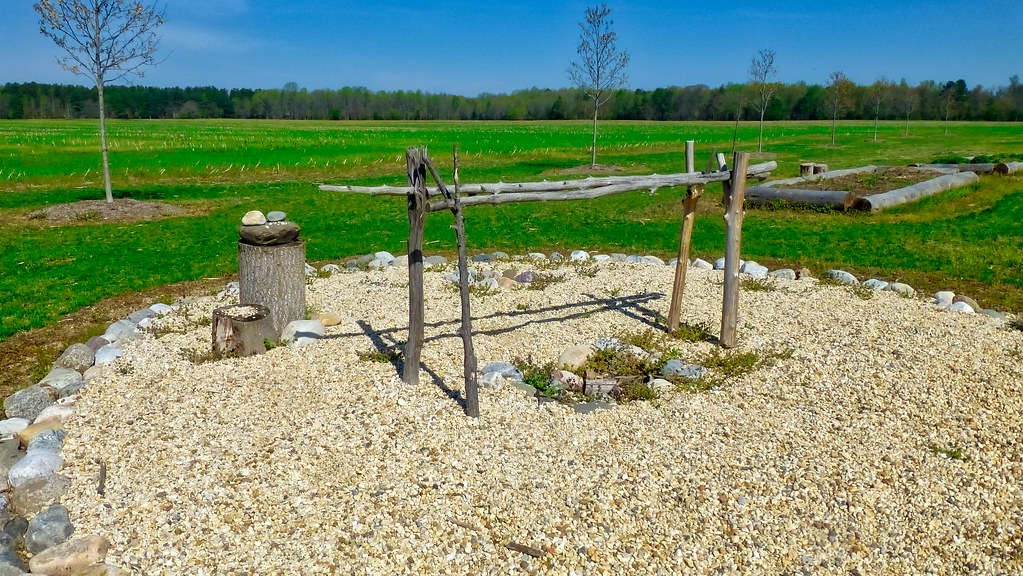
 Brown TrailHiking · Next doorPhoto: krossbow, CC BY 2.0 (via Flickr)
 Red LoopHiking · ~18 min drivePhoto: krossbow, CC BY 2.0 (via Flickr)
- Blue TraiilHiking · ~3 min drivePhoto: krossbow, CC BY 2.0 (via Flickr)
- Perimeter TrailHiking · ~18 min drive
- White TrailHiking · ~3 min drivePhoto: krossbow, CC BY 2.0 (via Flickr)
- Orange TrailHiking · ~4 min drivePhoto: krossbow, CC BY 2.0 (via Flickr)
- Osprey TrailHiking · ~12 min drivePhoto: krossbow, CC BY 2.0 (via Flickr)
- Red Tail TrailHiking · ~12 min drivePhoto: krossbow, CC BY 2.0 (via Flickr)
- Blue Heron TrailHiking · ~12 min drivePhoto: krossbow, CC BY 2.0 (via Flickr)
 Tanager TrailHiking · ~13 min drivePhoto: Andrew Turner, CC BY 2.0 (via Flickr)
Best time to visit Brown Trail
Best months: March–November. Best months have typical highs of 55–85 °F, lows of 30 °F or warmer (32 °F where the station doesn't record snow), at most one snowy day and no more than 12 wet days.
Jan
44° / 25°
10 wet · 2 snow
Feb
48° / 26°
9 wet · 2 snow
Mar
56° / 33°
10 wet · 1 snow
Apr
67° / 43°
10 wet
May
74° / 52°
11 wet
Jun
82° / 61°
10 wet
Jul
85° / 66°
10 wet
Aug
83° / 64°
9 wet
Sep
77° / 58°
8 wet
Oct
66° / 46°
9 wet
Nov
57° / 35°
9 wet
Dec
48° / 29°
9 wet · 1 snow
Typical high / low (°F) and days with rain or snow, 1991–2020. Measured at Mechanicsville 5 Ne, MD, 9.8 mi away at 100 ft. Source: NOAA NCEI U.S. Climate Normals 1991–2020.
Map and trail data © OpenStreetMap contributors
