Birder's Path
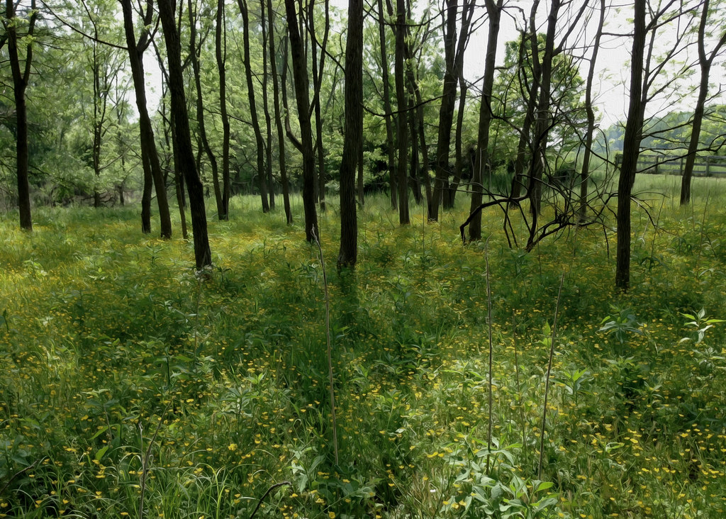 Photo: cdsessums, CC BY-SA 2.0 (via Flickr)
- 0.3 mi
- loop
- 200 ft
- high point
- Loop
- route
- Easy
- difficulty
- Apr–Jun, Aug–Nov
- best months
Birder's Path is a 0.32-mile loop hike in Maryland, about 0.4 miles from Cromwell Woods. The route is flat and easy, with no elevation gain, and it starts and ends at about 200 feet. The path is short enough for a quick outing, and the trip takes about half an hour. The loop runs mostly level, with a slight drop of about 47 feet along the way. The steepest part comes at about 0.26 miles in, with a 3% grade. The trail has limited wheelchair access, and bikes and horses are not allowed. Spring and fall are the most comfortable times to go. Typical averages from the Cylburn weather station, about 7 miles away, show May highs near 73°F and October highs near 66°F, while July averages around 86°F and January highs sit near 42°F. Several other short trails lie close by, including Minebank Run Trail (Blue) about 0.1 mile away and Greenhouse Path at 0.2 miles. Loch Raven Reservoir is about 3.7 miles off for fishing, and Fox Hill Crag offers climbing roughly 4.9 miles away.
Local outfitters
- Strasburg Scooters & Tours44 mi away
- Gettysburg Licensed Town Guides46 mi away
Not on Roamze yet. Their page has how to reach them.
Best time to go · Apr–Jun, Aug–Nov
Best time to visit Birder's Path
Best months: April–June and August–November. Best months have typical highs of 55–85 °F, lows of 30 °F or warmer (32 °F where the station doesn't record snow), at most one snowy day and no more than 12 wet days.
Jan
42° / 27°
Feb
46° / 28°
Mar
54° / 34°
Apr
66° / 45°
May
73° / 55°
Jun
82° / 64°
Jul
86° / 69°
Aug
84° / 67°
Sep
77° / 60°
Oct
66° / 49°
Nov
56° / 39°
Dec
46° / 31°
Typical high / low (°F) and days with rain or snow, 1991–2020. Measured at Cylburn, MD, 7.2 mi away at 235 ft. This station doesn't record snowfall. Source: NOAA NCEI U.S. Climate Normals 1991–2020.
Keep exploring — more trails worth the drive
Photo: cdsessums, CC BY-SA 2.0 (via Flickr)Minebank Run Trail (Blue)
Next door
0.96-mile point-to-point trail in Maryland with 147 ft elevation gain
 Photo: swampseth, CC BY-SA 2.0 (via Flickr)
Ridge Trail
~2 min drive
0.99-mile out-and-back Ridge Trail in Maryland gains 267 feet.
Photo: cdsessums, CC BY-SA 2.0 (via Flickr)Greenhouse Path
Next door
0.33-mile point-to-point trail in Maryland with 19 ft of elevation gain.
 Photo: cdsessums, CC BY-SA 2.0 (via Flickr)
Morgan Mill Trail
~4 min drive
A 3.77-mile point-to-point Maryland trail through diverse woodland terrain.
Photo: swampseth, CC BY-SA 2.0 (via Flickr)Sycamore Path
Next door
0.32-mile point-to-point trail in Maryland with 233 ft gain.
 Photo: aparlette, CC BY 2.0 (via Flickr)
Sweathouse Trail
~9 min drive
3.22-mile out-and-back trail in Maryland with 1,031 ft elevation gain
Photo: swampseth, CC BY-SA 2.0 (via Flickr)Barrans-Baldwin Trail (Green)
~1 min drive
Easy 1.75-mile woodland loop through Maryland forest.
 Photo: Jason Knauer, CC BY 3.0 (via Wikimedia Commons)
Big Gunpowder Falls Trail
~9 min drive
6.06-mile out-and-back hike in Maryland with 1,890 ft elevation gain and loss.
 Photo: cdsessums, CC BY-SA 2.0 (via Flickr)
Log Trail
~2 min drive
1.68-mile out-and-back trail in Maryland with 495 ft elevation gain.
Photo: aparlette, CC BY 2.0 (via Flickr)Gunpowder Falls Trail
~9 min drive
7.06-mile out-and-back hike in Maryland with 1,756 ft elevation gain and loss.
Map and trail data © OpenStreetMap contributors
