Mountain · 1 route
Spruce Hill
2,505 ft · Maine
- Summit
- 2,505 ft
- Routes
- 1 way up
Route up Spruce Hill
About Spruce Hill
Spruce Hill is a summit in Maine, 2505 feet elevation. It is reached by Spruce Hill Trail, a 3.3-mile trail with 1440 feet of elevation gain.
Forecast on Spruce Hill
Daily highs and lows, wind and the chance of precipitation at the summit and e. royce / spruce hill trailhead for the next 7 days, from the Open-Meteo model.
Questions about Spruce Hill
How tall is Spruce Hill?
2,505 ft (764 m).
How many routes go to the summit of Spruce Hill?
One: Spruce Hill Trail.
Where do the routes up Spruce Hill start?
Spruce Hill Trail starts at E. Royce / Spruce Hill Trailhead.
Mountains nearby
- Speckled Mountain2,903 ft · Maine2 routes1.3 mi away
- Blueberry Mountain1,785 ft · Maine2 routes1.8 mi away
- West Royce Mountain3,201 ft · New Hampshire2 routes2.0 mi away
- Adams Mountain1,647 ft · Maine1 route3.4 mi away
- Deer Hill1,360 ft · Maine2 routes3.9 mi away
- Mount Meader2,788 ft · New Hampshire1 route4.0 mi away
Facts about this place
When to go
Best time to go: May–Sep. The mildest months here, with typical highs of 62–75°F and lows of 39–53°F.
Typical monthly averages (not a forecast) from the Pinkham Notch, NH weather station, 14 mi away. High / low in °F.
- Jan26° high6° low
- Feb28° high7° low
- Mar36° high15° low
- Apr49° high27° low
- May62° high39° low
- Jun70° high48° low
- Jul75° high53° low
- Aug74° high52° low
- Sep68° high45° low
- Oct54° high35° low
- Nov42° high24° low
- Dec31° high14° low
Where it is
- Caribou-Speckled Mountain Wilderness · Wilderness
- Androscoggin Ranger District · Ranger district
- White Mountain National Forest · National forest
- Nearest town
- Bethel, Maine · 12 mi
Source: Wilderness.net boundaries; USFS EDW boundaries; USGS GNIS populated places
Conditions
Active alerts for Androscoggin Ranger District as of Oct 9, 2026:
Discovery Trail Emergency Closure
critical · posted Aug 27, 2026
Source: USFS forest alerts
Nearby
- Blueberry Ridge TrailHiking0.9 mi
- Laughing Lion TrailHiking0.9 mi
- Spruce Hill TrailHiking1 mi
- WM: Evans NotchRock climbing1.3 mi
- Cold RiverCamping2.5 mi
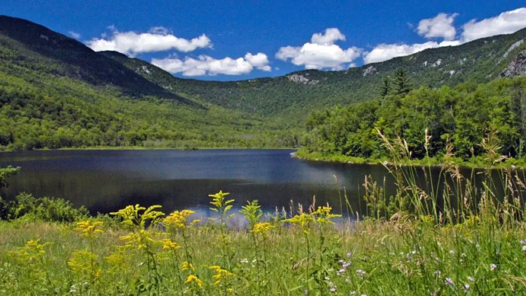 Basin CampgroundCampingPhoto: Recreation.gov (RIDB) / public domain2.7 mi
- Shell Pond BoulderingRock climbing3 mi
- High Meadow WallRock climbing3.1 mi
Source: Roamze catalog (indexable pages within 10 miles, PostGIS distance)
Is Spruce Hill open right now?
Closure in the area
There's a closure order in White Mountain National Forest. It doesn't name Spruce Hill, so check the source for the area it covers.
Rattlesnake Fire – Pemigewasset Ranger District
Agency closure covering White Mountain National Forest · USFS · White Mountain National Forest
Town Hall Road Camping and Fire Restrictions
Agency alert covering White Mountain National Forest · USFS · White Mountain National Forest
Lincoln Woods Trail Closure
Agency alert covering White Mountain National Forest · USFS · White Mountain National Forest
Forest Roads Status
Agency alert covering White Mountain National Forest · USFS · White Mountain National Forest
Sawyer River Road Temporarily Closed
Agency alert covering White Mountain National Forest · USFS · White Mountain National Forest
As of · Source: USFS · White Mountain National Forest. Agencies don't list every closure — check before you go.
Best time to visit Spruce Hill
Best months: September. Best months have typical highs of 55–85 °F, lows of 30 °F or warmer (32 °F where the station doesn't record snow), at most one snowy day and no more than 12 wet days.
Jan
26° / 6°
14 wet
Feb
28° / 7°
13 wet
Mar
36° / 15°
14 wet
Apr
49° / 27°
13 wet
May
62° / 39°
15 wet
Jun
70° / 48°
14 wet
Jul
75° / 53°
14 wet
Aug
74° / 52°
13 wet
Sep
68° / 45°
12 wet
Oct
54° / 35°
14 wet
Nov
42° / 24°
14 wet
Dec
31° / 14°
16 wet
Typical high / low (°F) and days with rain or snow, 1991–2020. Measured at Pinkham Notch, NH, 13.7 mi away at 2,025 ft. This station doesn't record snowfall. Source: NOAA NCEI U.S. Climate Normals 1991–2020.
