Mountain · 2 routes
Deer Hill
1,360 ft · Maine
- Summit
- 1,360 ft
- Routes
- 2 ways up
Routes up Deer Hill
- Deer Hills TrailModerateabout 2,128 ft of climbing4.9 mi round tripSee the route
- DEER HILL TRAILModerateabout 2,134 ft of climbing5.0 mi round tripSee the route
| Deer Hills Trail | DEER HILL TRAIL | |
|---|---|---|
| Climbing | About 2,128 ft | About 2,134 ft |
| Round trip | 4.9 mi | 5.0 mi |
| Difficulty | Moderate | Moderate |
| Terrain | Hike | Hike |
About Deer Hill
Deer Hill is a summit in the Saco Ranger District of the White Mountain National Forest in western Maine, about 15 miles from the town of Fryeburg. Summer and early fall are the most comfortable times to visit. Typical averages from a nearby weather station run from about 79°F highs and 57°F lows in July to 71°F and 47°F in September, and the summit sits higher than that station, so expect it to be a little cooler on top. The DEER HILL TRAIL and the Shell Pond Loop both start within about a mile of the summit. Climbers can head to Shell Pond Bouldering, and Cold River Campground lies about 2.4 miles away for overnight stays.
Forecast on Deer Hill
Daily highs and lows, wind and the chance of precipitation at the summit and route start for the next 7 days, from the Open-Meteo model.
Questions about Deer Hill
How tall is Deer Hill?
1,360 ft (415 m).
How many routes go to the summit of Deer Hill?
2: Deer Hills Trail and DEER HILL TRAIL.
What is the shortest route up Deer Hill?
Deer Hills Trail, about 4.9 mi round trip.
Mountains nearby
Facts about this place
When to go
Best time to go: May–Sep. The mildest months here, with typical highs of 65–79°F and lows of 42–57°F.
Typical monthly averages (not a forecast) from the Bethel 6 Sse, ME weather station, 13 mi away. High / low in °F.
- Jan28° high8° low
- Feb31° high11° low
- Mar40° high19° low
- Apr52° high31° low
- May65° high42° low
- Jun74° high51° low
- Jul79° high57° low
- Aug78° high56° low
- Sep71° high47° low
- Oct57° high37° low
- Nov45° high27° low
- Dec34° high17° low
Where it is
- Saco Ranger District · Ranger district
- White Mountain National Forest · National forest
- Nearest town
- Fryeburg, Maine · 15 mi
Conditions
Active alerts for White Mountain National Forest as of Oct 9, 2026:
Town Hall Road Camping and Fire Restrictions
caution · posted Sep 29, 2026
Sawyer River Road Temporarily Closed
caution · posted Aug 24, 2026
caution · posted Aug 24, 2026
information · posted Aug 24, 2026
Pemigewasset Wilderness Food Storage Requirement
information · posted Aug 24, 2026
caution · posted Aug 24, 2026
Rattlesnake Fire – Pemigewasset Ranger District
critical · posted Aug 24, 2026
Source: USFS forest alerts
Nearby
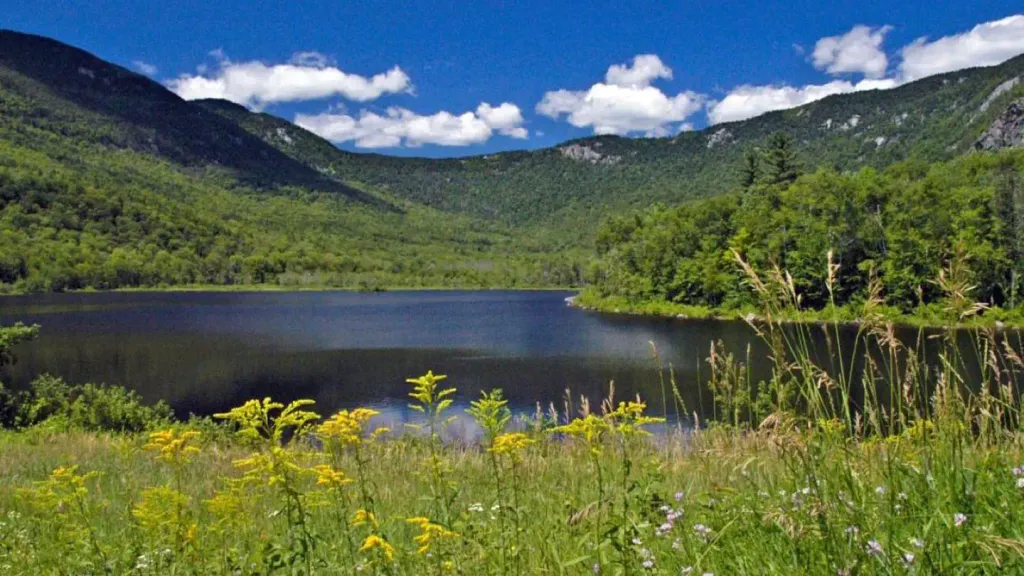
 Shell Pond LoopHikingPhoto: Me in ME, CC BY 2.0 (via Flickr)0.9 mi
- Deer Hills BypassHiking1 mi
- DEER HILL TRAILHiking1 mi
- Shell Pond BoulderingRock climbing1.1 mi
- High Meadow WallRock climbing1.4 mi
- The Family WallRock climbing1.5 mi
- Cold RiverCamping2.4 mi
 Basin CampgroundCampingPhoto: Recreation.gov (RIDB) / public domain2.8 mi
Source: Roamze catalog (indexable pages within 10 miles, PostGIS distance)
Is Deer Hill open right now?
Closure in the area
There's a closure order in White Mountain National Forest. It doesn't name Deer Hill, so check the source for the area it covers.
Rattlesnake Fire – Pemigewasset Ranger District
Agency closure covering White Mountain National Forest · USFS · White Mountain National Forest
Town Hall Road Camping and Fire Restrictions
Agency alert covering White Mountain National Forest · USFS · White Mountain National Forest
Lincoln Woods Trail Closure
Agency alert covering White Mountain National Forest · USFS · White Mountain National Forest
Forest Roads Status
Agency alert covering White Mountain National Forest · USFS · White Mountain National Forest
Sawyer River Road Temporarily Closed
Agency alert covering White Mountain National Forest · USFS · White Mountain National Forest
As of · Source: USFS · White Mountain National Forest. Agencies don't list every closure — check before you go.
Best time to visit Deer Hill
Best months: May–October. Best months have typical highs of 55–85 °F, lows of 30 °F or warmer (32 °F where the station doesn't record snow), at most one snowy day and no more than 12 wet days.
Jan
28° / 8°
Feb
31° / 11°
Mar
40° / 19°
Apr
52° / 31°
May
65° / 42°
Jun
74° / 51°
Jul
79° / 57°
Aug
78° / 56°
Sep
71° / 47°
Oct
57° / 37°
Nov
45° / 27°
Dec
34° / 17°
Typical high / low (°F) and days with rain or snow, 1991–2020. Measured at Bethel 6 Sse, ME, 12.8 mi away at 790 ft. The station sits about 600 ft lower than this place, so expect it a little cooler here. This station doesn't record snowfall. Source: NOAA NCEI U.S. Climate Normals 1991–2020.
