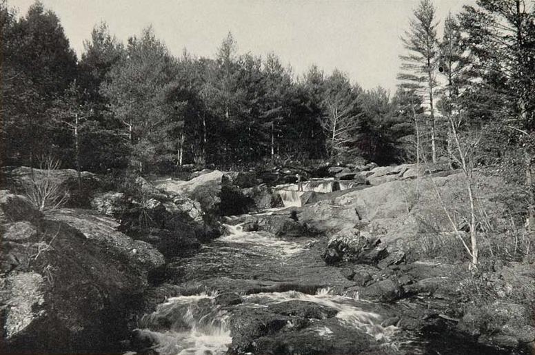
Little Ossipee River
 Photo: Unknown photographer, Public domain (via Wikimedia Commons)
- 2.5 mi
- distance
- 558 ft
- high point
- Jul–Oct
- best months
Clear at last check
Weather is good · OpenWeather · checked 14 h ago
Little Ossipee River is a canoeing route in Maine, about 0.6 miles from the small community of North Shapleigh. It is a paddling destination rather than a trail, and the distance from town makes it easy to reach, with the town sitting just beyond the river's edge. Summer is the most comfortable time to paddle. Typical averages from a nearby weather station in Hollis show July highs around 80°F with lows near 57°F, and September still runs in the low 70s by day. The station sits a few hundred feet below the river, so temperatures on the water may run slightly cooler. For a change from the river, Hansen Pond Trail is about 1.4 miles away and Goat Hill Trail about 2.8 miles. Paddlers looking for more moving water can head to the Salmon Falls River, roughly 7.5 miles off, or the Middle Branch Mousam River, about 9.2 miles away.
Local outfitters
- Granite State Whale Watch42 mi away
- Summer Sessions Surf Shop43 mi away
Not on Roamze yet. Their page has how to reach them.
- Hansen Pond TrailHiking1.4 mi
- Goat Hill TrailHiking2.8 mi
- Goose Pond Overlook TrailHiking3.1 mi
- Mary Grant Nature Preserve TrailHiking4.7 mi
 Salmon Falls RiverCanoeingPhoto: Unknown photographer, Public domain (via Wikimedia Commons)7.5 mi
- Breakneck Hill TrailHiking8.8 mi
- Middle Branch Mousam RiverCanoeing9.2 mi
- Mousam RiverCanoeing9.9 mi
Source: Roamze catalog (indexable pages within 10 miles, PostGIS distance)
- Salmon Falls RiverCanoeing · ~13 min drivePhoto: Unknown photographer, Public domain (via Wikimedia Commons)
- Horn Pond Boat RampBoat launch · ~8 min drive
 Suncook RiverCanoeing · ~42 min drivePhoto: Ken Gallager at en.wikipedia, CC BY-SA 3.0 (via Wikimedia Commons)
- Lower Mousam Lake Boat Launching FacilityBoat launch · ~13 min drive
- Middle Branch Mousam RiverCanoeing · ~16 min drive
- Lake Sokokis Public Boat RampBoat launch · ~15 min drive
- Mousam RiverCanoeing · ~17 min drive
- Pickeral Pond Boat AccessBoat launch · ~16 min drive
- Kennebunk RiverCanoeing · ~34 min drive
- Little Ossipee Flowage Boat RampBoat launch · ~17 min drive
Best time to visit Little Ossipee River
Best months: July–October. Best months have typical highs of 55–85 °F, lows of 30 °F or warmer (32 °F where the station doesn't record snow), at most one snowy day and no more than 12 wet days.
Jan
29° / 8°
12 wet · 8 snow
Feb
33° / 9°
10 wet · 7 snow
Mar
41° / 19°
11 wet · 6 snow
Apr
54° / 30°
12 wet · 2 snow
May
66° / 41°
13 wet
Jun
75° / 51°
13 wet
Jul
80° / 57°
12 wet
Aug
79° / 54°
10 wet
Sep
71° / 46°
9 wet
Oct
58° / 35°
12 wet
Nov
46° / 26°
12 wet · 2 snow
Dec
35° / 16°
12 wet · 7 snow
Typical high / low (°F) and days with rain or snow, 1991–2020. Measured at Hollis, ME, 11.7 mi away at 304 ft. Source: NOAA NCEI U.S. Climate Normals 1991–2020.
