River Trail
- 0.8 mi
- round trip
- 234 ft
- climb
- 155 ft
- high point
- Out and back
- route
- Apr, Aug–Oct
- best months
River Trail is a short, easy hike in the Newichawannock area of Maine, managed by a non-governmental organization. The nearest town is Foundry, New Hampshire, about 0.8 miles away. The trail is an out-and-back route of about 1.7 miles, with a total elevation gain of about 22 feet. The steepest part comes at about 0.64 miles in, where the grade reaches about 8 percent. The start sits at roughly 143 feet, and the high point is about 155 feet. Summer is the most comfortable time to go. Typical averages from a nearby weather station in Rochester, New Hampshire, show July highs around 82°F with lows near 60°F, while September cools to highs around 73°F. Nearby options include River Run and Bridle Path, both about 3.9 miles away, and the Riverloop Trail at about 4.2 miles. Climbers can head to Gonic Trails, about 6.4 miles away.
 River RunHikingPhoto: InAweofGod'sCreation, CC BY 2.0 (via Wikimedia Commons)3.9 mi
- Bridle PathHikingPhoto: InAweofGod'sCreation, CC BY 2.0 (via Wikimedia Commons)3.9 mi
- Lower Pond Trail 1.0 miHiking4.2 mi
- Riverloop TrailHiking4.2 mi
- Gonic TrailsRock climbing6.4 mi
- Kenyon Hill PreserveRock climbing8.3 mi
- Amigos TraverseRock climbing8.4 mi
- Two and a Half BouldermenRock climbing8.4 mi
Source: Roamze catalog (indexable pages within 10 miles, PostGIS distance)
- River RunHiking · ~7 min drivePhoto: InAweofGod'sCreation, CC BY 2.0 (via Wikimedia Commons)
- Norman Mill TrailHiking · ~13 min drive
- Bridle PathHiking · ~7 min drivePhoto: InAweofGod'sCreation, CC BY 2.0 (via Wikimedia Commons)
 Wintergreen TrailHiking · ~8 min drivePhoto: pauljohnson414, CC BY 2.0 (via Flickr)
 Cocheco River Loop (1 mile)Hiking · ~10 min drivePhoto: Magicpiano, CC BY-SA 3.0 (via Wikimedia Commons)
 Big Bump TrailHiking · ~12 min drivePhoto: GOC53, CC BY 2.0 (via Flickr)
- Orris Falls TrailHiking · ~12 min drivePhoto: GOC53, CC BY 2.0 (via Flickr)
- Lachance Point TrailHiking · ~12 min drivePhoto: GOC53, CC BY 2.0 (via Flickr)
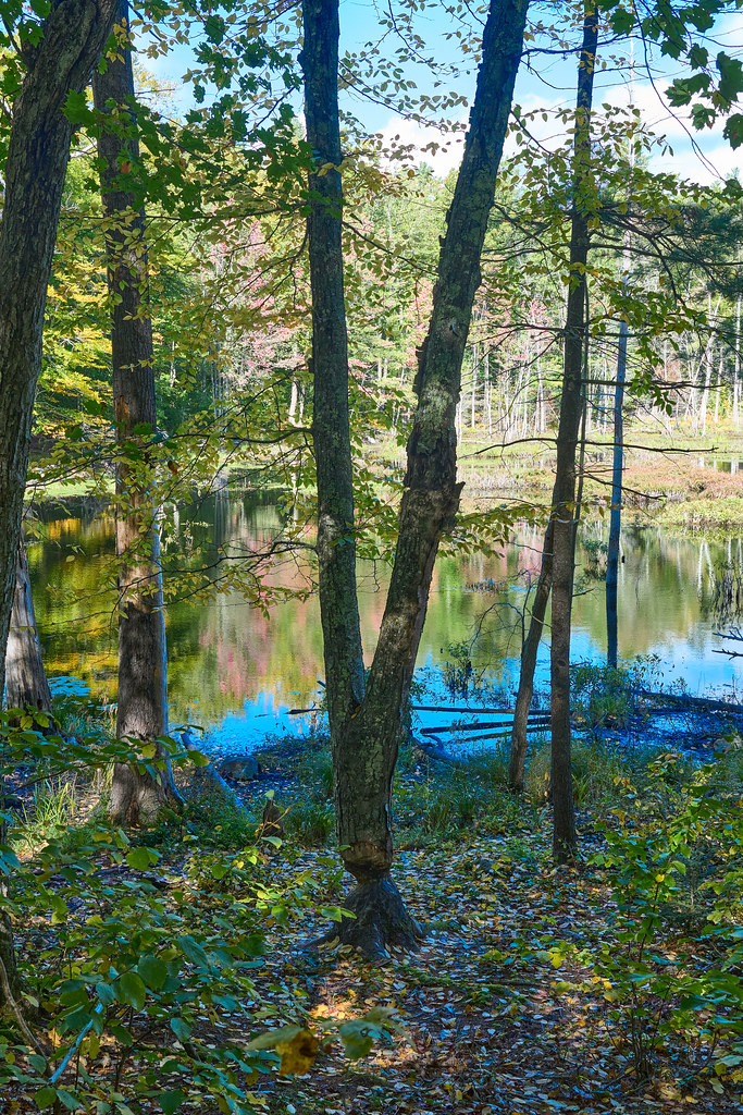 River Gorge TrailHiking · ~12 min drivePhoto: GOC53, CC BY 2.0 (via Flickr)
 Patti’s WayHiking · ~12 min drivePhoto: GOC53, CC BY 2.0 (via Flickr)
Best time to visit River Trail
Best months: April and August–October. Best months have typical highs of 55–85 °F, lows of 30 °F or warmer (32 °F where the station doesn't record snow), at most one snowy day and no more than 12 wet days.
Jan
33° / 15°
10 wet
Feb
35° / 17°
9 wet
Mar
44° / 25°
11 wet
Apr
57° / 35°
12 wet
May
67° / 45°
13 wet
Jun
77° / 54°
13 wet
Jul
82° / 60°
14 wet
Aug
81° / 58°
12 wet
Sep
73° / 50°
11 wet
Oct
60° / 39°
12 wet
Nov
48° / 31°
10 wet
Dec
37° / 22°
11 wet
Typical high / low (°F) and days with rain or snow, 1991–2020. Measured at Rochester Skyhaven Ap, NH, 4 mi away at 323 ft. This station doesn't record snowfall. Source: NOAA NCEI U.S. Climate Normals 1991–2020.
Map and trail data © OpenStreetMap contributors
