Loading…

Free — you'll pick up right here.
Watch this trail
Sign up to watch it — saving subscribes you to gate, closure and report changes.
Maine
0.8 mi
Distance
779 ft
Gain
27 min
Time
We won't guess. Here is exactly what we do and don't know.
What we do know
Inside Acadia National Park
National Park unit boundary is mapped — agency alerts for it feed this page automatically.
Boundary data
What's missing
No access route mapped
We don't yet know which road reaches this trailhead, so we can't tell you if it's gated.
Nobody's filed a report here yet — be the first.
Why you'll love it
Ocean Path Accessibility Information
AI-suggested draft · review before you go
No permit or access details on file for this trail — check with the local land manager before you go.
<p>Explore vast slabs of pink granite, picturesque cliffs, and breathtaking oceans views as the Ocean Path takes you along the bold coast of Maine. The Ocean Path is a great way to access Thunder Hole and Otter Point from Sand Beach on a gradual hike. </p> <h3>Getting to Ocean Path</h3> Ocean path begins in the upper parking lot of Sand Beach, on Park Loop Road. There are three entrances: Sand Beach, Thunder Hole, and Otter Point parking areas.<br /> <br /> Sand Beach has five accessible parking spaces in the lower parking lot. A rugged staircase, or steep walk on the road, can be taken to the upper car park where Ocean Path starts.<br /> <br /> Thunder Hole parking area is the most physically accessible entrance to Ocean Path. There are three accessible parking spots which lead to a ramp, a crosswalk, and the short section of Ocean Path that is paved.<br /> <br /> Otter Point parking area has one accessible parking spot, but the trail in this section is more hazardous with roots and larger rocks.<br /> <br /> Visitors can also use the fare-free <a href="https://www.nps.gov/acad/planyourvisit/island-explorer.htm">Island Explorer</a> to visit Ocean Path. The bus drops off and picks up at regular intervals throughout the day at the Island Explorer sign located in the right lane of Park Loop Road at Thunder Hole, and on the right of Sand Beach lower parking lot. <h3>What to Expect</h3> <ul> <li>Distance: 2.2 mile trail one way, 4.4 miles round trip. The trail is 0.7 miles from Sand Beach to Thunder Hole.</li> <li>Terrain/Safety: From Sand Beach to Thunder Hole the trail is a mix of concrete and packed gravel surfaces. The rest of the trail is gravelly and rocky with uneven surfaces. There are two staircases present 1.4 miles into the trail as the path climbs around a rocky cliff section. Watch out for steep drops into the ocean. Keep children away from the edge. Good footwear is recommended.</li> </ul> <h4>Hike Description</h4> <ul> <li>The trail begins from the upper parking lot of Sand Beach. It can also be accessed from the Thunder Hole and Otter Point parking areas.</li> <li>Leaving from Sand Beach the trail consists of concrete and packed gravel sections that gradually rise over a hill providing an overarching view across the entire ocean path coastline.</li> <li>Gradually descend on accessible trail to Thunder Hole, an underwater sea cave that with the right conditions (2 hours before high-tide and in high winds) can produce thundering crashes heard up and down the trail.</li> <li>Continuing past Thunder Hole, the trail becomes uneven but remains gradual as it begins climbing up through a spruce/fir forest.</li> <li>Arrive at Otter Cliffs, 110-foot cliffs that mark the highest point along the Ocean Path. Climb up a granite staircase to a walkway that parallels the road to cross over the cliffs and descend another staircase on the other side.</li> <li>The trail continues down to Otter Point where granite slabs are surrounded by ocean on both sides. Many people return to Sand Beach from here but a couple hundred feet more the trail ends at Otter Cove with a small staircase and a stunning view across the Otter Cove causeway with Cadillac and Dorr Mountain in the background.</li> </ul>
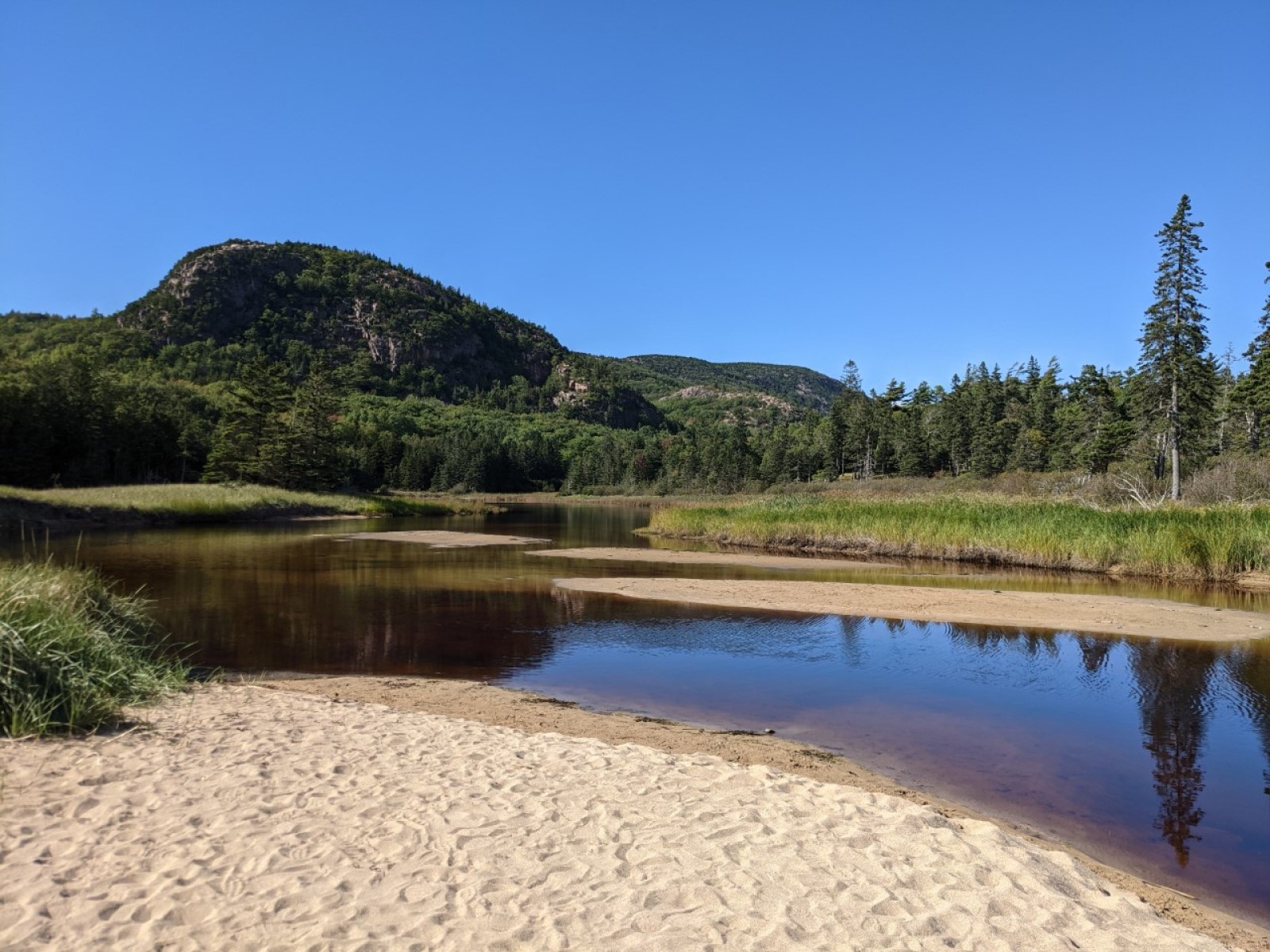
Beehive Overlook
~1 min drive
<p>The Beehive and many of Acadia’s other mountains are examples of a geologic feature called a “roche mountonée.” Roches mountonée always have this distinct shape: a gradual slope leading up to a steep drop-off. This shape was created by glaciers, which covered Acadia from 35…
Beehive Trail
~1 min drive
Steep point-to-point scramble with iron rungs and coastal views.
Bowl Trail
~1 min drive
Quick point-to-point trail perfect for a short Maine hike.
Murphy Lane
~3 min drive
A short point-to-point woodland walk in Maine.
Precipice Trail
~3 min drive
Steep cliff-side scramble with dramatic views and iron rungs.
Ladder Trail
~4 min drive
Quick point-to-point Maine hike with scenic terrain.
Dorr Mountain South Ridge Trail
~3 min drive
Steep point-to-point climb up Dorr Mountain's south ridge with rocky terrain.
A Murray Young Path
~3 min drive
Easy 1.19-mile point-to-point walk in Maine.
Hunters Beach Trail
~4 min drive
An easy 0.34-mile out-and-back trail in Maine, perfect for a quick and accessible coastal walk.
Cadillac West Face Trail
~5 min drive
Steep point-to-point trail up Cadillac Mountain's west face in Maine.
