Appalachian Trail
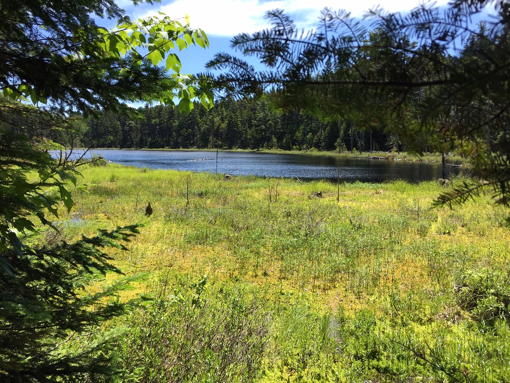 Photo: John Hayes (gravelboy), CC BY-SA 2.0 (via Flickr)
- 1.7 mi
- round trip
- 814 ft
- climb
- 1,157 ft
- high point
- Out and back
- route
- Sep
- best months
Is Appalachian Trail open right now?
Closure in the area
There's a closure order in Appalachian National Scenic Trail. It doesn't name Appalachian Trail, so check the source for the area it covers.
List of trail closures post-Hurricane Helene
Park closure covering Appalachian National Scenic Trail · NPS · Appalachian National Scenic Trail
Black Bears Frequenting the McAfee Knob Area in Virginia
Park alert covering Appalachian National Scenic Trail · NPS · Appalachian National Scenic Trail
As of · Source: NPS · Appalachian National Scenic Trail. Agencies don't list every closure — check before you go.
The Appalachian Trail passes through Maine on the Appalachian National Scenic Trail, a National Park Service unit. This stretch is an out-and-back hike of about 3.5 miles, with a total elevation gain of roughly 814 feet. The high point reaches 1,157 feet, and the low point is 1,019 feet. The trail is rated easy, and the climb is steady, with the steepest section at about 0.4 miles from the start, where the grade reaches about 14 percent. Summer is the most comfortable time to go. Typical July averages from a nearby weather station run around 75°F for highs and 57°F for lows, while winter months stay near or below freezing. The trip takes about 1.5 hours. For more time on foot, Lower Wilson Falls Trail is about 2.3 miles away and Snake Trail about 2.8 miles away. Craig's Trail Loop and Arthur's Loop are cross-country ski routes about 2.9 miles off.
Local outfitters
- Northeast Whitewater6 mi away
Not on Roamze yet. Their page has how to reach them.
- Lower Wilson Falls TrailHiking2.3 mi
- Snake TrailHiking2.8 mi
- Craig's Trail LoopCross-country skiing2.9 mi
- Arthur's LoopCross-country skiing2.9 mi
- Craig's Orchard LoopCross-country skiing3 mi
- Base TrailHiking3.2 mi
- Meandering MooseHiking3.2 mi
- T-Rex LoopCross-country skiing3.3 mi
Source: Roamze catalog (indexable pages within 10 miles, PostGIS distance)
- Appalachian TrailHiking · ~2 min drivePhoto: John Hayes (gravelboy), CC BY-SA 2.0 (via Flickr)
- Appalachian TrailHiking · ~4 min drive
- Base TrailHiking · ~5 min drive
- Appalachian TrailHiking · ~2 min drive
- Appalachian TrailHiking · ~10 min drive
- Appalachian TrailHiking · ~11 min drive
- Lower Wilson Falls TrailHiking · ~4 min drive
- Appalachian TrailHiking · ~13 min drive
- Appalachian TrailHiking · ~5 min drive
- Long Pond TrailHiking · ~15 min drive
Best time to visit Appalachian Trail
Best months: September. Best months have typical highs of 55–85 °F, lows of 30 °F or warmer (32 °F where the station doesn't record snow), at most one snowy day and no more than 12 wet days.
Jan
23° / 5°
13 wet
Feb
25° / 7°
12 wet
Mar
34° / 17°
13 wet
Apr
46° / 29°
13 wet
May
62° / 41°
14 wet
Jun
70° / 51°
14 wet
Jul
75° / 57°
15 wet
Aug
74° / 56°
13 wet
Sep
66° / 48°
11 wet
Oct
52° / 37°
13 wet
Nov
39° / 26°
14 wet
Dec
28° / 15°
16 wet
Typical high / low (°F) and days with rain or snow, 1991–2020. Measured at Greenville Maine Forestry Svc, ME, 9.3 mi away at 1,037 ft. This station doesn't record snowfall. Source: NOAA NCEI U.S. Climate Normals 1991–2020.
Map and trail data © OpenStreetMap contributors
