Flatwoods Trail
- 0.7 mi
- round trip
- 518 ft
- climb
- 1,173 ft
- high point
- Out and back
- route
- Sep–Nov
- best months
Is FLATWOODS TRAIL open right now?
Closure in the area
There's a closure order in Daniel Boone National Forest. It doesn't name FLATWOODS TRAIL, so check the source for the area it covers (2 listed).
National Visitor Use Monitoring, Oct 2026-Sept 2027
Agency closure covering Daniel Boone National Forest · USFS · Daniel Boone National Forest
Scott Creek Boat ramp briefly inaccessible, July 30
Agency closure covering Daniel Boone National Forest · USFS · Daniel Boone National Forest
Low water levels at Laurel River Lake
Agency alert covering Daniel Boone National Forest · USFS · Daniel Boone National Forest
Active logging operations near Redbird Crest Trail Sections 17-19
Agency alert covering Daniel Boone National Forest · USFS · Daniel Boone National Forest
Tornado Damaged Area Closure in London, Pulaski counties
Agency alert covering London Ranger District · Order 08-02-14-26-02 · USFS · London Ranger District
As of · Source: USFS · Daniel Boone National Forest. Agencies don't list every closure — check before you go.
Flatwoods Trail is an easy out-and-back hike in the London Ranger District of Daniel Boone National Forest in Kentucky. It is about 0.7 miles long, with a total elevation gain of 518 feet over the round trip, and the route runs from a high point of 1,173 feet to a low of 1,029 feet. The trail starts at the high point, and the steepest stretch comes early on, with a 15% grade at about 0.07 miles in. The most comfortable time to visit is fall. Typical averages from a nearby weather station in London run to highs around 70°F in October and 80°F in September, with fewer wet days in September than in the rest of the year. The hike takes about half an hour. Flatwoods Trail #470 lies about 0.3 miles away, and Laurel River Lake and Grove Boat-In Campgroind are each under a mile off. Grove Drive-In Campground is about 1.1 miles away.
- Flatwoods Trail #470Hiking0.3 mi
 Grove Boat-In CampgroindCampingPhoto: tent405, CC BY 3.0 (via Wikimedia Commons)0.7 mi
- Laurel River LakeLake fishing0.8 mi
- Duff BranchHiking0.9 mi
- Oak BranchHiking1.1 mi
- Grove Drive-In CampgroundCampingPhoto: tent405, CC BY 3.0 (via Wikimedia Commons)1.1 mi
 GroveCampingPhoto: Recreation.gov (RIDB) / public domain1.2 mi
- Long Bend Fishing SiteRiver fishing3.1 mi
Source: Roamze catalog (indexable pages within 10 miles, PostGIS distance)
 CRAIGS CREEKHiking · ~5 min drivePhoto: George Green, U.S. Army Corps of Engineers, Public domain (via Wikimedia Commons)
 Sheltowee Trace TrailHiking · ~6 min drivePhoto: George Green, U.S. Army Corps of Engineers, Public domain (via Wikimedia Commons)
- Sheltowee Trace TrailHiking · ~9 min drive
- Sheltowee Trace TrailHiking · ~10 min drive
- Boat Ramp Trail #483Hiking · ~5 min drivePhoto: George Green, U.S. Army Corps of Engineers, Public domain (via Wikimedia Commons)
- Flatwoods Trail #470Hiking · Next door
- Rockcastle Narrows Trail #503Hiking · ~13 min drive
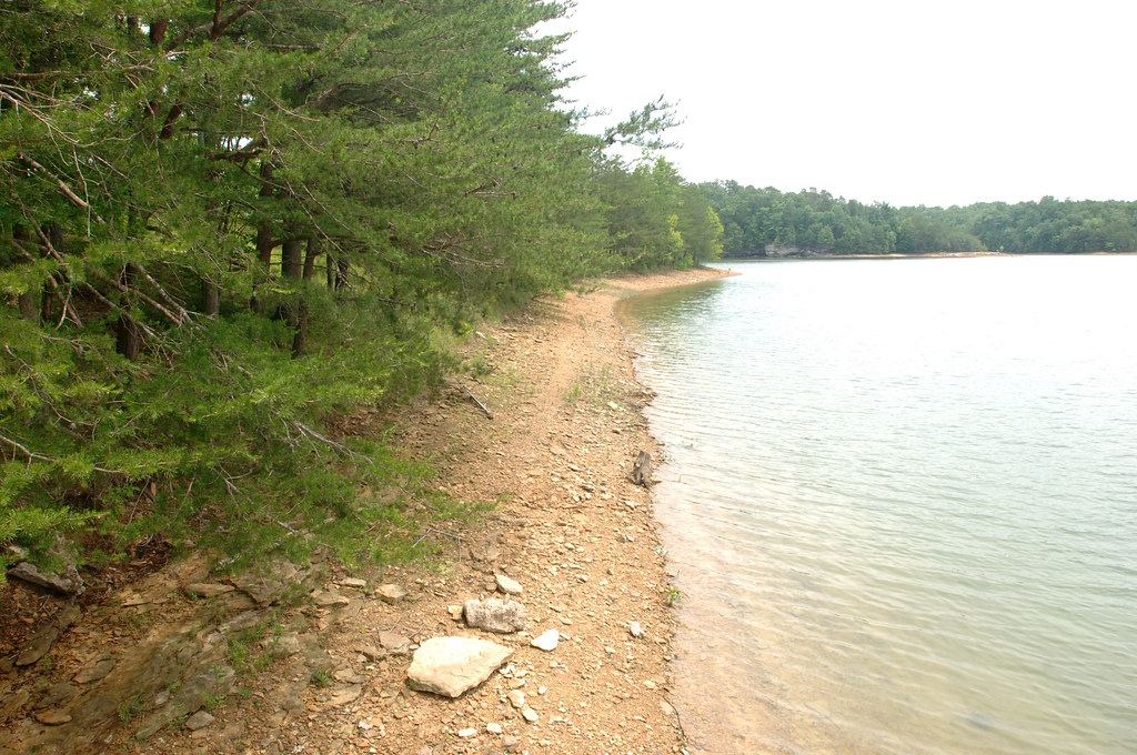 Holly Bay Trail #481Hiking · ~6 min drivePhoto: NashvilleCorps, CC BY-SA 2.0 (via Flickr)
- Bark Camp Trail #413Hiking · ~9 min drive
 Cold Rock SchoolHiking · ~6 min drivePhoto: fiforms, CC BY-SA 2.0 (via Flickr)
Best time to visit FLATWOODS TRAIL
Best months: September–November. Best months have typical highs of 55–85 °F, lows of 30 °F or warmer (32 °F where the station doesn't record snow), at most one snowy day and no more than 12 wet days.
Jan
45° / 27°
12 wet
Feb
50° / 30°
12 wet
Mar
58° / 36°
13 wet
Apr
69° / 45°
13 wet
May
77° / 54°
14 wet
Jun
84° / 62°
13 wet
Jul
86° / 66°
13 wet
Aug
86° / 65°
10 wet
Sep
80° / 58°
8 wet
Oct
70° / 45°
9 wet
Nov
58° / 36°
10 wet
Dec
48° / 30°
12 wet
Typical high / low (°F) and days with rain or snow, 1991–2020. Measured at London Corbin Ap, KY, 11.5 mi away at 1,188 ft. This station doesn't record snowfall. Source: NOAA NCEI U.S. Climate Normals 1991–2020.
