Laurel River Lake
- Sep–Nov
- best months
Is Laurel River Lake open right now?
Closure in the area
There's a closure order in Daniel Boone National Forest. It doesn't name Laurel River Lake, so check the source for the area it covers (3 listed).
Fees waived for Veterans Day, Nov 11
Agency closure covering Daniel Boone National Forest · USFS · Daniel Boone National Forest
National Visitor Use Monitoring, Oct 2026-Sept 2027
Agency closure covering Daniel Boone National Forest · USFS · Daniel Boone National Forest
Scott Creek Boat ramp briefly inaccessible, July 30
Agency closure covering Daniel Boone National Forest · USFS · Daniel Boone National Forest
Barren Fork Horse Camp, surrounding trails closed for prescribed burn operations, November 8
Agency alert covering Daniel Boone National Forest · USFS · Daniel Boone National Forest
Low water levels at Laurel River Lake
Agency alert covering Daniel Boone National Forest · USFS · Daniel Boone National Forest
As of · Source: USFS · Daniel Boone National Forest. Agencies don't list every closure — check before you go.
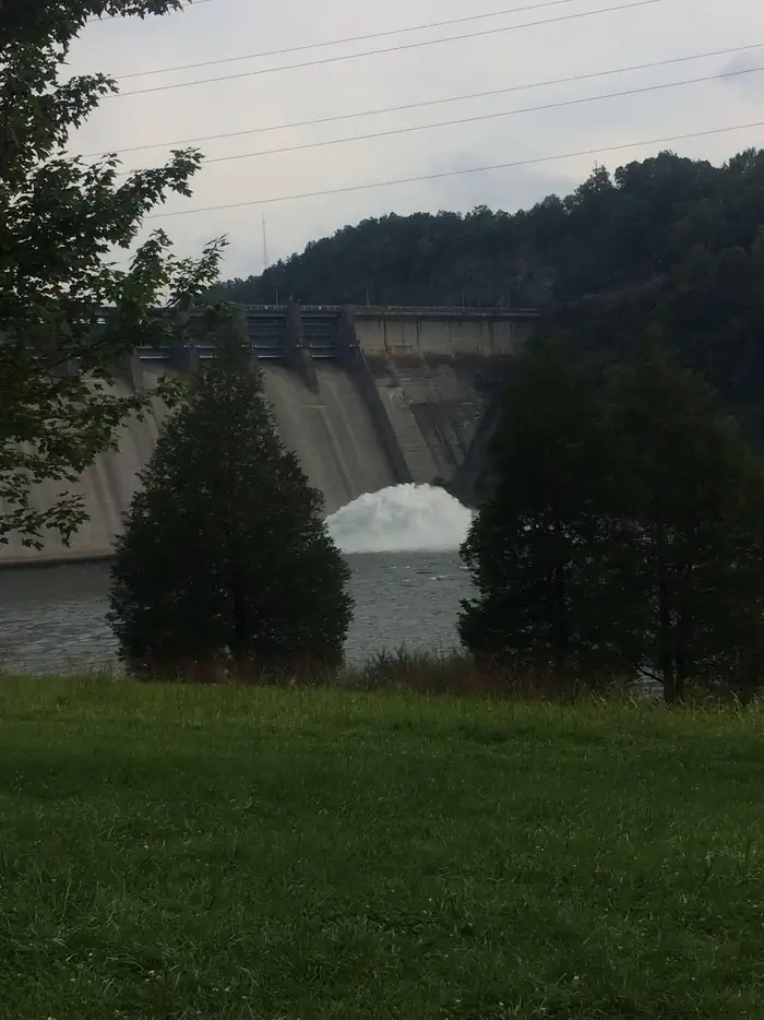
Laurel River Lake is located on London Ranger District and features 5,600 acres of clear, deep water and nearly 200 miles of tree-lined shore. The quiet coves and cliff-lined shores offer relaxation and quiet reflection, as well as boating, fishing, skiing and scuba diving in one of the deepest and cleanest lakes in Kentucky. Fishing for black bass, rainbow trout, walleye, crappie, blue gill and catfish is excellent. Night fishing for trout is also popular during the summer months.The U.S. Forest Service administers the lake and surrounding shoreline. The U.S. Army Corps of Engineers oversees the operation of the lake's dam and nearby recreation facilities, including a picnic area and a swimming beach at the spillway.Make this page look nicer by submitting photos of your visit to Laurel River Lake. Learn more... Campgrounds nearby:Drive-in Campgrounds - Holly Bay and GroveBoat-in Campgrounds - Grove and White OakGroup Campground: Craigs Creek Group CampgroundBoat Ramps nearby:Craigs Creek Boat RampFlatwoods Boat RampGrove Boat RampHightop Boat RampHolly Bay Boat RampLaurel Bridge Boat RampMarsh Branch Boat RampMarinas:Grove MarinaHolly Bay Marina
Best time to go · Sep–Nov
Best time to visit Laurel River Lake
Best months: September–November. Best months have typical highs of 55–85 °F, lows of 30 °F or warmer (32 °F where the station doesn't record snow), at most one snowy day and no more than 12 wet days.
Jan
45° / 27°
12 wet
Feb
50° / 30°
12 wet
Mar
58° / 36°
13 wet
Apr
69° / 45°
13 wet
May
77° / 54°
14 wet
Jun
84° / 62°
13 wet
Jul
86° / 66°
13 wet
Aug
86° / 65°
10 wet
Sep
80° / 58°
8 wet
Oct
70° / 45°
9 wet
Nov
58° / 36°
10 wet
Dec
48° / 30°
12 wet
Typical high / low (°F) and days with rain or snow, 1991–2020. Measured at London Corbin Ap, KY, 11.6 mi away at 1,188 ft. This station doesn't record snowfall. Source: NOAA NCEI U.S. Climate Normals 1991–2020.
Closures we've recorded since August 2026
London District Office on Laurel River Lake closed Sept 15
Daniel Boone National Forest · Order dated September 15, 2026; seen Sep 14, 2026 → lifted Sep 28, 2026 · Forest Service
Low water levels at Laurel River Lake
Daniel Boone National Forest · Order dated September 4, 2026; seen Sep 4, 2026, no lift recorded · Forest Service
London District Office on Laurel River Lake closed Sept 1-2
Daniel Boone National Forest · Order dated September 1, 2026; seen Sep 1, 2026 → lifted Sep 3, 2026 · Forest Service
London District Office on Laurel River Lake closed Sept 1
Daniel Boone National Forest · Order dated September 1, 2026; seen Aug 27, 2026 → lifted Sep 1, 2026 · Forest Service

Keep exploring — more waters worth the drive
SEE
Fall Creek Campground
~59 min drive
SEE
Lake Cumberland - Stearns
~20 min drive
SEE
Buckhorn Lake
~1h 23m drive
Buckhorn Lake is a 1,058-acre reservoir in Kentucky.
SEE
Long Bend Fishing Site
~4 min drive
SEE
Fishing Creek
~46 min drive
Fishing Creek is a river in Kentucky.
SEE
General Burnside Island State Park
~36 min drive
SEE
London Ranger District
~21 min drive
SEE
Pulaski County Park
~47 min drive
SEE
Fishing Point
~4 min drive
SEE
Lake Linville
~51 min drive
Lake Linville is a 356-acre lake near Mount Vernon, Kentucky, at about 1,059 feet.


