Brown's Hollow Camp
- Apr–Oct
- best months
Clear at last check
Weather is good · OpenWeather · checked 14 h ago
- At 689 ft
- Yellow River State Forest
Brown's Hollow Camp is a campground in Iowa at about 689 feet. It is managed by the state natural resources department.
Local outfitters
- WI River Outings26 mi away
Not on Roamze yet. Their page has how to reach them.
- Brown's HollowHiking0.4 mi
 Firetower TrialHikingPhoto: christinejwarner, CC BY 2.0 (via Flickr)0.6 mi
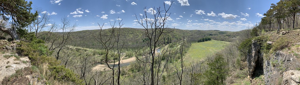 Red Oak Loop TrailHikingPhoto: christinejwarner, CC BY 2.0 (via Flickr)0.7 mi
- Donahue RoadHikingPhoto: christinejwarner, CC BY 2.0 (via Flickr)0.7 mi
- Firetower Rd./Brown's Hollow TrailHiking0.8 mi
- Firetower TrailHikingPhoto: christinejwarner, CC BY 2.0 (via Flickr)0.9 mi
- Paint CreekRiver fishing2.9 mi
- Yellow River Canoe AccessBoat launch7.6 mi
Source: Roamze catalog (indexable pages within 10 miles, PostGIS distance)
- Blackhawk ParkCamping · ~36 min drive
- Camp John SchultzCamping · ~2 min drive
- Heffern's Hill CampCamping · ~2 min drive
- Camp Glen WendelCamping · ~3 min drive
- Big Paint Creek CampgroundCamping · ~3 min drive
- Little Paint Creek CampgroundCamping · ~3 min drive
- Frenchman's Landing CampgroundCamping · ~7 min drive
- Bloody Run ParkCamping · ~14 min drive
- Spook Cave CampgroundCamping · ~16 min drive
- Gateway Campground and ParkCamping · ~19 min drive
Best time to visit Brown's Hollow Camp
Best months: April–October. Best months have typical highs of 55–85 °F, lows of 30 °F or warmer (32 °F where the station doesn't record snow), at most one snowy day and no more than 12 wet days.
Jan
27° / 10°
9 wet
Feb
31° / 13°
8 wet
Mar
44° / 25°
9 wet
Apr
58° / 37°
11 wet
May
70° / 49°
12 wet
Jun
79° / 59°
12 wet
Jul
82° / 63°
10 wet
Aug
80° / 61°
9 wet
Sep
73° / 53°
9 wet
Oct
60° / 41°
9 wet
Nov
44° / 29°
8 wet
Dec
32° / 17°
9 wet
Typical high / low (°F) and days with rain or snow, 1991–2020. Measured at Lynxville Dam 9, WI, 7.7 mi away at 633 ft. This station doesn't record snowfall. Source: NOAA NCEI U.S. Climate Normals 1991–2020.
Map and trail data © OpenStreetMap contributors
