Sycamore Trail
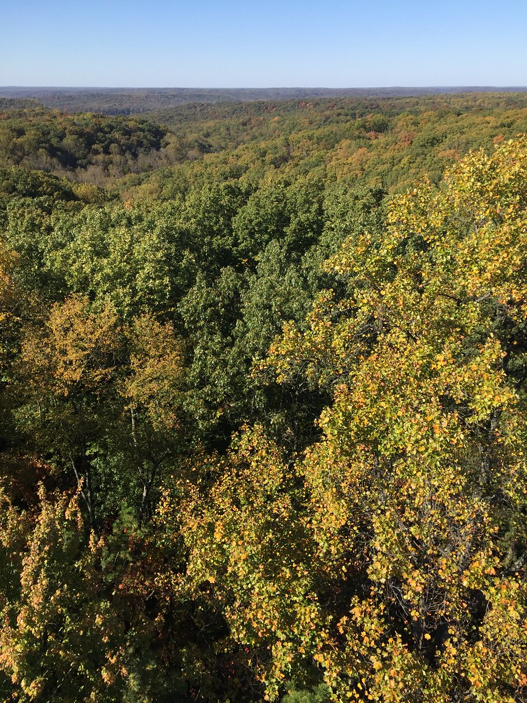 Photo: usfs_Eastern_Region, Public Domain Mark (via Flickr)
- 9.6 mi
- round trip
- 1,007 ft
- climb
- 896 ft
- high point
- Out and back
- route
- Apr, Jun–Oct
- best months
Is Sycamore Trail open right now?
Closure in the area
There's a closure order in Hoosier National Forest. It doesn't name Sycamore Trail, so check the source for the area it covers.
Firewood Permits
Agency closure covering Hoosier National Forest · USFS · Hoosier National Forest
Mano Point boat launch is sedimented in
Agency alert covering Hoosier National Forest · USFS · Hoosier National Forest
Hickory Ridge Trail 16 Closed
Agency alert covering Hoosier National Forest · Order 09-12-25-05 · USFS · Hoosier National Forest
Rainbow Lake Area Closure
Agency alert covering Hoosier National Forest · Order 09-12-25-03 · USFS · Hoosier National Forest
Seasonal Cave Closure in Effect
Agency alert covering Hoosier National Forest · Order 09-12-25-04 · USFS · Hoosier National Forest
As of · Source: USFS · Hoosier National Forest. Agencies don't list every closure — check before you go.
Sycamore Trail is a 9.6-mile out-and-back hike in the Charles C. Deam Wilderness, part of the Brownstown Ranger District of Hoosier National Forest in southern Indiana. The Forest Service manages the land, and the trail lies within designated wilderness. The route rises from about 571 feet to 896 feet, with a total climb of 1,007 feet and a steepest grade of 12% at about 0.36 miles in. The trail is rated hard, and the natural surface carries no horses or bikes. For comfortable weather, aim for late spring or early fall. Typical averages from a nearby weather station in Bloomington show May highs around 74°F and September highs around 78°F, with September also seeing the fewest wet days of the year. Several other trails start close by, including Terrill Ridge Trail at 0.3 miles and Hickory Ridge 19 at 1.1 miles. Blackwell Campground and Hickory Ridge Campground, both about 4 miles away, offer places to stay.
Best time to go · Apr, Jun–Oct
Best time to visit Sycamore Trail
Best months: April and June–October. Best months have typical highs of 55–85 °F, lows of 30 °F or warmer (32 °F where the station doesn't record snow), at most one snowy day and no more than 12 wet days.
Jan
37° / 21°
11 wet · 4 snow
Feb
42° / 23°
10 wet · 3 snow
Mar
52° / 32°
11 wet · 1 snow
Apr
64° / 42°
12 wet
May
74° / 53°
13 wet
Jun
82° / 62°
11 wet
Jul
85° / 65°
10 wet
Aug
85° / 64°
8 wet
Sep
78° / 56°
7 wet
Oct
66° / 44°
9 wet
Nov
53° / 34°
10 wet · 1 snow
Dec
41° / 26°
11 wet · 3 snow
Typical high / low (°F) and days with rain or snow, 1991–2020. Measured at Bloomington Indiana Univ, IN, 14.3 mi away at 830 ft. Source: NOAA NCEI U.S. Climate Normals 1991–2020.
Keep exploring — more trails worth the drive
 Photo: usfs_Eastern_Region, Public Domain Mark (via Flickr)
Terrill Ridge Trail
Next door
3.73-mile out-and-back hike in Indiana with 127 ft of elevation gain.
 Photo: usfs_Eastern_Region, Public Domain Mark (via Flickr)
Patton Cave Trail
~6 min drive
1.74-mile out-and-back trail in Indiana with 671 ft elevation gain
HIKE
Hickory Ridge 18
~5 min drive
9.83-mile out-and-back trail in Indiana with 1,490 ft elevation gain.
Photo: usfs_Eastern_Region, Public Domain Mark (via Flickr)Hickory Ridge 19
~2 min drive
3.54-mile out-and-back trail in Indiana with 180 ft elevation gain.
 Photo: usfs_Eastern_Region, Public Domain Mark (via Flickr)
Hickory Ridge 21
~7 min drive
Hickory Ridge 21 is a 2.12-mile out-and-back trail in Indiana with 894 feet of elevation gain.
HIKE
Cope Hollow Trail
~6 min drive
12.22-mile out-and-back hike in Indiana with 861 ft elevation gain.
 Photo: usfs_Eastern_Region, Public Domain Mark (via Flickr)
Axsom Branch Trail
~2 min drive
5.21-mile out-and-back trail in Indiana with 698 ft elevation gain.
Photo: usfs_Eastern_Region, Public Domain Mark (via Flickr)Hickory Ridge 13
~7 min drive
1.31-mile out-and-back trail in Indiana with 369 ft elevation gain.
HIKE
Grubb Ridge Trail
~7 min drive
Challenging 14.55-mile out-and-back ridge hike in Indiana.
Photo: usfs_Eastern_Region, Public Domain Mark (via Flickr)Martin Hollow Trail
~3 min drive
5.28-mile out-and-back trail in Indiana with 325 ft elevation gain.
Also worth it near here
