Black Trail
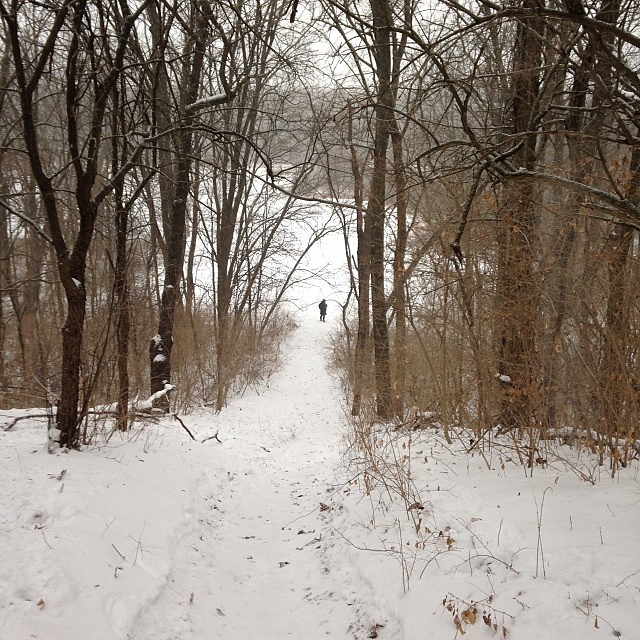 Photo: enn-here, CC BY 2.0 (via Flickr)
- 0.8 mi
- one way
- 11 ft
- climb
- 733 ft
- high point
- Point to point
- route
- Apr, Jun
- best months
Black Trail is a short, easy hike in Swallow Cliff Woods, a regional agency-managed area in Illinois. The trail is about 0.8 miles long, with a total elevation gain of about 11 feet, so it's a gentle walk rather than a climb. The route is a point-to-point path, and the steepest stretch comes early on, at about 0.15 miles in, with a grade of about 9 percent. Spring and fall are the most comfortable times to go. Typical averages from a nearby weather station show May highs around 73°F and October highs around 65°F, while July averages about 90°F. The trail sits among a network of other short routes. Brown Trail is just 0.1 mile away, and Yellow Loop, Tan Trail and Green Unpaved Trail are all within a mile.
 Brown TrailHikingPhoto: Ken Lund from Reno, Nevada, USA, CC BY-SA 2.0 (via Wikimedia Commons)0.1 mi
 Yellow LoopHikingPhoto: Darek214, CC BY 2.0 (via Flickr)0.6 mi
- Tan TrailHikingPhoto: Ken Lund from Reno, Nevada, USA, CC BY-SA 2.0 (via Wikimedia Commons)0.7 mi
- Green Unpaved TrailHikingPhoto: enn-here, CC BY 2.0 (via Flickr)0.8 mi
- Purple TrailHikingPhoto: Ken Lund from Reno, Nevada, USA, CC BY-SA 2.0 (via Wikimedia Commons)0.9 mi
- Green TrailHiking1.7 mi
 Blue TrailHikingPhoto: davidwilson1949, CC BY 2.0 (via Flickr)1.9 mi
- Canyon creek falls wallsRock climbing7 mi
Source: Roamze catalog (indexable pages within 10 miles, PostGIS distance)
- Brown TrailHiking · Next doorPhoto: Ken Lund from Reno, Nevada, USA, CC BY-SA 2.0 (via Wikimedia Commons)
- Yellow LoopHiking · ~1 min drivePhoto: Darek214, CC BY 2.0 (via Flickr)
- Tan TrailHiking · ~1 min drivePhoto: Ken Lund from Reno, Nevada, USA, CC BY-SA 2.0 (via Wikimedia Commons)
 Orange Unpaved LoopHiking · ~5 min drivePhoto: davidwilson1949, CC BY 2.0 (via Flickr)
- Green Unpaved TrailHiking · ~1 min drivePhoto: enn-here, CC BY 2.0 (via Flickr)
 Main TrailHiking · ~11 min drivePhoto: Joe K Gage, CC BY-SA 2.0 (via Flickr)
- Purple TrailHiking · ~1 min drivePhoto: Ken Lund from Reno, Nevada, USA, CC BY-SA 2.0 (via Wikimedia Commons)
- Yellow East TrailHiking · ~4 min drive
- Blue TrailHiking · ~3 min drivePhoto: davidwilson1949, CC BY 2.0 (via Flickr)
- Red Paved TrailHiking · ~6 min drive
Best time to visit Black Trail
Best months: April, June and September–October. Best months have typical highs of 55–85 °F, lows of 30 °F or warmer (32 °F where the station doesn't record snow), at most one snowy day and no more than 12 wet days.
Jan
33° / 15°
10 wet
Feb
37° / 18°
9 wet
Mar
49° / 28°
10 wet
Apr
62° / 39°
12 wet
May
73° / 50°
13 wet
Jun
84° / 60°
12 wet
Jul
90° / 64°
11 wet
Aug
87° / 63°
10 wet
Sep
80° / 55°
9 wet
Oct
65° / 43°
10 wet
Nov
50° / 31°
9 wet
Dec
38° / 21°
10 wet
Typical high / low (°F) and days with rain or snow, 1991–2020. Measured at Little Red School Hse, IL, 2.6 mi away at 715 ft. This station doesn't record snowfall. Source: NOAA NCEI U.S. Climate Normals 1991–2020.
Map and trail data © OpenStreetMap contributors
