Quartzite Butte
- 8,359 ft
- summit
- 1
- way up
Is Quartzite Butte open right now?
Closure in the area
There's a closure order in Nez Perce-Clearwater National Forest. It doesn't name Quartzite Butte, so check the source for the area it covers (2 listed).
Updated 250 Road Closure
Agency closure covering Nez Perce-Clearwater National Forest · USFS · Nez Perce-Clearwater National Forest
Red River Ranger District Road Closures
Agency closure covering Red River Ranger District · Order 01-17-05-26-002 · USFS · Red River Ranger District
NFSR #1803 Road Closure
Agency alert covering Red River Ranger District · Order 01-17-05-26-001 · USFS · Red River Ranger District
Laird Park Water Unavailable For 2026 Season
Agency alert covering Nez Perce-Clearwater National Forest · USFS · Nez Perce-Clearwater National Forest
As of · Source: USFS · Nez Perce-Clearwater National Forest. Agencies don't list every closure — check before you go.
Quartzite Butte is a summit in the Gospel-Hump Wilderness, part of the Red River Ranger District of the Nez Perce-Clearwater National Forest in Idaho. The nearest town is Cross Trails, about 4 miles away. The Quartzite Butte Trail lies about 2 miles from the summit, and the Elk Butte Trail is less than a mile off. Brandon Lake #236 and Shining Lake Trail #228 are also within about 3 miles.
Conditions and forecast
Daily highs and lows, wind and the chance of precipitation at the summit and route start for the next 7 days, from the Open-Meteo model.
- Summit elevation
- 8,359 ft
Elevation from USGS 3D Elevation Program terrain data (about 10 m resolution).
Map © Mapbox © OpenStreetMap contributors Questions about Quartzite Butte
How tall is Quartzite Butte?
8,359 ft (2,548 m).
How many routes go to the summit of Quartzite Butte?
One: Quartzite Butte Trail.
- Elk Butte TrailHiking0.7 mi
- Brandon Lake #236Hiking1.4 mi
- Quartzite Butte TrailHiking1.9 mi
- Shining Lake Trail #228Hiking3.1 mi
- Sugarloaf Ridge TrailHiking3.2 mi
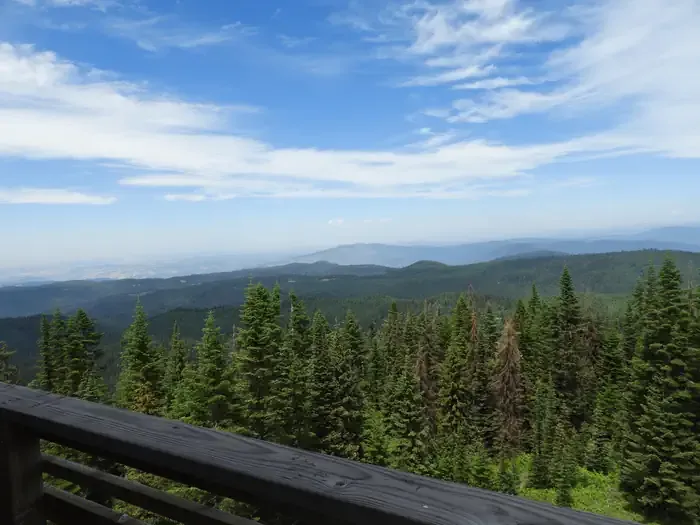 Lookout Butte LookoutCampingPhoto: Recreation.gov (RIDB) / public domain6.6 mi
- Wind RiverCanoeing7.9 mi
- Crooked CreekCanoeing9.4 mi
Source: Roamze catalog (indexable pages within 10 miles, PostGIS distance)
- Elk ButteSummit · ~4 min drive
- Oregon ButteSummit · ~6 min drive
- Black ButteSummit · ~11 min drive
- Jersey MountainSummit · ~15 min drive
- Cottontail PointSummit · ~16 min drive
- Hanover MountainSummit · ~17 min drive
- Burpee MountainSummit · ~24 min drive
- Nelson PointSummit · ~24 min drive
- Sourdough PeakSummit · ~26 min drive
- Nipple MountainSummit · ~26 min drive
