Wacko's Way
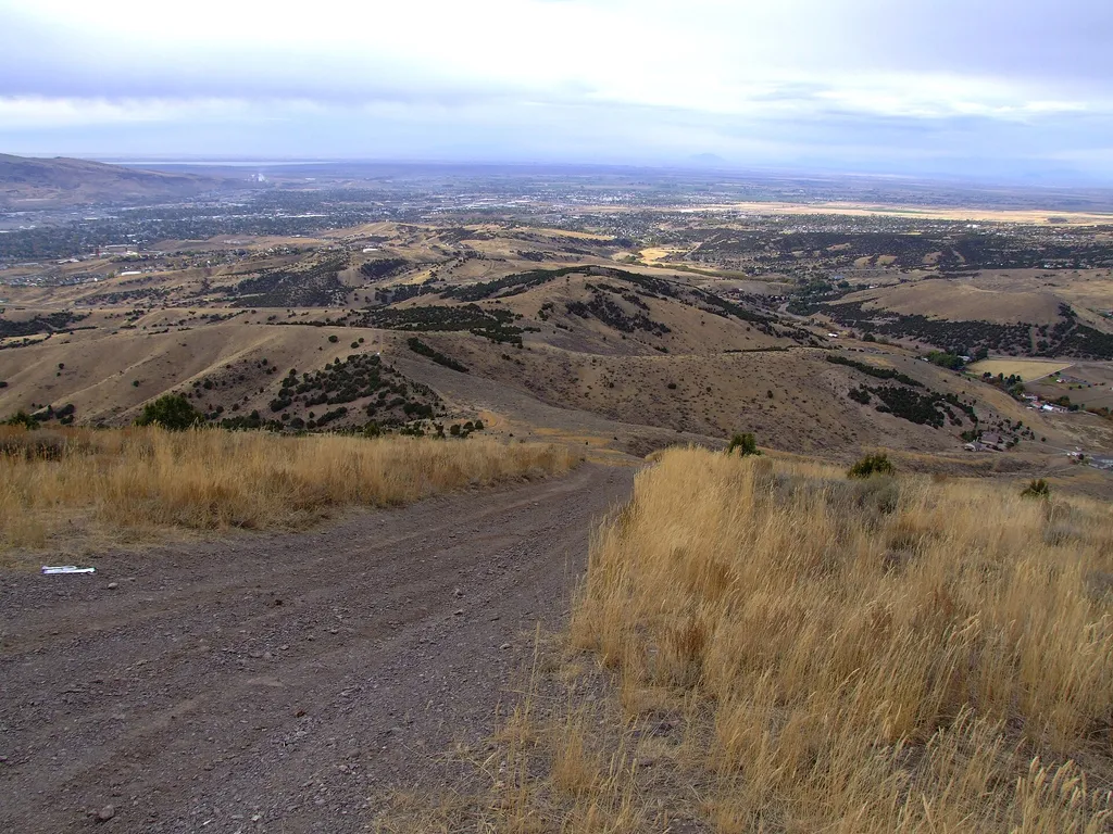 Photo: JF Hobbs — Wikimedia Commons (CC BY 3.0)
- 1.2 mi
- round trip
- 133 ft
- climb
- 5,484 ft
- high point
- Out and back
- route
- May–Jun, Sep
- best months
Wacko's Way is a short, easy hike on Bureau of Land Management land in the Pocatello Field Office in Idaho, about 1.2 miles long with a total elevation gain of 133 feet. It is an out-and-back route that starts and ends at roughly the same point, with the high point at 5,484 feet and the low at 5,341 feet. The trail is natural-surfaced and open to both horses and bikes, so it works for riders and pack animals as well as hikers. The nearest town is Pocatello, and the trail sits within the BLM's Pocatello Field Office. For comfortable weather, late spring and early fall are the best bets. Typical averages from a nearby weather station in Pocatello show May highs around 68°F and September highs around 77°F, while July and August average in the upper 80s. Several other short hikes lie within a few tenths of a mile, including Top of the First, South Paw and Otta Here. Climbers can find the Redhill Trail Bouldering area about 3.6 miles away.
Best time to go · May–Jun, Sep
Best time to visit Wacko's Way
Best months: May–June and September. Best months have typical highs of 55–85 °F, lows of 30 °F or warmer (32 °F where the station doesn't record snow), at most one snowy day and no more than 12 wet days.
Jan
36° / 20°
13 wet · 11 snow
Feb
41° / 22°
10 wet · 8 snow
Mar
51° / 29°
10 wet · 6 snow
Apr
58° / 34°
10 wet · 4 snow
May
68° / 42°
10 wet · 1 snow
Jun
78° / 49°
7 wet
Jul
89° / 57°
5 wet
Aug
88° / 56°
5 wet
Sep
77° / 48°
6 wet
Oct
62° / 37°
7 wet · 2 snow
Nov
46° / 27°
9 wet · 6 snow
Dec
35° / 20°
13 wet · 11 snow
Typical high / low (°F) and days with rain or snow, 1991–2020. Measured at Pocatello 2 Ne, ID, 1.2 mi away at 4,832 ft. The station sits about 700 ft lower than this place, so expect it a little cooler here. Source: NOAA NCEI U.S. Climate Normals 1991–2020.
Keep exploring — more trails worth the drive
 Photo: JF Hobbs, CC BY 3.0 (via Wikimedia Commons)
Serengeti Trail
~10 min drive
2.46-mile out-and-back trail in Idaho with 696 ft elevation gain
 Photo: JF Hobbs, CC BY 3.0 (via Wikimedia Commons)
EAST TRAIL CREEK
~12 min drive
1.96-mile out-and-back trail in Idaho with 1,022 ft elevation gain and loss.
 Photo: JF Hobbs, CC BY 3.0 (via Wikimedia Commons)
Mcnabe Creek
~16 min drive
6.85-mile out-and-back trail in Idaho with 1,901 ft elevation gain.
 Photo: JF Hobbs, CC BY 3.0 (via Wikimedia Commons)
City Creek Trail
~11 min drive
1.08-mile out-and-back trail in Idaho with 210 ft elevation gain
Photo: JF Hobbs, CC BY 3.0 (via Wikimedia Commons)Middle City Creek
~13 min drive
Middle City Creek is a 1.54-mile out-and-back trail in Idaho with 682 feet of elevation loss.
Photo: JF Hobbs, CC BY 3.0 (via Wikimedia Commons)Sterling Justice
~12 min drive
11.34-mile out-and-back trail in Idaho with 539 ft gain.
 Photo: JF Hobbs, CC BY 3.0 (via Wikimedia Commons)
Cherry Springs South
~18 min drive
Cherry Springs South is a 1.27-mile out-and-back trail in Idaho with 35 feet of elevation gain.
Photo: JF Hobbs, CC BY 3.0 (via Wikimedia Commons)Buckskin
~16 min drive
4.75-mile out-and-back trail in Idaho with 1,662 ft elevation gain.
HIKE
North Fork Gibson Jack--John
~13 min drive
7.45-mile out-and-back trail in Idaho with 1,285 ft gain
HIKE
Top of the First
Next door
Top of the First is a hiking trail in Idaho.

