Veteran's Trail
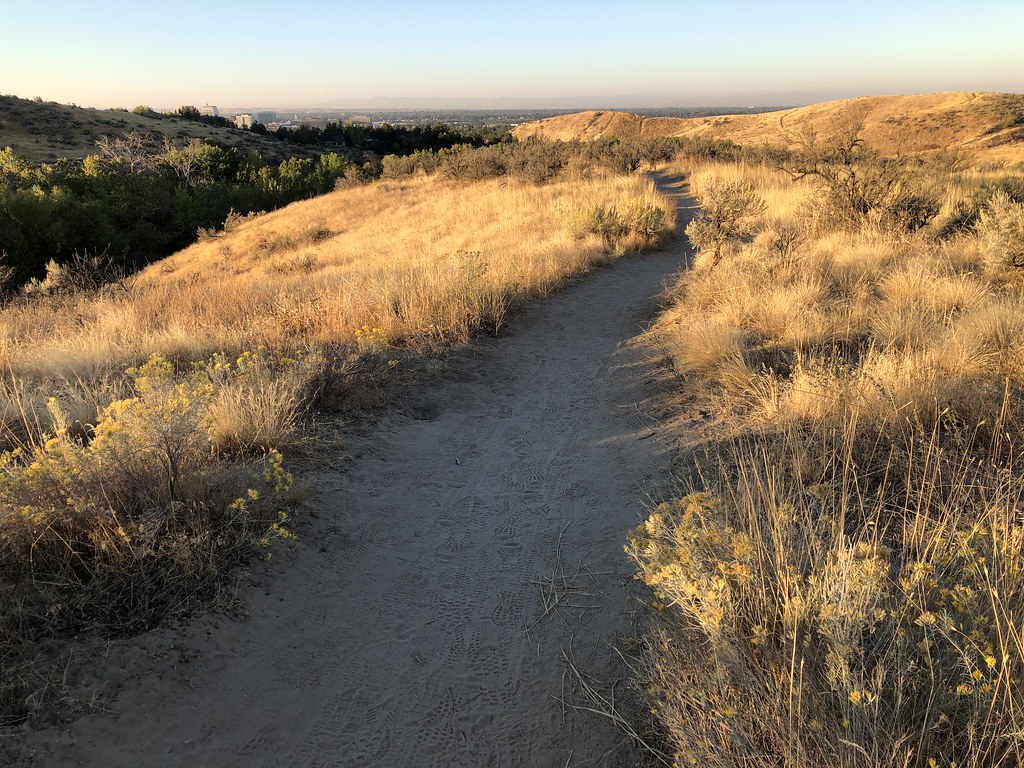
 Photo: Ben Christenson, CC BY 2.0 (via Flickr)
- 1.1 mi
- round trip
- 566 ft
- climb
- 2,854 ft
- high point
- Out and back
- route
- Apr–Jun, Sep–Oct
- best months
Veteran's Trail is a short, easy out-and-back hike in Idaho, managed by the State Department of Land. The route is about 2.2 miles long, with a total elevation gain of 566 feet, and it starts and ends at roughly 2,650 feet. The trail's high point is about 2,850 feet, and the steepest stretch comes at around 0.85 miles in, with a grade of about 11 percent. The most comfortable months for a visit are typically late spring and early fall. Typical averages from the nearby Boise Air Terminal weather station show May highs around 72°F and September highs around 80°F, while July and August average in the low 90s. The hike takes about an hour to complete. Several other trails sit close by, including Big Springs Loop at 0.7 miles, Seamans Gulch Access Trail at 0.8 miles and Valley View Trail at 0.9 miles. Climbers can find The Playground about 9 miles away.
Local outfitters
- Lake Point Campground19 mi away
- Riverpond Campground33 mi away
Not on Roamze yet. Their page has how to reach them.
- Big Springs LoopHikingPhoto: Ben Christenson, CC BY 2.0 (via Flickr)0.7 mi
- Seamans Gulch Access TrailHiking0.8 mi
- Valley View TrailHikingPhoto: Ben Christenson, CC BY 2.0 (via Flickr)0.9 mi
- Seamans Gulch TrailHiking1.2 mi
- The PlaygroundRock climbing8.8 mi
- Rocky CanyonRock climbing9.5 mi
- Bee BlockRock climbing9.6 mi
- Atomic BouldersRock climbing9.7 mi
Source: Roamze catalog (indexable pages within 10 miles, PostGIS distance)
- Big Springs LoopHiking · ~1 min drivePhoto: Ben Christenson, CC BY 2.0 (via Flickr)
- #26 Upper RidgeHiking · ~5 min drive
- #81 Polecat LoopHiking · ~7 min drive
- Valley View TrailHiking · ~2 min drivePhoto: Ben Christenson, CC BY 2.0 (via Flickr)
- #70 Landslide LoopHiking · ~8 min drive
 Who Now Loop #51Hiking · ~10 min drivePhoto: bgwashburn, CC BY 2.0 (via Flickr)
- Hawkins Reserve LoopHiking · ~11 min drive
 #38 The Grove LoopHiking · ~11 min drivePhoto: bgwashburn, CC BY 2.0 (via Flickr)
- Spring Creek - #9Hiking · ~11 min drive
 Chickadee Ridge #36AHiking · ~11 min drivePhoto: bgwashburn, CC BY 2.0 (via Flickr)
Best time to visit Veteran's Trail
Best months: April–June and September–October. Best months have typical highs of 55–85 °F, lows of 30 °F or warmer (32 °F where the station doesn't record snow), at most one snowy day and no more than 12 wet days.
Jan
39° / 26°
11 wet · 5 snow
Feb
46° / 29°
9 wet · 3 snow
Mar
55° / 35°
10 wet · 2 snow
Apr
62° / 40°
9 wet
May
72° / 48°
8 wet
Jun
81° / 54°
5 wet
Jul
93° / 62°
3 wet
Aug
91° / 61°
2 wet
Sep
80° / 53°
4 wet
Oct
65° / 42°
6 wet
Nov
49° / 32°
10 wet · 2 snow
Dec
39° / 25°
12 wet · 5 snow
Typical high / low (°F) and days with rain or snow, 1991–2020. Measured at Boise Air Terminal, ID, 9.2 mi away at 2,814 ft. Source: NOAA NCEI U.S. Climate Normals 1991–2020.

Map and trail data © OpenStreetMap contributors
