Sugar Beet Lake Path
- 0.4 mi
- round trip
- 26 ft
- climb
- 2,559 ft
- high point
- Out and back
- route
- Mar–Jun, Sep–Oct
- best months
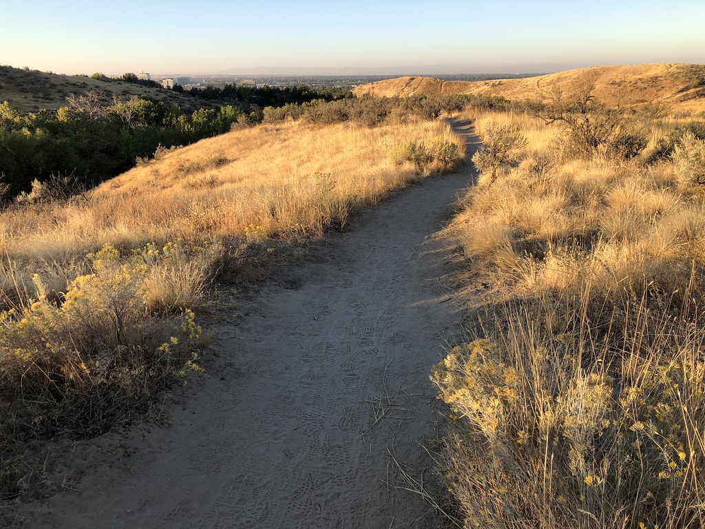
Sugar Beet Lake Path is a short, easy out-and-back hike in Idaho, about 3 miles from the town of Fischer. The route is just under a mile long, with a total elevation gain of about 26 feet, so it's a gentle walk that can be done in half an hour or so. The path is nearly flat, with the high point at about 2,559 feet and the low point at about 2,548 feet. That makes it an easy choice for a quick stop, and the trail is short enough to fit into a longer day of exploring the area. For comfortable weather, aim for late spring or early fall. Typical averages from a nearby weather station show May highs around 74°F and September highs around 81°F, while July and August average in the low 90s. Other hikes within a short drive include Wilson Trail, about 4 miles away, and Star River Walk and Swallow Nest Trail, both a little over 6 miles off.
Local outfitters
- Lake Point Campground10 mi away
- Riverpond Campground45 mi away
Not on Roamze yet. Their page has how to reach them.
- Wilson TrailHiking3.8 mi
- Star River WalkHiking6.3 mi
 Swallow Nest TrailHikingPhoto: cifraser1, CC BY 2.0 (via Flickr)6.4 mi
- Nature TrailHikingPhoto: cifraser1, CC BY 2.0 (via Flickr)7.1 mi
- Sagebrush TrailHikingPhoto: cifraser1, CC BY 2.0 (via Flickr)7.1 mi
- Middleton River WalkHiking8.1 mi
- Newbury Commons Walking PathHiking8.9 mi
Source: Roamze catalog (indexable pages within 10 miles, PostGIS distance)
- Swallow Nest TrailHiking · ~11 min drivePhoto: cifraser1, CC BY 2.0 (via Flickr)
- #26 Upper RidgeHiking · ~27 min drive
- #81 Polecat LoopHiking · ~29 min drive
- Nature TrailHiking · ~12 min drivePhoto: cifraser1, CC BY 2.0 (via Flickr)
- Sagebrush TrailHiking · ~12 min drivePhoto: cifraser1, CC BY 2.0 (via Flickr)
 Veteran's TrailHiking · ~23 min drivePhoto: Ben Christenson, CC BY 2.0 (via Flickr)
- Big Springs LoopHiking · ~24 min drivePhoto: Ben Christenson, CC BY 2.0 (via Flickr)
- Valley View TrailHiking · ~24 min drivePhoto: Ben Christenson, CC BY 2.0 (via Flickr)
 Who Now Loop #51Hiking · ~28 min drivePhoto: bgwashburn, CC BY 2.0 (via Flickr)
 #38 The Grove LoopHiking · ~30 min drivePhoto: bgwashburn, CC BY 2.0 (via Flickr)
Best time to visit Sugar Beet Lake Path
Best months: March–June and September–October. Best months have typical highs of 55–85 °F, lows of 30 °F or warmer (32 °F where the station doesn't record snow), at most one snowy day and no more than 12 wet days.
Jan
40° / 23°
10 wet
Feb
47° / 26°
8 wet
Mar
57° / 32°
9 wet
Apr
65° / 36°
9 wet
May
74° / 44°
8 wet
Jun
83° / 51°
5 wet
Jul
93° / 57°
2 wet
Aug
92° / 55°
2 wet
Sep
81° / 47°
3 wet
Oct
67° / 37°
6 wet
Nov
51° / 28°
10 wet
Dec
40° / 23°
11 wet
Typical high / low (°F) and days with rain or snow, 1991–2020. Measured at Nampa Sugar Factory, ID, 2.3 mi away at 2,470 ft. This station doesn't record snowfall. Source: NOAA NCEI U.S. Climate Normals 1991–2020.
Map and trail data © OpenStreetMap contributors
