Packsaddle
- 6.4 mi
- round trip
- 1,769 ft
- climb
- 5,385 ft
- high point
- Out and back
- route
- Jul–Sep
- best months
Is Packsaddle open right now?
Closure in the area
There's a closure order in Idaho Panhandle National Forests. It doesn't name Packsaddle, so check the source for the area it covers (4 listed).
Emergency Road Closure Lightning Creek / Forest Road 419
Agency closure covering Idaho Panhandle National Forests · Order 0104-06-26-002 · USFS · Idaho Panhandle National Forests
Emergency Road Closure Forest Road 225, Slate Creek
Agency closure covering St. Joe Ranger District · Order 01-04-04-26-001 · USFS · St. Joe Ranger District
Abandoned Mines Area Closure
Agency closure covering Idaho Panhandle National Forests · Order 1-04-00-25-001 · USFS · Idaho Panhandle National Forests
Idaho Panhandle Seasonal Food Storage Order
Agency closure covering Idaho Panhandle National Forests · Order 01-04-00-24-001 · USFS · Idaho Panhandle National Forests
Heavy Truck Traffic on FS Road 209
Agency alert covering Idaho Panhandle National Forests · USFS · Idaho Panhandle National Forests
As of · Source: USFS · Idaho Panhandle National Forests. Agencies don't list every closure — check before you go.
Packsaddle is a moderate out-and-back hike in Idaho's Idaho Panhandle National Forests, within the St. Joe Ranger District. The trail runs about 6.4 miles, with a one-way elevation gain of 1,769 feet, taking you from a low point of 2,595 feet to a high of 5,385 feet. The Forest Service manages the land, and the route is natural-surface, with horses and bikes allowed. Summer is the most comfortable time to go. Typical averages from a nearby weather station at Mullan Pass show July and August highs around 70°F with only about six wet days a month, while winter highs stay near 28°F. That station sits about 640 feet higher than the trail's high point, so temperatures on the route run a little warmer. The trail is open from June 1 to September 30. Turner Peak lies about 1.8 miles away, and Skookum Creek and the Nelson Ridge NRT are each about 3 miles off. Turner Flat campground is about 3.6 miles away.
Local outfitters
- CDA River RV36 mi away
- Lost Moose Campground38 mi away
Not on Roamze yet. Their page has how to reach them.
Best time to go · Jul–Sep
Best time to visit Packsaddle
Best months: July–September. Best months have typical highs of 55–85 °F, lows of 30 °F or warmer (32 °F where the station doesn't record snow), at most one snowy day and no more than 12 wet days.
Jan
28° / 19°
19 wet
Feb
28° / 19°
17 wet
Mar
34° / 22°
19 wet
Apr
40° / 27°
17 wet
May
50° / 36°
15 wet
Jun
58° / 42°
13 wet
Jul
70° / 52°
6 wet
Aug
69° / 51°
6 wet
Sep
59° / 44°
8 wet
Oct
44° / 32°
13 wet
Nov
32° / 23°
17 wet
Dec
27° / 18°
18 wet
Typical high / low (°F) and days with rain or snow, 1991–2020. Measured at Mullan Pass Vor/Dme, ID, 16.1 mi away at 6,028 ft. The station sits about 600 ft higher than this place, so expect it a little warmer here. This station doesn't record snowfall. Source: NOAA NCEI U.S. Climate Normals 1991–2020.
Keep exploring — more trails worth the drive
 Photo: Jon Roanhaus, CC BY-SA 3.0 (via Wikimedia Commons)
Clear Creek
~16 min drive
3.18-mile out-and-back trail in Idaho with 456 ft elevation gain.
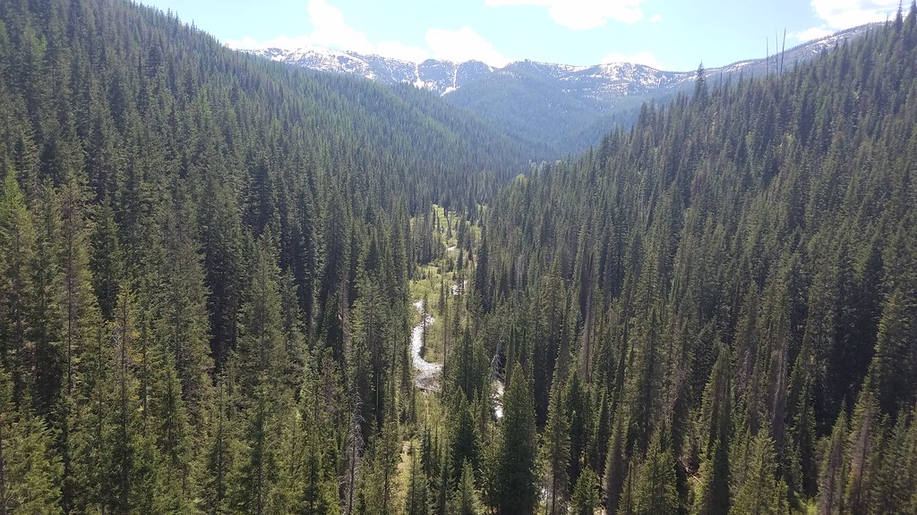 Photo: Forest Service - Northern Region, Public Domain Mark (via Flickr)
BEAR CREEK
~16 min drive
9.38-mile out-and-back trail in Idaho with 3,378 ft elevation gain
HIKE
NELSON RIDGE NRT
~5 min drive
18.52-mile out-and-back trail in Idaho with 5,225 ft elevation gain/loss.
HIKE
Arid Peak
~15 min drive
2.68-mile out-and-back trail to Arid Peak in Idaho with 165 ft of elevation gain.
HIKE
Roundhouse Gulch
~8 min drive
1.59-mile out-and-back trail in Idaho with 849 ft gain
HIKE
TURNER PEAK
~3 min drive
10.26-mile out-and-back trail in Idaho with 4,044 ft gain and 5,791 ft max elevation.
HIKE
Storm Peak
~20 min drive
21.38-mile out-and-back trail in Montana with 5,315 ft gain/loss and a max elevation of 6,198 ft.
HIKE
Twin Creek Cabin
~19 min drive
1.58-mile out-and-back trail to Twin Creek Cabin in Idaho with 202 ft of elevation gain.
HIKE
SLATE CREEK ACCESS
~17 min drive
1.84-mile out-and-back trail with 1,887 ft elevation gain and loss in Idaho
HIKE
Skookum Creek
~5 min drive
7.10-mile loop trail in Idaho with 3,042 ft elevation gain.
Also worth it near here
