Lodgepole Trail
- 3.1 mi
- round trip
- 3,432 ft
- climb
- 8,396 ft
- high point
- Out and back
- route
Caution at last check
Agency alerts are in effect for this area; weather is marginal · USFS, OpenWeather · checked 13 h ago
Is Lodgepole Trail open right now?
Closure in the area
There's a closure order in Boise National Forest. It doesn't name Lodgepole Trail, so check the source for the area it covers.
UPDATED Sept. 19 - Crooked Fire Area, Road, and Trail Closure
Agency closure covering Boise National Forest · Order 0402-03-140 · USFS · Boise National Forest
Lava Fire Road Closure
Agency alert covering Boise National Forest · Order 0402-06-84 · USFS · Boise National Forest
As of · Source: USFS · Boise National Forest. Agencies don't list every closure — check before you go.
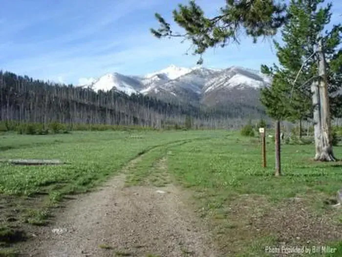
Lodgepole Trail is a hard hike in Idaho's Boise National Forest, within the Idaho City Ranger District. The route is an out-and-back of about 6.3 miles, with a total elevation gain of 3,432 feet. The trail starts at about 5,852 feet and climbs to a high point of 8,396 feet, and the steepest stretch comes early, around 0.6 miles in, with a grade of about 32 percent. The climb is front-loaded, so the hardest part of the hike is at the beginning. The trail is rated hard, and the round trip takes about four hours. The trail lies on Forest Service land, and the nearest town is Idaho City. For an overnight base, Graham Cabin is about 2.9 miles away and Deer Park Cabin about 4.5 miles. Horse Heaven Trail and West Warrior Trail are both within about 2 miles.
Local outfitters
- Camp Perkins24 mi away
- Riverpond Campground36 mi away
Not on Roamze yet. Their page has how to reach them.
- Horse Heaven TrailHiking1.7 mi
- West Warrior TrailHiking1.9 mi
 Graham CabinCampingPhoto: Recreation.gov (RIDB) / public domain2.9 mi
 Deer Park CabinCampingPhoto: Recreation.gov (RIDB) / public domain4.5 mi
- Johnson CreekHiking4.5 mi
- BayhouseHiking5.3 mi
- North Fork Boise RiverHiking5.6 mi
- Queens River CampgroundCamping8.6 mi
Source: Roamze catalog (indexable pages within 10 miles, PostGIS distance)
 North Fork Boise RiverHiking · ~23 min drivePhoto: Sam Beebe, CC BY 2.0 (via Flickr)
- Johnson CreekHiking · ~8 min drive
- BayhouseHiking · ~9 min drive
- Browns LakeHiking · ~13 min drive
- Horse Heaven TrailHiking · ~3 min drive
- North Fork Boise RiverHiking · ~10 min drive
- GRAND MOUNTAINHiking · ~13 min drive
- BEAR SUMMIT WESTHiking · ~16 min drive
- West Warrior TrailHiking · ~3 min drive
- Eagle Creek TrailHiking · ~10 min drive
Map and trail data © OpenStreetMap contributors
