Grand Traverse
- 3.3 mi
- round trip
- 9 ft
- climb
- 5,438 ft
- high point
- Out and back
- route
- May–Sep
- best months
Is Grand Traverse open right now?
Alert in the area
The Forest Service lists 5 alerts for Payette National Forest.
Over Snow Vehicle Closure
Agency alert covering Payette National Forest · Order 0412-638 · USFS · Payette National Forest
Brundage Mountain Resort Snowcat Route Closure
Agency alert covering Payette National Forest · Order 0412-637 · USFS · Payette National Forest
Lost Valley Log Hauling
Agency alert covering Payette National Forest · USFS · Payette National Forest
Granite Mountain Over Snow Vehicle Closure
Agency alert covering Payette National Forest · Order 0412-635 · USFS · Payette National Forest
Gordon Titus Upper Elevation Parking Lot Winter Restrictions
Agency alert covering Payette National Forest · Order 0412-543 · USFS · Payette National Forest
As of · Source: USFS · Payette National Forest. Agencies don't list every closure — check before you go.
Grand Traverse is a 3.3-mile out-and-back hike in the McCall Ranger District of Idaho's Payette National Forest, managed by the Forest Service. The route rises from a low of about 5,200 feet to a high of about 5,438 feet, with an elevation gain of about 9 feet, which makes it a low-key outing rather than a steep climb. The trail has a natural surface, and bikes are allowed. It is not an accessible trail. Summer is the most comfortable time to go. Typical averages from the nearby McCall weather station show July and August highs around 81°F with only about five wet days a month, while winter brings highs near 30°F and regular snow. The trail opens from May 1 to October 31. The Westy and Westy Trail are both about 0.1 mile away. Last Chance campground is about 4 miles off, and Goose Creek offers canoeing about 5 miles away.
Local outfitters
- Black Bear RV Park4 mi away
- Arrowhead RV Park30 mi away
Not on Roamze yet. Their page has how to reach them.
Best time to go · May–Sep
Best time to visit Grand Traverse
Best months: May–September. Best months have typical highs of 55–85 °F, lows of 30 °F or warmer (32 °F where the station doesn't record snow), at most one snowy day and no more than 12 wet days.
Jan
31° / 13°
14 wet · 11 snow
Feb
36° / 14°
12 wet · 9 snow
Mar
43° / 20°
13 wet · 7 snow
Apr
51° / 27°
12 wet · 3 snow
May
61° / 35°
12 wet · 1 snow
Jun
70° / 40°
10 wet
Jul
81° / 45°
5 wet
Aug
81° / 43°
5 wet
Sep
72° / 36°
6 wet
Oct
57° / 28°
9 wet · 2 snow
Nov
40° / 21°
13 wet · 7 snow
Dec
30° / 13°
15 wet · 12 snow
Typical high / low (°F) and days with rain or snow, 1991–2020. Measured at Mccall, ID, 4.3 mi away at 5,025 ft. Source: NOAA NCEI U.S. Climate Normals 1991–2020.
Keep exploring — more trails worth the drive
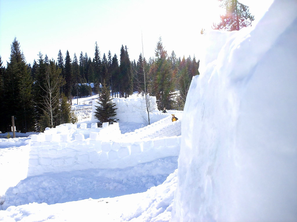 Photo: Stupid Dingo, CC BY 2.0 (via Flickr)
Peninsula Trail
~6 min drive
0.78-mile out-and-back hike in Idaho with 110 ft of elevation gain.
HIKE
Polar Express
Next door
3.83-mile out-and-back trail in Idaho with 137 ft elevation gain.
HIKE
Brundage-Bear Basin
~2 min drive
12.49-mile out-and-back trail in Idaho with 1,647 ft elevation gain.
HIKE
Goose Creek Trail
~12 min drive
10.97-mile out-and-back hike in Idaho with 623 ft gain and 2,129 ft loss.
 Photo: waterarchives, CC BY-SA 2.0 (via Flickr)
Ridgeline Trail
~7 min drive
0.90-mile lollipop trail in Idaho with 230 ft elevation gain.
HIKE
Huckleberry Loop
~7 min drive
7.32-mile out-and-back trail in Idaho with 2,207 ft elevation gain
HIKE
Fall Creek Loop
~10 min drive
11.60-mile out-and-back trail in Idaho with 1,034 ft of elevation gain.
HIKE
Fall Creek Trail
~17 min drive
11.72-mile out-and-back trail in Idaho with 4,775 ft elevation gain and loss.
HIKE
Sleepy Hollow
Next door
1.10-mile out-and-back trail in Idaho with 32 ft of elevation gain.
HIKE
Lakeview Vista
~8 min drive
5.9-mile out-and-back trail in Idaho with 1,458 ft elevation gain/loss.
Also worth it near here
