
Village of Trees RV Resort
Hiking business nearby (~31 mi away) — hasn't claimed their Roamze page yet
0.51-mile loop around a rock feature in Idaho with 93 ft gain.
 Photo: Seth Tisue, CC BY-SA 2.0 (via Flickr)
Best months: April–June and September–October. Best months have typical highs of 55–85 °F, lows of 30 °F or warmer (32 °F where the station doesn't record snow), at most one snowy day and no more than 12 wet days.
Jan
40° / 21°
6 wet
Feb
44° / 24°
6 wet
Mar
54° / 30°
7 wet
Apr
60° / 34°
8 wet
May
69° / 41°
9 wet
Jun
78° / 48°
6 wet
Jul
86° / 57°
4 wet
Aug
86° / 56°
4 wet
Sep
77° / 47°
4 wet
Oct
64° / 37°
5 wet
Nov
49° / 28°
6 wet
Dec
39° / 21°
6 wet
Typical high / low (°F) and days with rain or snow, 1991–2020. Measured at Oakley, ID, 13.9 mi away at 4,559 ft. We don't have this place's elevation, so higher spots nearby can run cooler. This station doesn't record snowfall. Source: NOAA NCEI U.S. Climate Normals 1991–2020.
Around the Rock Trail is a short 0.51-mile loop in Idaho with 93 feet of elevation gain. This brief circuit offers a quick walk around a rocky feature within the National Park Service-managed area.
 Photo: Seth Tisue, CC BY-SA 2.0 (via Flickr)
Backyard Boulders Trailhead
~0 min drive
Trailhead and Stines Creek Picnic Area Although the loop trail can be walked in either direction, the numbering system and trail features are described clock-wise. From the kiosk, travel left (south) for 200 yards, then follow the trail right or west, below the popular climbs…
 Photo: Seth Tisue, CC BY-SA 2.0 (via Flickr)
Backyard Boulders Trail
~0 min drive
1.38-mile loop trail in Idaho with 177 ft elevation gain.
Photo: Seth Tisue, CC BY-SA 2.0 (via Flickr)Castle Rocks Trail
~1 min drive
8.68-mile out-and-back trail in Idaho with 894 ft of elevation gain.
Almo Creek Trail
~6 min drive
6.06-mile out-and-back trail in Idaho with 2,568 ft elevation gain/loss.
 Photo: Seth Tisue, CC BY-SA 2.0 (via Flickr)
Backyard Boulders Return Route
~0 min drive
The trail returns alongside Stines Creek, Kid Rock and the Stines Creek Picnic Area. For other family friendly hikes, rangers suggest the trails to the Almo Creek Wetland and Eagle Rock Grove. For the adventurous, take the five-mile, three-hour Castle Rock Trail.
Photo: Seth Tisue, CC BY-SA 2.0 (via Flickr)Archery Course
~1 min drive
1.14-mile loop trail in Idaho with 132 ft of elevation gain.
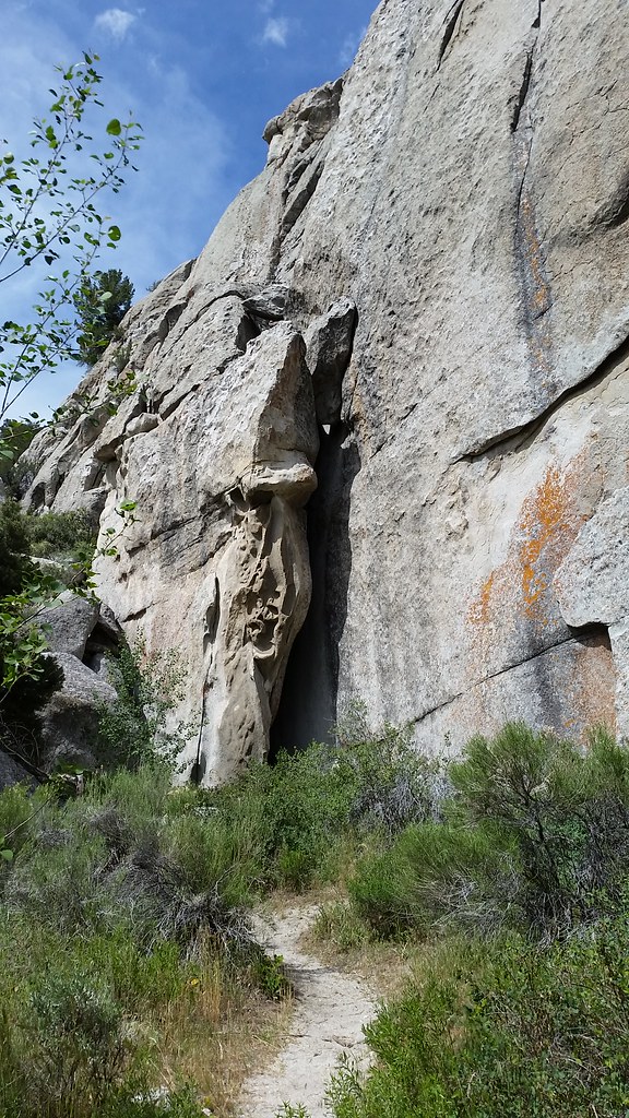 Photo: cifraser1, CC BY 2.0 (via Flickr)
Beef Jello Trail
~5 min drive
1.7-mile out-and-back trail in Idaho with 857 ft elevation gain.
ALMO CREEK
~6 min drive
5.18-mile out-and-back trail in Idaho with 2,574 ft elevation gain and loss.
Geological Interpretive Trail - 1 mile
~4 min drive
Have you ever visited City of Rocks and wondered, “How did this happen?” or “Why do the rocks look like this?” The Geological Interpretive Trail is the perfect short hike to: see fascinating geological formations up close examine the difference between the Green Creek Comple…
Photo: Seth Tisue, CC BY-SA 2.0 (via Flickr)Bracksiek`s Pillar Trail
~1 min drive
1.24-mile out-and-back hike to Bracksiek`s Pillar in Idaho with 330 ft gain.
Outfitters and businesses. They haven’t set up their Roamze page yet.
Village of Trees RV Resort
Hiking business nearby (~31 mi away) — hasn't claimed their Roamze page yet
