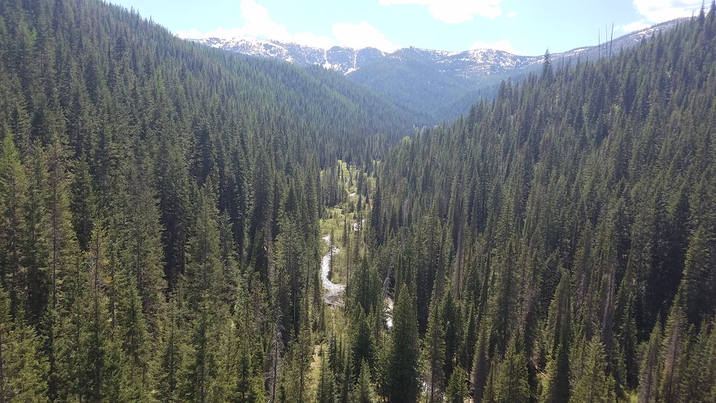
Rd 338 Mi 2.8
- May–Sep
- best months
Is Rd 338 Mi 2.8 open right now?
Closure in the area
There's a closure order in Idaho Panhandle National Forests. It doesn't name Rd 338 Mi 2.8, so check the source for the area it covers (4 listed).
Emergency Road Closure Lightning Creek / Forest Road 419
Agency closure covering Idaho Panhandle National Forests · Order 0104-06-26-002 · USFS · Idaho Panhandle National Forests
Emergency Road Closure Forest Road 225, Slate Creek
Agency closure covering St. Joe Ranger District · Order 01-04-04-26-001 · USFS · St. Joe Ranger District
Abandoned Mines Area Closure
Agency closure covering Idaho Panhandle National Forests · Order 1-04-00-25-001 · USFS · Idaho Panhandle National Forests
Idaho Panhandle Seasonal Food Storage Order
Agency closure covering Idaho Panhandle National Forests · Order 01-04-00-24-001 · USFS · Idaho Panhandle National Forests
Heavy Truck Traffic on FS Road 209
Agency alert covering Idaho Panhandle National Forests · USFS · Idaho Panhandle National Forests
As of · Source: USFS · Idaho Panhandle National Forests. Agencies don't list every closure — check before you go.
- At 3,320 ft
- St. Joe Ranger DistrictIdaho Panhandle National Forests
RD 338 MI 2.8 (Camping Area)
Local outfitters
- Campground St. Regis23 mi away
- CDA River RV39 mi away
Not on Roamze yet. Their page has how to reach them.
- Bernier CreekHiking0.1 mi
- Turner PeakSummit1.5 mi
- Malin PointSummit2.9 mi
- Tin Can FlatCamping2.9 mi
- Allen RidgeHiking2.9 mi
- Turner FlatCamping3.1 mi
- MALIN RIDGEHiking3.5 mi
- Bernier PointSummit3.7 mi
Source: Roamze catalog (indexable pages within 10 miles, PostGIS distance)
- Rd 338 Mi 7.9Camping · ~2 min drive
- Rd 338 Mi 8.3Camping · ~2 min drive
- Rd 338 Mi 0.9Camping · ~3 min drive
- Fh 50 Mi 56.7Camping · ~4 min drive
- Fh 50 Mi 59.7 Site BCamping · ~5 min drive
- Rd 338 Mi 11.7Camping · ~5 min drive
- Fh 50 Mi 59.7 Site ACamping · ~5 min drive
- Bird CrCamping · ~5 min drive
- Fh 50 Mi 57.2 Site BCamping · ~5 min drive
- Fh 50 Mi 59.6Camping · ~5 min drive
Best time to visit Rd 338 Mi 2.8
Best months: May–September. Best months have typical highs of 55–85 °F, lows of 30 °F or warmer (32 °F where the station doesn't record snow), at most one snowy day and no more than 12 wet days.
Jan
31° / 17°
Feb
36° / 18°
Mar
44° / 23°
Apr
54° / 27°
May
65° / 34°
Jun
71° / 40°
Jul
84° / 43°
Aug
83° / 41°
Sep
72° / 35°
Oct
53° / 30°
Nov
38° / 24°
Dec
30° / 18°
Typical high / low (°F) and days with rain or snow, 1991–2020. Measured at Haugan 1 W, MT, 12 mi away at 3,160 ft. This station doesn't record snowfall. Source: NOAA NCEI U.S. Climate Normals 1991–2020.