A.T. Carter Gap Shelter
Campground
Campground · 1.8 mi from the trail
 Photo: Thomson200, CC0 (via Wikimedia Commons)
Closure in the area
There's a closure order in Chattahoochee-Oconee National Forests. It doesn't name Dicks Knob, so check the source for the area it covers (5 listed).
West Cowpen, FS Road 17, Road Maintenance
Agency closure covering Chattahoochee-Oconee National Forests · USFS · Chattahoochee-Oconee National Forests
Bear Creek Road, FS 241, Temporarily Closed
Agency closure covering Chattahoochee-Oconee National Forests · USFS · Chattahoochee-Oconee National Forests
Prescribed fire on Oconee Ranger District at Jasper County
Agency closure covering Chattahoochee-Oconee National Forests · USFS · Chattahoochee-Oconee National Forests
Muskrat Road, FS 218, Temporarily Closed
Agency closure covering Chattahoochee-Oconee National Forests · USFS · Chattahoochee-Oconee National Forests
Flash Flood Awareness
Agency closure covering Chattahoochee-Oconee National Forests · USFS · Chattahoochee-Oconee National Forests
As of · Source: USFS · Chattahoochee-Oconee National Forests. Agencies don't list every closure — check before you go.
Dicks Knob is a summit of 4,627 feet in the Southern Nantahala Wilderness, part of the Chattooga River Ranger District of the Chattahoochee-Oconee National Forests in north Georgia. The nearest town is Tate City, about 1.8 miles away. Summer is the most comfortable time to go. Typical averages from a nearby weather station show July highs around 77°F with lows near 61°F, and the summit sits higher than that station, so expect it to run a little cooler. Several trails start close by. Hickory Nut Cove Trail is about 1.1 miles away and Chestnut Mountain Trail about 1.2 miles. Tate Branch Campground, roughly 2.7 miles off, offers a place to stay. Across the line in North Carolina, Pickens Nose is a climbing area about 4.5 miles away.
A.T. Carter Gap Shelter
Campground
Dillard Deli
Pizza restaurant
Sunset Rock
Viewpoint
Cliff in Macon County, North Carolina, United States
Places © OpenStreetMap contributors, Places © Overture Maps Foundation
More in HighlandsDaily highs and lows, wind and the chance of precipitation at the summit for the next 7 days, from the Open-Meteo model.
Elevation from USGS 3D Elevation Program terrain data (about 10 m resolution).
We don't know of a mapped trail or route to the summit of Dicks Knob. Plan the approach with local maps, a guidebook or a local guide, and check conditions before you go.
4,627 ft (1,410 m).
We don't know of a mapped trail or route to the summit. Plan the approach with local maps, a guidebook or a local guide.

 Hickory Nut Cove TrailHikingPhoto: ChattOconeeNF, CC BY 2.0 (via Flickr)1.1 miChestnut Mountain TrailHikingPhoto: ChattOconeeNF, CC BY 2.0 (via Flickr)1.2 miSnake Den TrailHikingPhoto: ChattOconeeNF, CC BY 2.0 (via Flickr)1.4 mi
Source: Roamze catalog (indexable pages within 10 miles, PostGIS distance)
Albert MountainSummit · ~9 min drivePhoto: Thomson200, CC0 (via Wikimedia Commons) Glassy MountainSummit · ~17 min drivePhoto: Thomson200, CC0 (via Wikimedia Commons)
 Oakey MountainSummit · ~17 min drivePhoto: Thomson200, CC0 (via Wikimedia Commons)
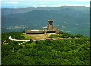 Brasstown BaldSummit · ~31 min drivePhoto: Public domain (via Wikimedia Commons)
 Rabun BaldSummit · ~22 min drivePhoto: Thomson200, CC0 (via Wikimedia Commons)
Best months: March–November. Best months have typical highs of 55–85 °F, lows of 30 °F or warmer (32 °F where the station doesn't record snow), at most one snowy day and no more than 12 wet days.
Jan
45° / 26°
Feb
49° / 29°
Mar
55° / 34°
Apr
64° / 42°
May
69° / 50°
Jun
74° / 59°
Jul
77° / 61°
Aug
76° / 60°
Sep
72° / 55°
Oct
65° / 45°
Nov
57° / 36°
Dec
49° / 30°
Typical high / low (°F) and days with rain or snow, 1991–2020. Measured at Mtn City 2 Sw, GA, 8.3 mi away at 3,464 ft. The station sits about 1,200 ft lower than this place, so expect it a little cooler here. This station doesn't record snowfall. Source: NOAA NCEI U.S. Climate Normals 1991–2020.
Spring 2026 Forest-wide Fire Restrictions
Chattahoochee-Oconee National Forests · Order dated April 23, 2026; seen Aug 23, 2026 → lifted Oct 13, 2026 · Forest Service

