Camp Bulter's Guided Nature Trail
- 1.9 mi
- loop
- 238 ft
- climb
- 488 ft
- high point
- Loop
- route
- Oct–Apr
- best months
Camp Bulter's Guided Nature Trail is an easy hike of about 1.9 miles inside Fort Benning in Georgia. It gains about 240 feet in elevation, and the route's highest point is around 488 feet, with the low point near 381 feet. The trail starts at about 445 feet, and the steepest stretch comes early, at about 7% grade within the first 0.14 miles. It is a short outing that fits easily into a few hours on the base. Spring and fall are the most comfortable times to go. Typical averages from a nearby weather station at Fort Benning show April highs around 79°F with lows near 48°F, and October highs around 80°F with lows near 51°F. That station sits a few hundred feet lower than the trail, so temperatures on the trail run a little cooler. Tank Trail is about 2.6 miles away, and Keystone Trail is about 3.4 miles off. Mountain bikers can head to Stowers MTB Loop at about 4 miles, and paddlers will find Oswichee Creek about 4.3 miles away.
Conditions and forecast on Turner Hill
Daily highs and lows, wind and the chance of precipitation at the summit and route start for the next 7 days, from the Open-Meteo model.
- Tank TrailHiking2.6 mi
- Keystone TrailHiking3.4 mi
- Stowers MTB LoopMountain biking4 mi
- Ft. Moore MTB TrailMountain biking4.1 mi
- Follow Me Fitness TrailHiking4.2 mi
- Oswichee CreekCanoeing4.3 mi
- Hichitee CreekCanoeing8.7 mi
- Ochillee CreekCanoeing9.6 mi
Source: Roamze catalog (indexable pages within 10 miles, PostGIS distance)
 CanyonsHiking · ~36 min drivePhoto: StephenGA, Public Domain Dedication (CC0) (via Flickr)
- Backcountry TrailHiking · ~36 min drivePhoto: StephenGA, Public Domain Dedication (CC0) (via Flickr)
- Pine Moutain TrailHiking · ~57 min drive
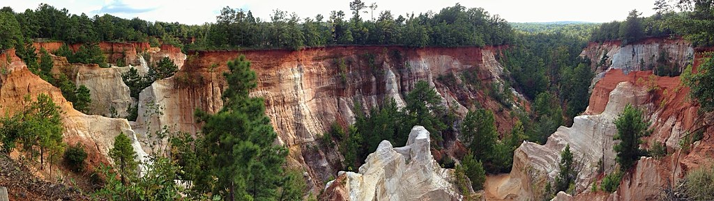 Canyon Loop TrailHiking · ~36 min drivePhoto: StephenGA, Public Domain Dedication (CC0) (via Flickr)
 White Candle TrailHiking · ~59 min drivePhoto: Bas van Oorschot, CC BY-SA 3.0 (via Wikimedia Commons)
 Beaver Pond TrailHiking · ~59 min drivePhoto: Bas van Oorschot, CC BY-SA 3.0 (via Wikimedia Commons)
- Lumpkin TrailHiking · ~9 min drive
- Tank TrailHiking · ~4 min drive
- Buzancy TrailHiking · ~17 min drive
- Keystone TrailHiking · ~6 min drive
Best time to visit Camp Bulter's Guided Nature Trail
Best months: October–April. Best months have typical highs of 55–85 °F, lows of 30 °F or warmer (32 °F where the station doesn't record snow), at most one snowy day and no more than 12 wet days.
Jan
61° / 32°
Feb
65° / 35°
Mar
72° / 41°
Apr
79° / 48°
May
86° / 57°
Jun
91° / 66°
Jul
93° / 70°
Aug
93° / 69°
Sep
89° / 64°
Oct
80° / 51°
Nov
71° / 39°
Dec
63° / 34°
Typical high / low (°F) and days with rain or snow, 1991–2020. Measured at Ft Benning Lawson Fld, GA, 7.8 mi away at 289 ft. This station doesn't record snowfall. Source: NOAA NCEI U.S. Climate Normals 1991–2020.
Route details
- Distance
- 1.9 mi
- Climbing
- About 238 ft
- Summit
- 481 ft
- Difficulty
- Easy
- Time
- About 1 hour
Questions about this route
How long is the Camp Bulter's Guided Nature Trail on Turner Hill?
About 1.9 mi.
How much elevation gain is on the Camp Bulter's Guided Nature Trail?
About 238 ft of climbing round trip.
How hard is the Camp Bulter's Guided Nature Trail?
It is rated easy.
How long does the Camp Bulter's Guided Nature Trail take?
About 1 hour round trip.
Map and trail data © OpenStreetMap contributors
