 Photo: Public domain (via Wikimedia Commons)
Paddling · 200 spots
Featured spots
Photo: Public domain (via Wikimedia Commons)Canoeing
Alapaha River
Ocilla, Georgia
 Photo: Tim Kiser, CC BY-SA 4.0 (via Wikimedia Commons)
Canoeing
Alcovy River
Monroe, Georgia
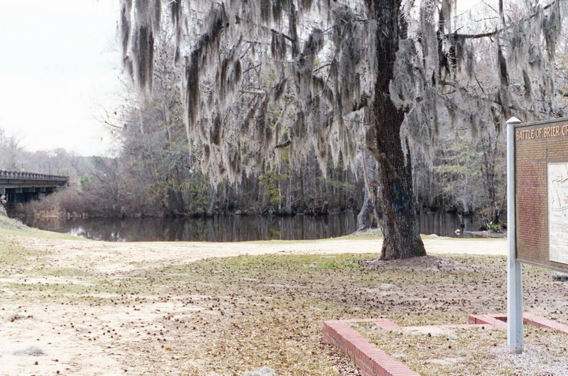 Photo: Dereddick, Public domain (via Wikimedia Commons)
Canoeing
Brier Creek
Dearing, Georgia
 Photo: Sarah Zukoff, CC BY 2.0 (via Wikimedia Commons)
Canoeing
Canoochee River
Metter, Georgia
 Photo: Thomson200, CC0 (via Wikimedia Commons)
Canoeing
Etowah River
Dahlonega, Georgia
All spots · 200 of 297 spots

Boat launch
Abbatoir Boat Ramp
Georgia

Boat launch
Abbotts Bridge Ramp
Georgia

Boat launch
Abercorn Creek Boat Ramp
Georgia

Canoeing
Abrams Creek
Oakfield, Georgia
Canoeing
Alligator Creek
Fargo, Georgia

Canoeing
Alligator Creek
Helena, Georgia
Canoeing
Amicalola Creek
Dawsonville, Georgia
Canoeing
Apalachee River
Bethlehem, Georgia

Canoeing
Attapulgus Creek
Attapulgus, Georgia
Canoeing
Avery Creek
Roberta, Georgia
Boat launch
Azalea Boat Launch
Georgia
Canoeing
Barnetts Creek
Ochlocknee, Georgia
Boat launch
Baurle Boat Ramp at Lock and Dam Park
Georgia
Canoeing
Beards Creek
Glennville, Georgia
Canoeing
Beaverdam Creek
Sylvania, Georgia
Canoeing
Beaverdam Creek
Dewy Rose, Georgia
Canoeing
Beech Creek
Hogansville, Georgia
Canoeing
Big Cedar Creek
Wrightsville, Georgia
Canoeing
Big Cedar Creek
Haddock, Georgia
Canoeing
Big Cotton Indian Creek
Stockbridge, Georgia
Canoeing
Big Creek
Wrens, Georgia
Canoeing
Big Creek
Unadilla, Georgia
Canoeing
Big Creek
Winterville, Georgia
Canoeing
Big Creek
East Dublin, Georgia
Keep exploring — more water worth the drive
Commissioner Creek
~22 min drive
Commissioner Creek is a 42-mile paddling stretch near McIntyre, Georgia. It flows year-round. USGS models an average flow of about 209 cfs and a gradient of about 7.2 feet per mile.
Abbatoir Boat Ramp
~32 min drive
Abbatoir Boat Ramp is a boat launch in Georgia.
Big Sandy Creek
~22 min drive
Big Sandy Creek is a 44-mile paddling stretch near Jeffersonville, Georgia. It flows year-round. USGS models an average flow of about 290 cfs and a gradient of about 5.6 feet per mile.
Wise Creek Take-out
~59 min drive
Wise Creek Take-out is a boat launch in Georgia.
Fishing Creek
~27 min drive
Fishing Creek is a 12-mile paddling stretch near Milledgeville, Georgia. It flows year-round. USGS models an average flow of about 63 cfs and a gradient of about 12.1 feet per mile.
Swords Boat Day Use Area
~1h 24m drive
A worthwhile stop near Georgia.
Big Cedar Creek
~36 min drive
Big Cedar Creek is a 9.8-mile paddling stretch near Haddock, Georgia. It flows year-round. USGS models an average flow of about 148 cfs and a gradient of about 3.2 feet per mile.
Tobesofkee Creek
~39 min drive
Tobesofkee Creek is a 20-mile paddling stretch near Macon, Georgia. It flows year-round. USGS models an average flow of about 271 cfs and a gradient of about 10.2 feet per mile.
Shellstone Creek
~41 min drive
Shellstone Creek is a 11-mile paddling stretch near Dry Branch, Georgia. It is intermittent and may run dry in some seasons. USGS models an average flow of about 85 cfs and a gradient of about 14.2 feet per mile.
Turkey Creek
~50 min drive
Turkey Creek is a 36-mile paddling stretch near Dudley, Georgia. It flows year-round. USGS models an average flow of about 321 cfs and a gradient of about 5.9 feet per mile.
South Shellstone Creek
~50 min drive
South Shellstone Creek is a 6.5-mile paddling stretch near Cochran, Georgia. It flows year-round. USGS models an average flow of about 37 cfs and a gradient of about 14.7 feet per mile.
Rocky Creek
~52 min drive
Rocky Creek is a 29-mile paddling stretch near Dudley, Georgia. It is intermittent and may run dry in some seasons. USGS models an average flow of about 157 cfs and a gradient of about 7.8 feet per mile.

